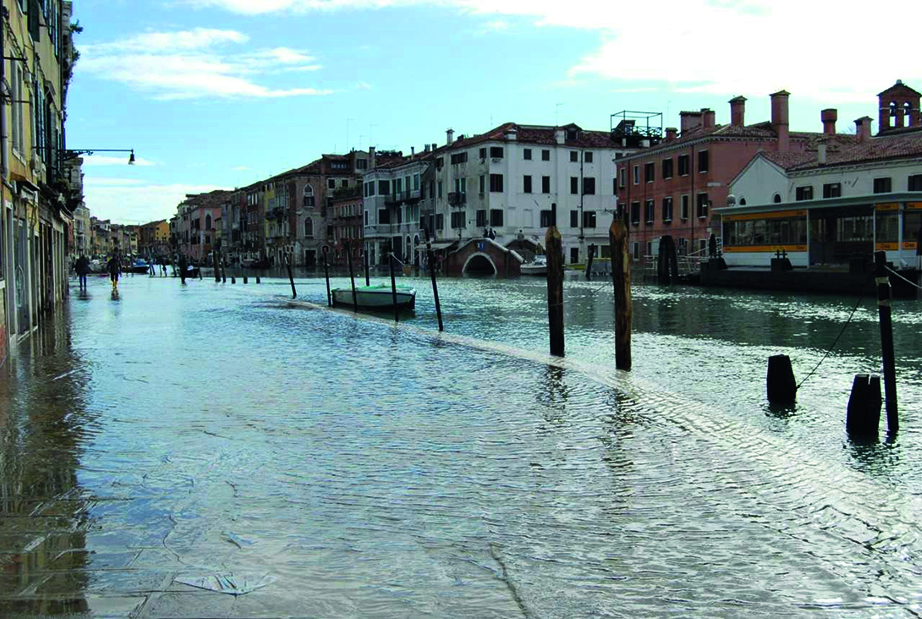
Autumn 2018 was characterised by a continuation of dry weather in northern Europe while southern Europe experienced several episodes of very wet and windy weather. In this article, we will focus on a cyclone which developed from a large-scale trough over the western Mediterranean. On 29 October, it moved from Sardinia towards the Alps. In Sardinia, severe convection linked to the cyclone brought extreme accumulations of hail. In the Eastern Alps, recorded wind gusts reached 59 m/s. The storm uprooted or broke 11 million trees, and torrential rainfall led to flash floods. Later the Po river experienced moderate flooding. The storm was accompanied by significant wave heights up to 11 m in the Tyrrhenian and Ligurian Seas west of Italy and more than 9 m in the Adriatic. About six metres were recorded at the ISMAR oceanographic tower in the Gulf of Venice. There was a severe surge bringing flooding to Venice, thankfully mitigated by the fact that the meteorological peak occurred during low tide. This is an example of a single weather system bringing multiple hazards, and here we will discuss the predictability of some of them.

For the verification of 24‑hour precipitation, we have access to high-resolution observations from many of our Member and Co‑operating States thanks to a project to collect high-density observations. For the period 29 October 06 UTC to 30 October 06 UTC, three stations in Italy reported more than 300 mm, and the average precipitation from all observations in a 2°x2° box centred over north-eastern Italy was 100 mm. The maximum precipitation in ECMWF’s high-resolution forecast (HRES) starting on 25 October 00 UTC reached 173 mm. Underestimation of orographic precipitation is a known model deficiency even though it has improved in recent years as a result of upgrades in model physics and model resolution. The area average in the 2°x2° box for this HRES forecast was 82 mm based on all observation points and 63 mm based on all grid points, on a similar level to short-range forecasts. The HRES and ensemble median consistently predicted values above the 99th percentile of the model climate from six days before the event and onwards.
The signal of extensive rainfall, violent wind gusts and high waves in northern Italy on 29 October began to appear in the ensemble forecast a week before the event. This resulted in a relatively strong Extreme Forecast Index (EFI) signal, as exemplified by forecasts for the three variables from 23 October 00 UTC. The early predictability was linked to the deep trough over the western Mediterranean.
The ensemble wave forecast gradually became more and more extreme as the event approached. Seven days before the event, the median of all ensemble forecasts was above the 75th percentile of the model climate and three days before above the 99th percentile in the Northern Adriatic. The last ensemble forecast before the event had a median significant wave height of 3 m while HRES gave 3.7 m. This is still significantly below the observed value of nearly 6 m. The discrepancy is not unexpected because of the global model’s limited ability to resolve the Gulf of Venice and its bathymetry, and here limited-area wave models play a role. The regional wave forecasts from the Institute of Marine Sciences (CNR ISMAR), Venice, use ECMWF’s wind forecasts but adjust them (+16%) for a known underestimation in the Adriatic Sea. This simulation at higher resolution (about 0.08° for the wave model and down to about 100 m for the surge model) led to a very good forecast of wave and surge conditions, both accurately quantified several days in advance. For surge and flood forecasts, a key difficulty is to pinpoint with sufficient accuracy the time of the storm. Small phase differences between astronomical and meteorological components can lead to drastic differences in flooding. In the present case, the timing was sufficiently correct 24 hours in advance.
Overall, ECMWF forecasts provided an early indication of hazardous weather in this case, although they did not always capture just how extreme conditions were going to be. ECMWF is going to work on understanding if this type of event has predictability in the extended range (beyond 10 days) and also to explore how forecasts of extreme surface wind and precipitation can be improved.
