Datasets
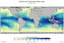
This catalogue entry provides the TCWV data product usually called Hamburg Ocean Atmosphere Parameters and Fluxes from Satellite Data (HOAPS).
Interval/period: Wed, 05/01/2002 - Thu, 03/01/2012
Interval/period: Tue, 12/01/2020 - Wed, 04/01/2026
Interval/period: Thu, 01/01/1976 - Fri, 12/31/2100
Interval/period: Thu, 01/01/1976 - Fri, 12/31/2100

Interval/period: Sun, 01/01/2017 - Fri, 05/01/2026

Interval/period: Sun, 01/01/2017 - Fri, 05/01/2026

Interval/period: Thu, 01/01/1981 - Fri, 05/01/2026
Interval/period: Fri, 01/01/1993 - Fri, 05/01/2026

Interval/period: Thu, 01/01/1981 - Fri, 05/01/2026
Interval/period: Thu, 01/01/1981 - Fri, 05/01/2026

Interval/period: Thu, 01/01/1981 - Fri, 05/01/2026
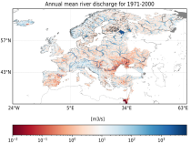
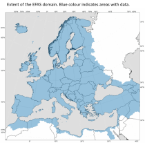
River discharge
Volumetric soil moisture
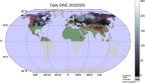
Snow water equivalent
Soil wetness index (root zone)
Runoff water equivalent (surface plus subsurface)
Interval/period: Sun, 11/01/2020 - Wed, 04/01/2026
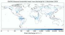
River discharge
Soil wetness index (root zone)
Snow water equivalent
Runoff water equivalent (surface plus subsurface)
Interval/period: Tue, 12/01/2020 - Wed, 04/01/2026
River discharge
Volumetric soil moisture
Snow water equivalent
Soil wetness index (root zone)
Runoff water equivalent (surface plus subsurface)
Interval/period: Fri, 01/01/1999 - Tue, 05/12/2026
Interval/period: Tue, 01/02/1979 - Tue, 05/12/2026
ECV datasets provide the empirical evidence needed to understand the current climate and predict future changes.
CIIs contain condensed climate information which facilitate relatively quick and efficient subsequent analysis. Therefore, CIIs make climate information accessible to application focussed users within a sector.
Interval/period: N/A
Interval/period: Thu, 01/01/1750 - Fri, 01/01/2021
Interval/period: Wed, 01/01/1986 - Mon, 12/31/2085
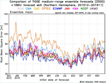
The dataset has been available since October 2006. TIGGE was established as a key component of THORPEX: a World Weather Research Programme to accelerate the improvements in the accuracy of 1-day to 2 week high-impact weather forecasts (THORPEX stands for THe Observing system Research and Predictability EXperiment)
Interval/period: Sun, 10/01/2006 - Wed, 05/06/2026