Displaying 176 - 200 of 224
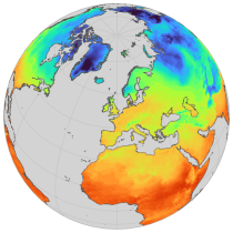
ERA5-Land is a reanalysis dataset providing a consistent view of the evolution of land variables over several decades at an enhanced resolution compared to ERA5. ERA5-Land has been produced by replaying the land component of the ECMWF ERA5 climate reanalysis. Reanalysis combines model data with observations from across the world into a globally complete and consistent dataset using the laws of physics. Reanalysis produces data that goes several decades back in time, providing an accurate description of the climate of the past.

calendar_today Interval/period: Sun, 01/01/1950 - Thu, 06/25/2026
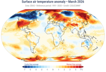
The Essential Climate Variables for assessment of climate variability from 1979 to present dataset contains a selection of climatologies, monthly anomalies and monthly mean fields of Essential Climate Variables (ECVs) suitable for monitoring and assessment of climate variability and change. Selection criteria are based on accuracy and temporal consistency on monthly to decadal time scales.

calendar_today Interval/period: Mon, 01/01/1979 - Fri, 05/01/2026
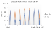
The CAMS solar radiation services provide historical values (2004 to present) of global (GHI), direct (BHI) and diffuse (DHI) solar irradiation, as well as direct normal irradiation (BNI). The aim is to fulfil the needs of European and national policy development and the requirements of both commercial and public downstream services, e.g. for planning, monitoring, efficiency improvements and the integration of solar energy systems into energy supply grids.

calendar_today Interval/period: Thu, 01/01/2004 - Tue, 06/30/2026
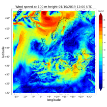
The Copernicus European Regional ReAnalysis (CERRA) datasets provide spatially and temporally consistent historical reconstructions of meteorological variables in the atmosphere and at the surface. There are four subsets: single levels (atmospheric and surface quantities), height levels (upper-air fields up to 500m), pressure levels (upper-air fields up to 1hPa) and model levels (native levels of the model). This entry provides reanalysis and forecast data on height levels for Europe from 1984 to present.

calendar_today Interval/period: Sat, 09/01/1984 - Tue, 03/31/2026
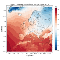
The Copernicus European Regional ReAnalysis (CERRA) datasets provide spatially and temporally consistent historical reconstructions of meteorological variables in the atmosphere and at the surface. There are four subsets: single levels (atmospheric and surface quantities), height levels (upper-air fields up to 500m), pressure levels (upper-air fields up to 1hPa) and model levels (native levels of the model). This entry provides reanalysis data on model levels for Europe from 1984 to present.

calendar_today Interval/period: Sat, 09/01/1984 - Tue, 03/31/2026
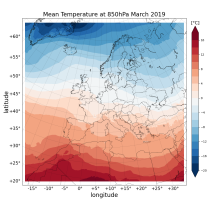
The Copernicus European Regional ReAnalysis (CERRA) datasets provide spatially and temporally consistent historical reconstruction of meteorological variables in the atmosphere and at the surface. There are four subsets: single levels (atmospheric and surface quantities), height levels (upper-air fields up to 500m), pressure levels (upper-air fields up to 1hPa) and model levels (native levels of the model). This entry provides reanalysis and forecast data on pressure levels for Europe from 1984 to present.

calendar_today Interval/period: Sat, 09/01/1984 - Tue, 03/31/2026
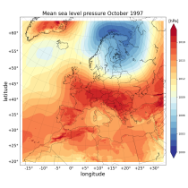
The Copernicus European Regional ReAnalysis (CERRA) datasets provide spatially and temporally consistent historical reconstructions of meteorological variables in the atmosphere and at the surface. There are four subsets: single levels (atmospheric and surface quantities), height levels (upper-air fields up to 500m), pressure levels (upper-air fields up to 1hPa) and model levels (native levels of the model). This entry provides reanalysis and forecast data on single levels for Europe from 1984 to present.

calendar_today Interval/period: Sat, 09/01/1984 - Tue, 03/31/2026
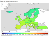
The Copernicus climate change service (C3S) operational energy dataset provides climate and energy indicators for the European energy sector. The climate-relevant indicators for the energy sector considered are: air temperature, precipitation, incoming solar radiation, wind speed at 10 m and 100 m, and mean sea level air pressure. The energy indicators are electricity demand and power generation from various sources: wind (both onshore and offshore), solar and hydro (run-of-river and reservoir) power.

calendar_today Interval/period: Mon, 01/01/1979 - Fri, 05/01/2026
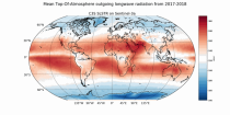
The Earth’s Radiation Budget (ERB) represents the overall balance between incoming and outgoing radiant energy at the Earth’s top-of-the-atmosphere. This Essential Climate Variable is the primary forcing of the climate system and is therefore a fundamental quantity to be monitored to understand the Earth’s climate and its variability. The Earth’s Radiation Budget comprises of the quantification of the incoming radiation from the Sun and the outgoing reflected shortwave and emitted longwave radiation.

calendar_today Interval/period: Mon, 01/01/1979 - Sun, 03/01/2026
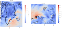
The C3S Arctic Regional Reanalysis (CARRA) dataset contains hourly data including 3-hourly analyses and hourly short term forecasts of atmospheric height level meteorological variables (temperature, humidity, wind, and other thermodynamic variables) at 2.5 km resolution. Additionally, forecasts up to 30 hours initialised from the analyses at 00 and 12 UTC are available.

calendar_today Interval/period: Sat, 09/01/1990 - Thu, 04/30/2026
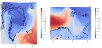
The C3S Arctic Regional Reanalysis (CARRA) dataset contains hourly data including 3-hourly analyses and hourly short term forecasts of atmospheric model level meteorological variables (temperature, humidity, wind, cloud, precipitation and turbulent kinetic energy) at 2.5 km resolution. Additionally, forecasts up to 30 hours initialised from the analyses at 00 and 12 UTC are available.

calendar_today Interval/period: Sat, 09/01/1990 - Thu, 04/30/2026
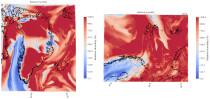
The C3S Arctic Regional Reanalysis (CARRA) dataset contains hourly data including 3-hourly analyses and hourly short term forecasts of atmospheric pressure level meteorological variables (temperature, humidity, wind, and other thermodynamic variables) at 2.5 km resolution. Additionally, forecasts up to 30 hours initialised from the analyses at 00 and 12 UTC are available.

calendar_today Interval/period: Sat, 09/01/1990 - Thu, 04/30/2026
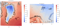
The C3S Arctic Regional Reanalysis (CARRA) dataset contains 3-hourly analyses and hourly short term forecasts of atmospheric and surface meteorological variables (surface and near-surface temperature, surface and top of atmosphere fluxes, precipitation, cloud, humidity, wind, pressure, snow and sea variables) at 2.5 km resolution. Additionally, forecasts up to 30 hours initialised from the analyses at 00 and 12 UTC are available.

calendar_today Interval/period: Sat, 09/01/1990 - Thu, 04/30/2026
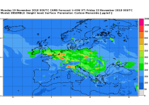
This dataset provides daily air quality analyses and forecasts for Europe.
CAMS produces specific daily air quality analyses and forecasts for the European
domain at significantly higher spatial resolution (0.1 degrees, approx. 10km)
than is available from the global analyses and forecasts. The production is
based on an ensemble of eleven air quality forecasting systems across Europe. A
median ensemble is calculated from individual outputs, since ensemble products

calendar_today Interval/period: Tue, 06/27/2023 - Wed, 07/01/2026
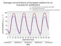
This dataset provides daily air quality forecasts at European observation
stations after optimisation using a statistical post-processing method called
Model Output Statistics (MOS). The unoptimised "raw" forecasts are also
provided in the same format.
The MOS method uses machine learning with predictive variables including
background air quality observation datasets, ECMWF meteorological forecasts and
the "raw" CAMS European air quality ensemble median forecast. The result is

calendar_today Interval/period: Wed, 01/17/2024 - Wed, 07/01/2026
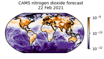
CAMS produces global forecasts for atmospheric composition twice a day. The forecasts consist of more than 50 chemical species (e.g. ozone, nitrogen dioxide, carbon monoxide) and seven different types of aerosol (desert dust, sea salt, organic matter, black carbon, sulphate, nitrate and ammonium aerosol). In addition, several meteorological variables are available as well.

calendar_today Interval/period: Thu, 01/01/2015 - Wed, 07/01/2026
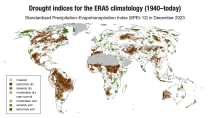
ERA5–Drought is a global reconstruction of drought indices from 1940 to present.
The dataset comprises two standardised drought indices:
- the Standardised Precipitation Index (SPI)
- the Standardised Precipitation-Evapotranspiration Index (SPEI).

calendar_today Interval/period: Mon, 01/01/1940 - Fri, 05/01/2026
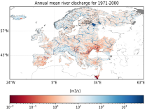
This dataset provides hydrological seasonal forecasts of monthly mean river discharge across Europe. Two hydrological model ensembles are provided. The first is an E-HYPE multi-model system comprising eight model realisations using a catchment-based resolution. The second comprises the E-HYPEgrid, VIC-WUR and EFAS (LISFLOOD) hydrological models at a 5km gridded resolution.

calendar_today Interval/period: Tue, 12/01/2020 - Mon, 06/01/2026
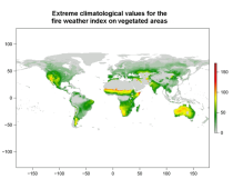
This data set provides complete historical reconstruction of meteorological conditions favourable to the start, spread and sustainability of fires. The fire danger metrics provided are part of a vast dataset produced by the Copernicus Emergency Management Service for the

calendar_today Interval/period: Wed, 01/03/1940 - Mon, 06/29/2026
open_in_newview in EWDS|open_in_newview in EWDS
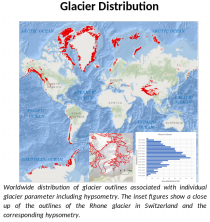
This dataset, commonly known as the Randolph Glacier Inventory (RGI), provides global glacier outlines compiled from maps, aerial photographs and satellite images. The dataset is a snapshot (one outline per glacier) constructed from source data that were mostly acquired in the period 1998-2010.

calendar_today Interval/period: Thu, 01/01/1998 - Fri, 12/31/2010
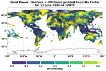
This dataset provides global climate and energy indicators from 1950 to the present at hourly and coarser temporal resolutions, offering a long-term, harmonised data foundation for energy-sector applications. It enables users to analyse energy indicators for the past climate, supporting energy planning, system design, risk assessments, climate impact modelling and model benchmarking.

calendar_today Interval/period: Sun, 01/01/1950 - Wed, 04/01/2026
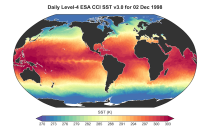
This dataset provides daily and monthly global estimates of sea surface temperature (SST) based on observations from multiple satellite sensors since July 1979 (for the daily product) and January 1980 respectivly (for the monthly product). SST is a key driver of global weather and climate patterns and plays an important role in the exchanges of energy, momentum, moisture and gases between the ocean and atmosphere. Accurate SST data are therefore essential for understanding and assessing variability and long-term changes in the Earth’s climate.

calendar_today Interval/period: Fri, 07/13/1979 - Thu, 06/11/2026
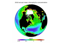
This dataset provides global daily and monthly estimates of ocean surface chlorophyll-a concentration and remote sensing reflectance derived from multiple satellite sensors. These two products are part of the broader discipline of ocean colour remote sensing, which analyses ocean surface radiances measured from space to derive information about the optical properties and constituents of the upper ocean.

calendar_today Interval/period: Mon, 09/01/1997 - Tue, 03/31/2026
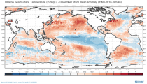
This dataset provides global ocean and sea-ice reanalysis (ORAS5: Ocean Reanalysis System 5) monthly mean data prepared by the European Centre for Medium-Range Weather Forecasts (ECMWF) OCEAN5 ocean analysis-reanalysis system. This system comprises 5 ensemble members from which one member is published in this catalogue entry.

calendar_today Interval/period: Wed, 01/01/1958 - Fri, 05/01/2026
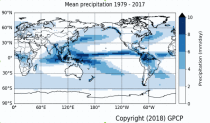
Within the hydrological cycle, precipitation is the main component of water transport from the atmosphere to the Earth’s surface. Precipitation varies strongly, depending on geographical location, season, synopsis, and other meteorological factors. The supply of freshwater through precipitation is vital for many subsystems of the climate and the environment, but there are also hazards related to extensive precipitation or the lack of precipitation.

calendar_today Interval/period: Mon, 01/01/1979 - Mon, 06/30/2025