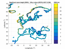
The dataset presents wave climate indicators based upon ocean surface wave parameters computed for a European-wide domain. This dataset provides an understanding of the European wave climate under the impact of climate change. It provides added value for various coastal sectors and studies such as port, shipping, and coastal management.

calendar_today Interval/period: Thu, 01/01/1976 - Fri, 12/31/2100
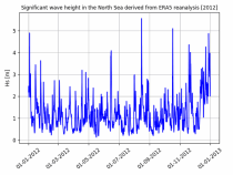
The dataset presents time series of the coastal wave climate based upon ocean surface wave parameters computed for a European-wide domain. This dataset provides an understanding of the wave climate under the impact of climate change for the Northwest European Shelf and Mediterranean Sea. It provides added value for various coastal sectors and studies such as port, shipping, and coastal management.

calendar_today Interval/period: Thu, 01/01/1976 - Fri, 12/31/2100
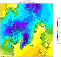
The C3S Arctic Regional Reanalysis second generation (CARRA2) dataset contains daily and monthly meteorological variables at 2.5 km resolution. These variables are specified at single levels (including surface) and also at soil, height, pressure and model levels. These daily and monthly data are pre-calculated and have the following types depending on the variables: daily and monthly averages, extremes and totals.

calendar_today Interval/period: Tue, 10/01/1985 - Wed, 12/31/2025
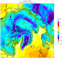
The C3S Arctic Regional Reanalysis second generation (CARRA2) dataset contains 3-hourly analyses at 2.5 km resolution. These variables are specified at single levels (including surface) and also at soil, height, pressure and model levels. Additionally, hourly forecasts are available between the analysis times and particularly forecasts up to 18 hours initialised from the analyses at 00 and 12 UTC.

calendar_today Interval/period: Sun, 09/01/1985 - Wed, 12/31/2025
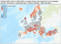
This dataset provides meteorological and snow indicators for Europe, characterizing operating conditions of winter ski resorts under past and future climate scenarios. The dataset consists of 39 indicators of atmospheric and snow conditions computed in a similar manner for all mountain regions in Europe at the scale of NUTS-3 regions (Nomenclature of Territorial Units for Statistics) and by steps of 100 m elevation.

calendar_today Interval/period: Sun, 01/01/1950 - Fri, 01/01/2100
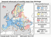
This dataset provides hydrological seasonal reforecasts of monthly mean river discharge across Europe for the period 1993 to 2016. The first is an E-HYPE multi-model system comprising eight model realisations using a catchment-based resolution. The second comprises the E-HYPEgrid, VIC-WUR and LISFLOOD-EFAS hydrological models at a 5km gridded resolution.

calendar_today Interval/period: Fri, 01/01/2021 - Wed, 08/26/2026
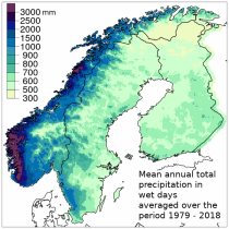
The Nordic Gridded Climate Dataset (NGCD) is a high resolution, observational, gridded dataset of daily minimum, maximum and mean temperatures and daily precipitation totals, covering Finland, Sweden and Norway. The time period covered begins in January 1961 and continues to the present.
Spatial interpolation methods are applied to observational datasets to create gridded datasets.
In general, there are three types of such methods: deterministic (type 1), stochastic (type 2) and pure mathematical (type 3).

calendar_today Interval/period: Sun, 01/01/1961 - Thu, 09/18/2025
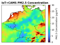
This dataset provides surface-level particulate matter (PM2.5 and PM10) concentrations derived from in situ low-cost sensor (LCS) measurements, produced by the European Centre for Medium-Range Weather Forecasts (ECMWF) in the context of the Horizon Europe All Data for Green Deal project. This dataset differs from existing air quality datasets by combining crowdsourced observations with a robust correction framework, producing high-resolution, reference-aligned gridded products.

calendar_today Interval/period: Mon, 01/01/2018 - Tue, 12/31/2024
open_in_newview in XDS
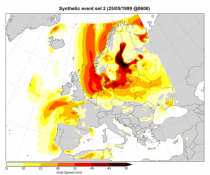
This dataset contains a set of synthetic windstorm events consisting of 22,980 individual storm footprints over Europe. These are a physically realistic set of plausible windstorm events based on the modelled climatic conditions. It is not designed to reproduce actual historical observations but as a comparator for the stochastic event sets generally used for windstorm risk analysis in the insurance industry. This is because there is no data assimilation process used to align the model output to historical observations.

calendar_today Interval/period: Wed, 01/01/1986 - Wed, 11/30/2011
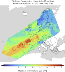
This dataset provides climate indicators of windstorms associated with extratropical cyclones, derived from the fifth generation of the European Centre for Medium-Range Weather Forecasts (ECMWF) atmospheric reanalyses (ERA5) over a pan-European domain. Developed as part of Copernicus Climate Change Service's (C3S) Enhanced Windstorm Service (EWS), and responding to requirements from users in the insurance sector, this dataset extends the previous C3S Windstorm Service (winter months only) to include the entire year.

calendar_today Interval/period: Thu, 02/01/1940 - Fri, 01/23/2026
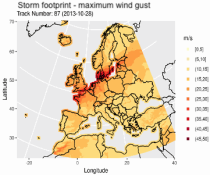
This dataset provides climatological indicators on European winter windstorms and their economic impact derived from ERA5 reanalysis. Also provided are risk indicators from a synthetically derived set of physically realistic windstorm events based on modelled climatic conditions. The primary users include the insurance sector, reinsurers and insurance industry service providers in response to their requirements for a catalogue of historic windstorm events within Europe.

calendar_today Interval/period: Sat, 03/01/1986 - Wed, 11/30/2011
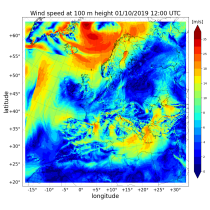
The Copernicus European Regional ReAnalysis (CERRA) datasets provide spatially and temporally consistent historical reconstructions of meteorological variables in the atmosphere and at the surface. There are four subsets: single levels (atmospheric and surface quantities), height levels (upper-air fields up to 500m), pressure levels (upper-air fields up to 1hPa) and model levels (native levels of the model). This entry provides reanalysis and forecast data on height levels for Europe from 1984 to present.

calendar_today Interval/period: Sat, 09/01/1984 - Tue, 03/31/2026
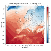
The Copernicus European Regional ReAnalysis (CERRA) datasets provide spatially and temporally consistent historical reconstructions of meteorological variables in the atmosphere and at the surface. There are four subsets: single levels (atmospheric and surface quantities), height levels (upper-air fields up to 500m), pressure levels (upper-air fields up to 1hPa) and model levels (native levels of the model). This entry provides reanalysis data on model levels for Europe from 1984 to present.

calendar_today Interval/period: Sat, 09/01/1984 - Tue, 03/31/2026
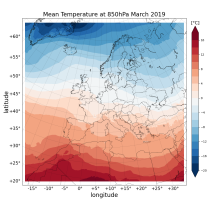
The Copernicus European Regional ReAnalysis (CERRA) datasets provide spatially and temporally consistent historical reconstruction of meteorological variables in the atmosphere and at the surface. There are four subsets: single levels (atmospheric and surface quantities), height levels (upper-air fields up to 500m), pressure levels (upper-air fields up to 1hPa) and model levels (native levels of the model). This entry provides reanalysis and forecast data on pressure levels for Europe from 1984 to present.

calendar_today Interval/period: Sat, 09/01/1984 - Tue, 03/31/2026
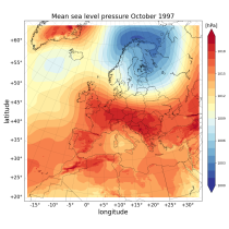
The Copernicus European Regional ReAnalysis (CERRA) datasets provide spatially and temporally consistent historical reconstructions of meteorological variables in the atmosphere and at the surface. There are four subsets: single levels (atmospheric and surface quantities), height levels (upper-air fields up to 500m), pressure levels (upper-air fields up to 1hPa) and model levels (native levels of the model). This entry provides reanalysis and forecast data on single levels for Europe from 1984 to present.

calendar_today Interval/period: Sat, 09/01/1984 - Tue, 03/31/2026
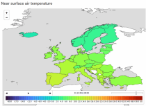
The Copernicus climate change service (C3S) operational energy dataset provides climate and energy indicators for the European energy sector. The climate-relevant indicators for the energy sector considered are: air temperature, precipitation, incoming solar radiation, wind speed at 10 m and 100 m, and mean sea level air pressure. The energy indicators are electricity demand and power generation from various sources: wind (both onshore and offshore), solar and hydro (run-of-river and reservoir) power.

calendar_today Interval/period: Mon, 01/01/1979 - Fri, 05/01/2026
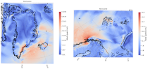
The C3S Arctic Regional Reanalysis (CARRA) dataset contains hourly data including 3-hourly analyses and hourly short term forecasts of atmospheric height level meteorological variables (temperature, humidity, wind, and other thermodynamic variables) at 2.5 km resolution. Additionally, forecasts up to 30 hours initialised from the analyses at 00 and 12 UTC are available.

calendar_today Interval/period: Sat, 09/01/1990 - Thu, 04/30/2026
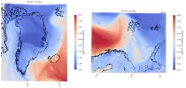
The C3S Arctic Regional Reanalysis (CARRA) dataset contains hourly data including 3-hourly analyses and hourly short term forecasts of atmospheric model level meteorological variables (temperature, humidity, wind, cloud, precipitation and turbulent kinetic energy) at 2.5 km resolution. Additionally, forecasts up to 30 hours initialised from the analyses at 00 and 12 UTC are available.

calendar_today Interval/period: Sat, 09/01/1990 - Thu, 04/30/2026
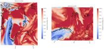
The C3S Arctic Regional Reanalysis (CARRA) dataset contains hourly data including 3-hourly analyses and hourly short term forecasts of atmospheric pressure level meteorological variables (temperature, humidity, wind, and other thermodynamic variables) at 2.5 km resolution. Additionally, forecasts up to 30 hours initialised from the analyses at 00 and 12 UTC are available.

calendar_today Interval/period: Sat, 09/01/1990 - Thu, 04/30/2026
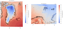
The C3S Arctic Regional Reanalysis (CARRA) dataset contains 3-hourly analyses and hourly short term forecasts of atmospheric and surface meteorological variables (surface and near-surface temperature, surface and top of atmosphere fluxes, precipitation, cloud, humidity, wind, pressure, snow and sea variables) at 2.5 km resolution. Additionally, forecasts up to 30 hours initialised from the analyses at 00 and 12 UTC are available.

calendar_today Interval/period: Sat, 09/01/1990 - Thu, 04/30/2026
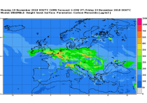
This dataset provides daily air quality analyses and forecasts for Europe.
CAMS produces specific daily air quality analyses and forecasts for the European
domain at significantly higher spatial resolution (0.1 degrees, approx. 10km)
than is available from the global analyses and forecasts. The production is
based on an ensemble of eleven air quality forecasting systems across Europe. A
median ensemble is calculated from individual outputs, since ensemble products

calendar_today Interval/period: Tue, 06/27/2023 - Wed, 07/01/2026
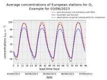
This dataset provides daily air quality forecasts at European observation
stations after optimisation using a statistical post-processing method called
Model Output Statistics (MOS). The unoptimised "raw" forecasts are also
provided in the same format.
The MOS method uses machine learning with predictive variables including
background air quality observation datasets, ECMWF meteorological forecasts and
the "raw" CAMS European air quality ensemble median forecast. The result is

calendar_today Interval/period: Wed, 01/17/2024 - Wed, 07/01/2026
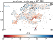
This dataset provides hydrological seasonal forecasts of monthly mean river discharge across Europe. Two hydrological model ensembles are provided. The first is an E-HYPE multi-model system comprising eight model realisations using a catchment-based resolution. The second comprises the E-HYPEgrid, VIC-WUR and EFAS (LISFLOOD) hydrological models at a 5km gridded resolution.

calendar_today Interval/period: Tue, 12/01/2020 - Mon, 06/01/2026
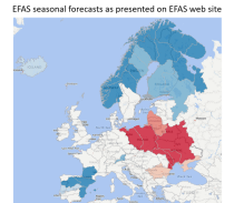
This dataset provides gridded modelled daily hydrological time series forced with seasonal meteorological forecasts. The dataset is a consistent representation of the most important hydrological variables across the European Flood Awareness (EFAS) domain. The temporal resolution is daily forecasts initialised once a month consisting of:

River discharge
Volumetric soil moisture
Snow water equivalent
Soil wetness index (root zone)
Runoff water equivalent (surface plus subsurface)

calendar_today Interval/period: Sun, 11/01/2020 - Mon, 06/01/2026
open_in_newview in EWDS|open_in_newview in EWDS
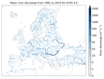
This dataset provides gridded modelled hydrological time series forced with medium-range meteorological forecasts. The data is a consistent representation of the most important hydrological variables across the European Flood Awareness System (EFAS) domain. The temporal resolution is sub-daily high-resolution and ensemble forecasts of:

River discharge
Volumetric soil moisture
Snow water equivalent
Soil wetness index (root zone)
Runoff water equivalent (surface plus subsurface)

calendar_today Interval/period: Thu, 10/11/2018 - Mon, 06/01/2026

open_in_newview in EWDS