Displaying 576 - 600 of 643
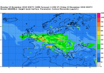
This dataset provides daily air quality analyses and forecasts for Europe.
CAMS produces specific daily air quality analyses and forecasts for the European
domain at significantly higher spatial resolution (0.1 degrees, approx. 10km)
than is available from the global analyses and forecasts. The production is
based on an ensemble of eleven air quality forecasting systems across Europe. A
median ensemble is calculated from individual outputs, since ensemble products

calendar_today Interval/period: Tue, 06/27/2023 - Wed, 07/01/2026
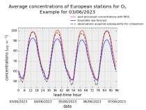
This dataset provides daily air quality forecasts at European observation
stations after optimisation using a statistical post-processing method called
Model Output Statistics (MOS). The unoptimised "raw" forecasts are also
provided in the same format.
The MOS method uses machine learning with predictive variables including
background air quality observation datasets, ECMWF meteorological forecasts and
the "raw" CAMS European air quality ensemble median forecast. The result is

calendar_today Interval/period: Wed, 01/17/2024 - Wed, 07/01/2026
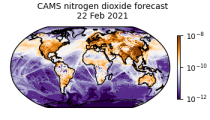
CAMS produces global forecasts for atmospheric composition twice a day. The forecasts consist of more than 50 chemical species (e.g. ozone, nitrogen dioxide, carbon monoxide) and seven different types of aerosol (desert dust, sea salt, organic matter, black carbon, sulphate, nitrate and ammonium aerosol). In addition, several meteorological variables are available as well.

calendar_today Interval/period: Thu, 01/01/2015 - Wed, 07/01/2026

 CAMS Global atmospheric composition forecast production system is used to produce the daily forecasts of pollutants, aerosols and greenhouse gases across the globe. Satellite observations of atmospheric composition are merged with a detailed computer simulation of the atmosphere using a method called data assimilation. The resulting analyses, i.e.

calendar_today Interval/period: N/A

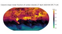
CAMS produces global forecasts for the two main long-lived greenhouse gases once a day. This dataset consists of 5-day high-resolution forecasts of carbon dioxide (CO2) and methane (CH4). Additionally, carbon monoxide (CO) and meteorological parameters relevant to the CAMS greenhouse gas forecast are included.

calendar_today Interval/period: Fri, 03/01/2024 - Wed, 07/01/2026

HRES-WAM (High RESolution WAve Model) is coupled to the atmospheric model (HRES). More details can be found here: https://confluence.ecmwf.int/display/FUG/2.2+Ocean+Wave+Model+-+ECWAM The products are provided in GRIB 1 or GRIB 2 format.

calendar_today Interval/period: N/A

HRES-WAM (High RESolution WAve Model) is coupled to the atmospheric model (HRES). More details can be found here: https://confluence.ecmwf.int/display/FUG/2.2+Ocean+Wave+Model+-+ECWAM The products are provided in GRIB 1 or GRIB 2 format.

calendar_today Interval/period: N/A

Surface parameters from the ECMWF HRES Atmospheric Model (10-day). The products are provided in GRIB 1 or GRIB 2 format.

calendar_today Interval/period: N/A

Pressure level parameters from the ECMWF HRES Atmospheric Model (10-day). The products are provided in GRIB 1 or GRIB 2 format.

calendar_today Interval/period: N/A

Model level parameters from the ECMWF HRES Atmospheric Model (10-day). The products are provided in GRIB 1 or GRIB 2 format. Model level information can be found here: https://confluence.ecmwf.int/display/UDOC/Model+level+definitions

calendar_today Interval/period: N/A

Human Thermal Comfort Indices parameters from the Control forecast (formerly HRES) up to 15 days. The products are provided in GRIB 1 or GRIB 2 format.

calendar_today Interval/period: N/A

The products consist of values of the individual members of the real-time forecast at grid points (single locations). The products are provided in BUFR code. Select the number of locations you will require. Once you have submitted your order, you will be required to provide a list of all points to the Licensor handling your data.

calendar_today Interval/period: N/A

Tropical cyclone tracks are provided in BUFR format. These data will only be disseminated when a tropical cyclone is active. Tropical cyclone tracks are free of charge as part of the WMO Essential dataset: https://www.ecmwf.int/en/forecasts/datasets/wmo-essential

calendar_today Interval/period: N/A

Information on Simulated Satellite Images can be found here: https://confluence.ecmwf.int/display/FCST/Simulated+satellite+data

calendar_today Interval/period: N/A

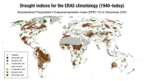
ERA5–Drought is a global reconstruction of drought indices from 1940 to present.
The dataset comprises two standardised drought indices:
- the Standardised Precipitation Index (SPI)
- the Standardised Precipitation-Evapotranspiration Index (SPEI).

calendar_today Interval/period: Mon, 01/01/1940 - Fri, 05/01/2026
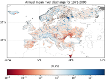
This dataset provides hydrological seasonal forecasts of monthly mean river discharge across Europe. Two hydrological model ensembles are provided. The first is an E-HYPE multi-model system comprising eight model realisations using a catchment-based resolution. The second comprises the E-HYPEgrid, VIC-WUR and EFAS (LISFLOOD) hydrological models at a 5km gridded resolution.

calendar_today Interval/period: Tue, 12/01/2020 - Mon, 06/01/2026
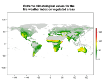
This data set provides complete historical reconstruction of meteorological conditions favourable to the start, spread and sustainability of fires. The fire danger metrics provided are part of a vast dataset produced by the Copernicus Emergency Management Service for the

calendar_today Interval/period: Wed, 01/03/1940 - Mon, 06/29/2026
open_in_newview in EWDS|open_in_newview in EWDS
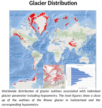
This dataset, commonly known as the Randolph Glacier Inventory (RGI), provides global glacier outlines compiled from maps, aerial photographs and satellite images. The dataset is a snapshot (one outline per glacier) constructed from source data that were mostly acquired in the period 1998-2010.

calendar_today Interval/period: Thu, 01/01/1998 - Fri, 12/31/2010
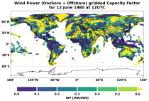
This dataset provides global climate and energy indicators from 1950 to the present at hourly and coarser temporal resolutions, offering a long-term, harmonised data foundation for energy-sector applications. It enables users to analyse energy indicators for the past climate, supporting energy planning, system design, risk assessments, climate impact modelling and model benchmarking.

calendar_today Interval/period: Sun, 01/01/1950 - Wed, 04/01/2026
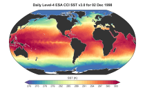
This dataset provides daily and monthly global estimates of sea surface temperature (SST) based on observations from multiple satellite sensors since July 1979 (for the daily product) and January 1980 respectivly (for the monthly product). SST is a key driver of global weather and climate patterns and plays an important role in the exchanges of energy, momentum, moisture and gases between the ocean and atmosphere. Accurate SST data are therefore essential for understanding and assessing variability and long-term changes in the Earth’s climate.

calendar_today Interval/period: Fri, 07/13/1979 - Thu, 06/11/2026
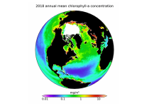
This dataset provides global daily and monthly estimates of ocean surface chlorophyll-a concentration and remote sensing reflectance derived from multiple satellite sensors. These two products are part of the broader discipline of ocean colour remote sensing, which analyses ocean surface radiances measured from space to derive information about the optical properties and constituents of the upper ocean.

calendar_today Interval/period: Mon, 09/01/1997 - Tue, 03/31/2026
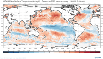
This dataset provides global ocean and sea-ice reanalysis (ORAS5: Ocean Reanalysis System 5) monthly mean data prepared by the European Centre for Medium-Range Weather Forecasts (ECMWF) OCEAN5 ocean analysis-reanalysis system. This system comprises 5 ensemble members from which one member is published in this catalogue entry.

calendar_today Interval/period: Wed, 01/01/1958 - Fri, 05/01/2026
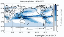
Within the hydrological cycle, precipitation is the main component of water transport from the atmosphere to the Earth’s surface. Precipitation varies strongly, depending on geographical location, season, synopsis, and other meteorological factors. The supply of freshwater through precipitation is vital for many subsystems of the climate and the environment, but there are also hazards related to extensive precipitation or the lack of precipitation.

calendar_today Interval/period: Mon, 01/01/1979 - Mon, 06/30/2025