Displaying 101 - 125 of 145
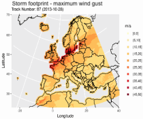
This dataset provides climatological indicators on European winter windstorms and their economic impact derived from ERA5 reanalysis. Also provided are risk indicators from a synthetically derived set of physically realistic windstorm events based on modelled climatic conditions. The primary users include the insurance sector, reinsurers and insurance industry service providers in response to their requirements for a catalogue of historic windstorm events within Europe.

calendar_today Interval/period: Sat, 03/01/1986 - Wed, 11/30/2011
ERA5 is the fifth generation ECMWF reanalysis for the global climate and weather for the past 8 decades.
Data is available from 1940 onwards.
ERA5 replaces the ERA-Interim reanalysis.

calendar_today Interval/period: Mon, 01/01/1940 - Thu, 06/25/2026
ERA5 is the fifth generation ECMWF reanalysis for the global climate and weather for the past 8 decades.
Data is available from 1940 onwards.
ERA5 replaces the ERA-Interim reanalysis.

calendar_today Interval/period: Mon, 01/01/1940 - Thu, 06/25/2026
ERA5 is the fifth generation ECMWF reanalysis for the global climate and weather for the past 8 decades.
Data is available from 1940 onwards.
ERA5 replaces the ERA-Interim reanalysis.

calendar_today Interval/period: Mon, 01/01/1940 - Fri, 05/01/2026
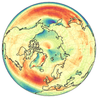
ERA5 is the fifth generation ECMWF reanalysis for the global climate and weather for the past 8 decades.
Data is available from 1940 onwards.
ERA5 replaces the ERA-Interim reanalysis.

calendar_today Interval/period: Mon, 01/01/1940 - Fri, 05/01/2026
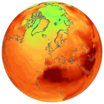
ERA5 is the fifth generation ECMWF reanalysis for the global climate and weather for the past 8 decades.
Data is available from 1940 onwards.
ERA5 replaces the ERA-Interim reanalysis.

calendar_today Interval/period: Mon, 01/01/1940 - Thu, 06/25/2026
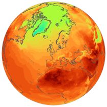
ERA5 is the fifth generation ECMWF reanalysis for the global climate and weather for the past 8 decades.
Data is available from 1940 onwards.
ERA5 replaces the ERA-Interim reanalysis.

calendar_today Interval/period: Mon, 01/01/1940 - Thu, 06/25/2026
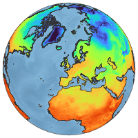
ERA5-Land is a reanalysis dataset providing a consistent view of the evolution of land variables over several decades at an enhanced resolution compared to ERA5. ERA5-Land has been produced by replaying the land component of the ECMWF ERA5 climate reanalysis. Reanalysis combines model data with observations from across the world into a globally complete and consistent dataset using the laws of physics. Reanalysis produces data that goes several decades back in time, providing an accurate description of the climate of the past.

calendar_today Interval/period: Sun, 01/01/1950 - Thu, 06/25/2026
ERA5-Land is a reanalysis dataset providing a consistent view of the evolution of land variables over several decades at an enhanced resolution compared to ERA5. ERA5-Land has been produced by replaying the land component of the ECMWF ERA5 climate reanalysis. Reanalysis combines model data with observations from across the world into a globally complete and consistent dataset using the laws of physics. Reanalysis produces data that goes several decades back in time, providing an accurate description of the climate of the past.

calendar_today Interval/period: Sun, 01/01/1950 - Fri, 05/01/2026
ERA5-Land is a reanalysis dataset providing a consistent view of the evolution of land variables over several decades at an enhanced resolution compared to ERA5. ERA5-Land has been produced by replaying the land component of the ECMWF ERA5 climate reanalysis. Reanalysis combines model data with observations from across the world into a globally complete and consistent dataset using the laws of physics. Reanalysis produces data that goes several decades back in time, providing an accurate description of the climate of the past.

calendar_today Interval/period: Sun, 01/01/1950 - Thu, 06/25/2026
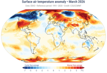
The Essential Climate Variables for assessment of climate variability from 1979 to present dataset contains a selection of climatologies, monthly anomalies and monthly mean fields of Essential Climate Variables (ECVs) suitable for monitoring and assessment of climate variability and change. Selection criteria are based on accuracy and temporal consistency on monthly to decadal time scales.

calendar_today Interval/period: Mon, 01/01/1979 - Fri, 05/01/2026
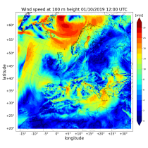
The Copernicus European Regional ReAnalysis (CERRA) datasets provide spatially and temporally consistent historical reconstructions of meteorological variables in the atmosphere and at the surface. There are four subsets: single levels (atmospheric and surface quantities), height levels (upper-air fields up to 500m), pressure levels (upper-air fields up to 1hPa) and model levels (native levels of the model). This entry provides reanalysis and forecast data on height levels for Europe from 1984 to present.

calendar_today Interval/period: Sat, 09/01/1984 - Tue, 03/31/2026
The Copernicus European Regional ReAnalysis (CERRA) datasets provide spatially and temporally consistent historical reconstructions of meteorological variables in the atmosphere and at the surface. There are four subsets: single levels (atmospheric and surface quantities), height levels (upper-air fields up to 500m), pressure levels (upper-air fields up to 1hPa) and model levels (native levels of the model). This entry provides reanalysis data on model levels for Europe from 1984 to present.

calendar_today Interval/period: Sat, 09/01/1984 - Tue, 03/31/2026
The Copernicus European Regional ReAnalysis (CERRA) datasets provide spatially and temporally consistent historical reconstruction of meteorological variables in the atmosphere and at the surface. There are four subsets: single levels (atmospheric and surface quantities), height levels (upper-air fields up to 500m), pressure levels (upper-air fields up to 1hPa) and model levels (native levels of the model). This entry provides reanalysis and forecast data on pressure levels for Europe from 1984 to present.

calendar_today Interval/period: Sat, 09/01/1984 - Tue, 03/31/2026
The Copernicus European Regional ReAnalysis (CERRA) datasets provide spatially and temporally consistent historical reconstructions of meteorological variables in the atmosphere and at the surface. There are four subsets: single levels (atmospheric and surface quantities), height levels (upper-air fields up to 500m), pressure levels (upper-air fields up to 1hPa) and model levels (native levels of the model). This entry provides reanalysis and forecast data on single levels for Europe from 1984 to present.

calendar_today Interval/period: Sat, 09/01/1984 - Tue, 03/31/2026
The Copernicus climate change service (C3S) operational energy dataset provides climate and energy indicators for the European energy sector. The climate-relevant indicators for the energy sector considered are: air temperature, precipitation, incoming solar radiation, wind speed at 10 m and 100 m, and mean sea level air pressure. The energy indicators are electricity demand and power generation from various sources: wind (both onshore and offshore), solar and hydro (run-of-river and reservoir) power.

calendar_today Interval/period: Mon, 01/01/1979 - Fri, 05/01/2026
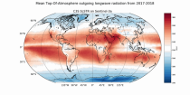
The Earth’s Radiation Budget (ERB) represents the overall balance between incoming and outgoing radiant energy at the Earth’s top-of-the-atmosphere. This Essential Climate Variable is the primary forcing of the climate system and is therefore a fundamental quantity to be monitored to understand the Earth’s climate and its variability. The Earth’s Radiation Budget comprises of the quantification of the incoming radiation from the Sun and the outgoing reflected shortwave and emitted longwave radiation.

calendar_today Interval/period: Mon, 01/01/1979 - Sun, 03/01/2026
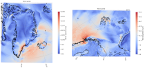
The C3S Arctic Regional Reanalysis (CARRA) dataset contains hourly data including 3-hourly analyses and hourly short term forecasts of atmospheric height level meteorological variables (temperature, humidity, wind, and other thermodynamic variables) at 2.5 km resolution. Additionally, forecasts up to 30 hours initialised from the analyses at 00 and 12 UTC are available.

calendar_today Interval/period: Sat, 09/01/1990 - Thu, 04/30/2026
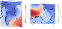
The C3S Arctic Regional Reanalysis (CARRA) dataset contains hourly data including 3-hourly analyses and hourly short term forecasts of atmospheric model level meteorological variables (temperature, humidity, wind, cloud, precipitation and turbulent kinetic energy) at 2.5 km resolution. Additionally, forecasts up to 30 hours initialised from the analyses at 00 and 12 UTC are available.

calendar_today Interval/period: Sat, 09/01/1990 - Thu, 04/30/2026
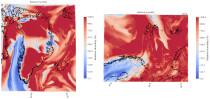
The C3S Arctic Regional Reanalysis (CARRA) dataset contains hourly data including 3-hourly analyses and hourly short term forecasts of atmospheric pressure level meteorological variables (temperature, humidity, wind, and other thermodynamic variables) at 2.5 km resolution. Additionally, forecasts up to 30 hours initialised from the analyses at 00 and 12 UTC are available.

calendar_today Interval/period: Sat, 09/01/1990 - Thu, 04/30/2026
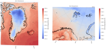
The C3S Arctic Regional Reanalysis (CARRA) dataset contains 3-hourly analyses and hourly short term forecasts of atmospheric and surface meteorological variables (surface and near-surface temperature, surface and top of atmosphere fluxes, precipitation, cloud, humidity, wind, pressure, snow and sea variables) at 2.5 km resolution. Additionally, forecasts up to 30 hours initialised from the analyses at 00 and 12 UTC are available.

calendar_today Interval/period: Sat, 09/01/1990 - Thu, 04/30/2026
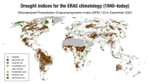
ERA5–Drought is a global reconstruction of drought indices from 1940 to present.
The dataset comprises two standardised drought indices:
- the Standardised Precipitation Index (SPI)
- the Standardised Precipitation-Evapotranspiration Index (SPEI).

calendar_today Interval/period: Mon, 01/01/1940 - Fri, 05/01/2026
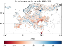
This dataset provides hydrological seasonal forecasts of monthly mean river discharge across Europe. Two hydrological model ensembles are provided. The first is an E-HYPE multi-model system comprising eight model realisations using a catchment-based resolution. The second comprises the E-HYPEgrid, VIC-WUR and EFAS (LISFLOOD) hydrological models at a 5km gridded resolution.

calendar_today Interval/period: Tue, 12/01/2020 - Mon, 06/01/2026
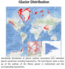
This dataset, commonly known as the Randolph Glacier Inventory (RGI), provides global glacier outlines compiled from maps, aerial photographs and satellite images. The dataset is a snapshot (one outline per glacier) constructed from source data that were mostly acquired in the period 1998-2010.

calendar_today Interval/period: Thu, 01/01/1998 - Fri, 12/31/2010
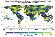
This dataset provides global climate and energy indicators from 1950 to the present at hourly and coarser temporal resolutions, offering a long-term, harmonised data foundation for energy-sector applications. It enables users to analyse energy indicators for the past climate, supporting energy planning, system design, risk assessments, climate impact modelling and model benchmarking.

calendar_today Interval/period: Sun, 01/01/1950 - Wed, 04/01/2026