
The Earth’s surface slows down and deflects atmospheric flow in a variety of ways. Scientists believe a better representation of these processes in models can lead to improved weather forecasts.
One of the ways in which the surface affects the flow is through friction. The magnitude of the effect depends on the nature of the surface. Vegetation, buildings, mountains and ocean waves slow down the air to varying degrees at the lowest levels of the atmosphere.
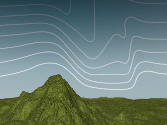
Large features, such as mountains, can also cause waves in the atmosphere by forcing the air that hits them upwards. Such ‘gravity waves’ propagate to the upper levels of the atmosphere, where they may break and slow the flow.
Known collectively as ‘drag processes’, these interactions between the Earth’s surface and the atmosphere can have a strong impact on the weather at all scales.
But the effects of some of these processes on the flow are poorly understood and their exact magnitude is unknown. Scientists therefore believe that there is scope to improve their representation in weather prediction and climate models.
“Currently different numerical weather prediction models represent drag processes in different ways,” says ECMWF scientist Irina Sandu, who specialises in this area. “They particularly differ in the representation of mountain effects on the flow,” she observes.
Wide range of impacts
The drag exerted by the Earth’s surface plays an important role in the general circulation of the atmosphere. It influences the strength of near-surface easterly winds in the tropics and of near-surface westerlies in the extratropics as well as the position of the jet stream in the mid-latitudes.
The drag exerted by mountains, also known as orographic drag, is particularly important for the wintertime circulation in the northern hemisphere.

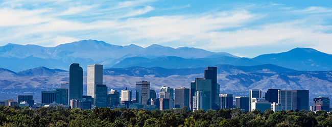
Surface features such as forests, buildings and mountains influence atmospheric flow in different ways and to varying degrees. (Photo: Fred_Bartholomew/iStock/Thinkstock)
Representing such effects correctly in models is thus crucial for correctly predicting not just near-surface winds but also the overall circulation during winter, including the position of storm tracks in the North Atlantic.
It is also important for predicting how the atmospheric circulation will change in a changing climate.
Modelling orographic drag processes
Representing orographic drag processes in atmospheric models is particularly challenging. For a start, the resolution of most global climate and weather models is not fine enough to represent surface features such as hills or mountains in the required detail.
The models divide the atmosphere into millions of grid boxes whose sides are typically tens of kilometres long for weather models and hundreds of kilometres long for climate models.
The laws of physics can be used to predict the way in which parameters such as wind, atmospheric pressure or temperature change over time in each grid box.
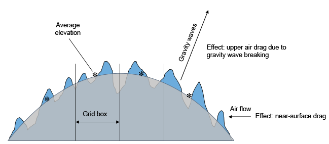
In these equations, the mountain ranges are represented by the average surface elevation in each grid box derived from more detailed topographical data. Only the drag exerted by the largest mountains is therefore accounted for directly in the model.
The drag associated with more detailed small-scale topographic features has to be estimated based on certain assumptions and included in the model.

In global models, mountain ranges are represented as elevations averaged from more detailed topographical data. The effects of the detailed topography are estimated based on certain assumptions and are included in the model.
“It is in the estimate of the drag processes associated with these small-scale features of the topography that the models differ the most,” Dr Sandu says.
The way forward
Despite their importance, the representation of drag processes in models is still subject to large uncertainties.
“One of the reasons is the lack of direct observations: it is impossible to observe globally the distribution of the friction exerted on the flow,” Dr Sandu notes.
“Another reason is that, despite their importance, relatively little research has been done into the representation of these processes in models compared to others, such as those related to clouds.”
 |
“The way forward lies in using newly available high-resolution simulations at the kilometre scale combined with novel observations to better understand these processes and their effects and improve their representation in global models.” (Irina Sandu) |
But things are beginning to change: two workshops were organised recently to discuss why models differ so much in their representation of drag processes, and how drag associated with small scale features of the surface can be better accounted for in order to improve both weather forecasts and climate predictions.
One of them, hosted by ECMWF from 12 to 15 September 2016, was devoted to ‘Drag processes and their links to large-scale circulation’.
Dr Sandu is adamant that progress can be made: “The way forward lies in using newly available high-resolution simulations at the kilometre scale combined with novel observations to better understand these processes and their effects and improve their representation in global models.”