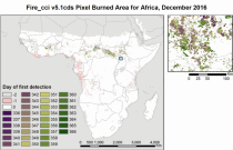
The Burned Area products provide global information of total burned area (BA) at pixel and grid scale. The BA is identified with the date of first detection of the burned signal in the case of the pixel product, and with the total BA per grid cell in the case of the grid product. The products were obtained through the analysis of reflectance changes from medium resolution sensors (Terra MODIS, Sentinel-3 OLCI), supported by the use of MODIS thermal information.

calendar_today Interval/period: Mon, 01/01/2001 - Fri, 04/01/2022
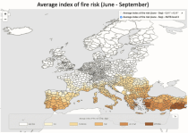
The dataset presents projections of fire danger indicators for Europe based upon the Canadian Fire Weather Index System (FWI) under future climate conditions. The FWI is a meteorologically based index used worldwide to estimate the fire danger and is implemented in the Global ECMWF Fire Forecasting model (GEFF). In this dataset, daily FWI values, seasonal FWI values, and other FWI derived, threshold-specific, indicators were modelled using the GEFF model to estimate the fire danger in future climate scenarios.

calendar_today Interval/period: N/A

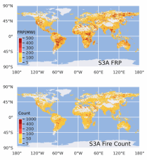
This dataset provides global information on the timing and location of Active Fires (AF) burning on Earth's surface during satellite overpasses, and also records their Fire Radiative Power (FRP) as a measure of strength. FRP relates to a fire's combustion rate, and the rate at which smoke containing greenhouse gases, reactive gases and particular matter is released into the atmosphere. The vast majority of detected hotspots are related to landscape fires, however other high temperature targets such as active volcanoes and gas flares are also present in the data.

calendar_today Interval/period: Wed, 01/01/2020 - Fri, 02/28/2025

Note: This Generation 1 Collection has been superseded by Generation 2 Simulation-level Collections

calendar_today Interval/period: N/A

Note: This Generation 1 Collection has been superseded by Generation 2 Simulation-level Collections

calendar_today Interval/period: N/A

The nextGEMS data is aligned with the Climate Change Adaptation Digital Twin. The DestinE Digital Twin for Climate Change Adaptation (Climate DT) supports adaptation activities by providing innovative climate information on multi-decadal timescales, globally, at scales at which many impacts of climate change are observed.

calendar_today Interval/period: N/A

The nextGEMS data is aligned with the Climate Change Adaptation Digital Twin. The DestinE Digital Twin for Climate Change Adaptation (Climate DT) supports adaptation activities by providing innovative climate information on multi-decadal timescales, globally, at scales at which many impacts of climate change are observed.

calendar_today Interval/period: N/A

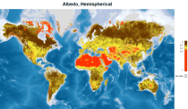
This catalogue entry provides satellite-derived estimates of surface albedo, an Essential Climate Variable (ECV) as defined by the Global Climate Observing System (GCOS). Surface albedo is critical for understanding the Earth’s climate, its variability, and trends, as it quantifies the fraction of solar irradiance reflected by the Earth’s surface. This variable plays a vital role in the global radiation budget, influencing surface temperatures, water balance, and climate feedback mechanisms, such as the ice-albedo feedback in polar regions.

calendar_today Interval/period: Tue, 09/01/1981 - Sun, 12/01/2024
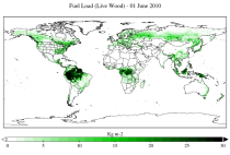
This dataset provides a record of fuel characteristics at high spatiotemporal resolution: ~9km, daily.
The two main variable groups are fuel load and fuel moisture, both of which are further divided by live/dead and wood/foliage fractions.
The dataset combines state-of-the-art model data (ERA5-Land) with observations from multiple satellites and in-situ variables into a globally complete and consistent dataset.

calendar_today Interval/period: Wed, 01/01/2003 - Fri, 12/31/2021
open_in_newview in XDS
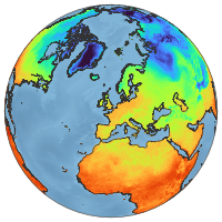
ERA5-Land is a reanalysis dataset providing a consistent view of the evolution of land variables over several decades at an enhanced resolution compared to ERA5. ERA5-Land has been produced by replaying the land component of the ECMWF ERA5 climate reanalysis. Reanalysis combines model data with observations from across the world into a globally complete and consistent dataset using the laws of physics. Reanalysis produces data that goes several decades back in time, providing an accurate description of the climate of the past.

calendar_today Interval/period: Sun, 01/01/1950 - Thu, 06/25/2026
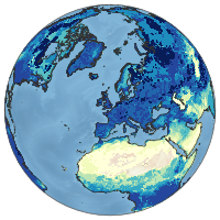
ERA5-Land is a reanalysis dataset providing a consistent view of the evolution of land variables over several decades at an enhanced resolution compared to ERA5. ERA5-Land has been produced by replaying the land component of the ECMWF ERA5 climate reanalysis. Reanalysis combines model data with observations from across the world into a globally complete and consistent dataset using the laws of physics. Reanalysis produces data that goes several decades back in time, providing an accurate description of the climate of the past.

calendar_today Interval/period: Sun, 01/01/1950 - Fri, 05/01/2026
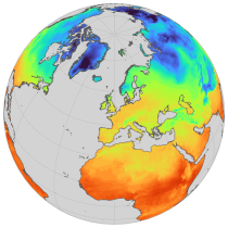
ERA5-Land is a reanalysis dataset providing a consistent view of the evolution of land variables over several decades at an enhanced resolution compared to ERA5. ERA5-Land has been produced by replaying the land component of the ECMWF ERA5 climate reanalysis. Reanalysis combines model data with observations from across the world into a globally complete and consistent dataset using the laws of physics. Reanalysis produces data that goes several decades back in time, providing an accurate description of the climate of the past.

calendar_today Interval/period: Sun, 01/01/1950 - Thu, 06/25/2026
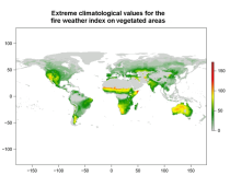
This data set provides complete historical reconstruction of meteorological conditions favourable to the start, spread and sustainability of fires. The fire danger metrics provided are part of a vast dataset produced by the Copernicus Emergency Management Service for the

calendar_today Interval/period: Wed, 01/03/1940 - Mon, 06/29/2026
open_in_newview in EWDS|open_in_newview in EWDS
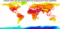
This dataset provides daily surface meteorological data for the period from 1979 to present as input for agriculture and agro-ecological studies. This dataset is based on the hourly ECMWF ERA5 data at surface level and is referred to as AgERA5. Acquisition and pre-processing of the original ERA5 data is a complex and specialized job. By providing the AgERA5 dataset, users are freed from this work and can directly start with meaningful input for their analyses and modelling.

calendar_today Interval/period: Mon, 01/01/1979 - Tue, 06/23/2026
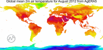
This catalogue entry provides the time series of the originally gridded Agrometeorological indicators from 1979 to present derived from reanalysis, also known as AgERA5. The main difference with the related entry is that the dataset is organised here to make time the primary dimension for analysis and extraction. For any user-defined location (point) or small area, the dataset returns the temporal evolution of the selected variables, enabling efficient time-series studies without requiring users to download and manage full global gridded files.

calendar_today Interval/period: Mon, 01/01/1979 - Sun, 01/04/2026
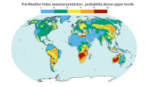
This dataset offers modeled daily fire danger time series, driven by seasonal weather forecasts. It provides long-range predictions of meteorological conditions conducive to the initiation, spread, and persistence of fires. The fire danger metrics included in this dataset are part of an extensive dataset produced by the Copernicus Emergency Management Service (CEMS) for the European Forest Fire Information System (EFFIS) and the Global Wildfire Information System (GWIS).

calendar_today Interval/period: Sun, 02/01/1981 - Fri, 05/01/2026

open_in_newview in EWDS