Displaying 101 - 122 of 122

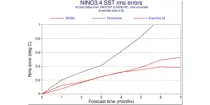
This chart provides a range of skill scores relating to forecasts of the evolution of the sea ...

calendar_today Interval/period: N/A

open_in_newview in Open Charts

GraphCast (Google DeepMind): a deep learning-based system developed by Google DeepMind.It is initialised with ECMWF analysis. GraphCast operates at 0.25° resolution.

calendar_today Interval/period: N/A

open_in_newview in Open Charts

Pangu-Weather: a deep learning-based system developed by Huawei. It is initialised with ECMWF analysis. Pangu-Weather operates at 0.25° resolution.

calendar_today Interval/period: N/A

open_in_newview in Open Charts

Pangu-Weather: a deep learning-based system developed by Huawei. It is initialised with ECMWF analysis. Pangu-Weather operates at 0.25° resolution.

calendar_today Interval/period: N/A

open_in_newview in Open Charts

Pangu-Weather: a deep learning-based system developed by Huawei. It is initialised with ECMWF analysis. Pangu-Weather operates at 0.25° resolution.

calendar_today Interval/period: N/A

open_in_newview in Open Charts

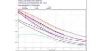
These diagrams compare the Brier Skill Scores (BSS) and the  Continuous Ranked Probability ...

calendar_today Interval/period: N/A

open_in_newview in Open Charts
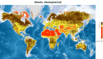
This catalogue entry provides satellite-derived estimates of surface albedo, an Essential Climate Variable (ECV) as defined by the Global Climate Observing System (GCOS). Surface albedo is critical for understanding the Earth’s climate, its variability, and trends, as it quantifies the fraction of solar irradiance reflected by the Earth’s surface. This variable plays a vital role in the global radiation budget, influencing surface temperatures, water balance, and climate feedback mechanisms, such as the ice-albedo feedback in polar regions.

calendar_today Interval/period: Tue, 09/01/1981 - Sun, 12/01/2024
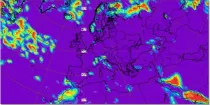
This chart shows probabilities for the 7-day mean anomalies of surface temperature to be in ...

calendar_today Interval/period: N/A

open_in_newview in Open Charts

This chart shows probabilities that 7-day mean surface temperatures (from the 101 forecast ...

calendar_today Interval/period: N/A

open_in_newview in Open Charts

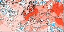
This chart shows 7-day mean anomalies of surface temperature from the ECMWF Sub-seasonal range ...

calendar_today Interval/period: N/A

open_in_newview in Open Charts
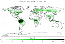
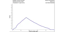
This dataset provides a record of fuel characteristics at high spatiotemporal resolution: ~9km, daily.
The two main variable groups are fuel load and fuel moisture, both of which are further divided by live/dead and wood/foliage fractions.
The dataset combines state-of-the-art model data (ERA5-Land) with observations from multiple satellites and in-situ variables into a globally complete and consistent dataset.

calendar_today Interval/period: Wed, 01/01/2003 - Fri, 12/31/2021
open_in_newview in XDS

**Note:** In **June 2023** ECMWF implemented a **major upgrade ...**

calendar_today Interval/period: N/A

open_in_newview in Open Charts

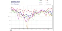
These diagrams compare recent ECMWF verification scores for 500 hPa height with those of other ...

calendar_today Interval/period: N/A

open_in_newview in Open Charts
ERA5-Land is a reanalysis dataset providing a consistent view of the evolution of land variables over several decades at an enhanced resolution compared to ERA5. ERA5-Land has been produced by replaying the land component of the ECMWF ERA5 climate reanalysis. Reanalysis combines model data with observations from across the world into a globally complete and consistent dataset using the laws of physics. Reanalysis produces data that goes several decades back in time, providing an accurate description of the climate of the past.

calendar_today Interval/period: Sun, 01/01/1950 - Thu, 06/25/2026
ERA5-Land is a reanalysis dataset providing a consistent view of the evolution of land variables over several decades at an enhanced resolution compared to ERA5. ERA5-Land has been produced by replaying the land component of the ECMWF ERA5 climate reanalysis. Reanalysis combines model data with observations from across the world into a globally complete and consistent dataset using the laws of physics. Reanalysis produces data that goes several decades back in time, providing an accurate description of the climate of the past.

calendar_today Interval/period: Sun, 01/01/1950 - Fri, 05/01/2026
ERA5-Land is a reanalysis dataset providing a consistent view of the evolution of land variables over several decades at an enhanced resolution compared to ERA5. ERA5-Land has been produced by replaying the land component of the ECMWF ERA5 climate reanalysis. Reanalysis combines model data with observations from across the world into a globally complete and consistent dataset using the laws of physics. Reanalysis produces data that goes several decades back in time, providing an accurate description of the climate of the past.

calendar_today Interval/period: Sun, 01/01/1950 - Thu, 06/25/2026
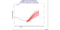
This chart provides information on the predicted evolution of the sea surface temperature (SST) ...

calendar_today Interval/period: N/A

open_in_newview in Open Charts
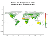
This data set provides complete historical reconstruction of meteorological conditions favourable to the start, spread and sustainability of fires. The fire danger metrics provided are part of a vast dataset produced by the Copernicus Emergency Management Service for the

calendar_today Interval/period: Wed, 01/03/1940 - Mon, 06/29/2026
open_in_newview in EWDS|open_in_newview in EWDS

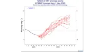
This chart provides information on the predicted evolution of the sea surface temperature (SST) ...

calendar_today Interval/period: N/A

open_in_newview in Open Charts
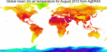
This dataset provides daily surface meteorological data for the period from 1979 to present as input for agriculture and agro-ecological studies. This dataset is based on the hourly ECMWF ERA5 data at surface level and is referred to as AgERA5. Acquisition and pre-processing of the original ERA5 data is a complex and specialized job. By providing the AgERA5 dataset, users are freed from this work and can directly start with meaningful input for their analyses and modelling.

calendar_today Interval/period: Mon, 01/01/1979 - Tue, 06/23/2026
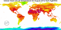
This catalogue entry provides the time series of the originally gridded Agrometeorological indicators from 1979 to present derived from reanalysis, also known as AgERA5. The main difference with the related entry is that the dataset is organised here to make time the primary dimension for analysis and extraction. For any user-defined location (point) or small area, the dataset returns the temporal evolution of the selected variables, enabling efficient time-series studies without requiring users to download and manage full global gridded files.

calendar_today Interval/period: Mon, 01/01/1979 - Sun, 01/04/2026
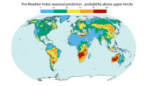
This dataset offers modeled daily fire danger time series, driven by seasonal weather forecasts. It provides long-range predictions of meteorological conditions conducive to the initiation, spread, and persistence of fires. The fire danger metrics included in this dataset are part of an extensive dataset produced by the Copernicus Emergency Management Service (CEMS) for the European Forest Fire Information System (EFFIS) and the Global Wildfire Information System (GWIS).

calendar_today Interval/period: Sun, 02/01/1981 - Fri, 05/01/2026

open_in_newview in EWDS