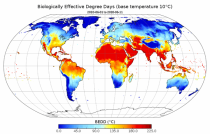
This dataset provides agroclimatic indicators used to characterise plant-climate interactions for global agriculture. Agroclimatic indicators are useful in conveying climate variability and change in the terms that are meaningful to the agricultural sector. The objective of this dataset is to provide these indicators at a global scale in an easily accessible and usable format for further downstream analysis and the forcing of agricultural impact models.

calendar_today Interval/period: Mon, 01/01/1951 - Thu, 08/27/2026
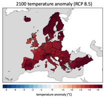
This dataset provides climate and energy indicators for the Europe as part of the Copernicus climate change service (C3S) Energy operational service. The climate-relevant indicators for the energy sector considered are: air temperature, precipitation, incoming solar radiation, wind speed at 10 m and 100 m, and mean sea level air pressure. The energy indicators are electricity demand and power generation from various sources: wind (both onshore and offshore), solar and hydro (run-of-river and reservoir) power.

calendar_today Interval/period: N/A

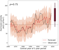
This catalogue entry provides daily and monthly global climate model data from Decadal Climate Predictions Project (DCPP) experiments, part of the sixth phase of the Coupled Model Intercomparison Project (CMIP6). The decadal data in the Climate Data Store (CDS) are a quality-controlled subset of the full DCPP.

calendar_today Interval/period: Sun, 01/01/1860 - Mon, 12/31/2300
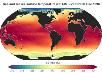
This dataset provides daily and monthly fields of global sea surface temperature (SST) and sea ice surface temperature (IST) from 1982 to the present, using observations from multiple infrared and passive microwave satellite sensors. SST is a key driver of global weather and climate, affecting ocean-atmosphere interactions and driving climate variability.

calendar_today Interval/period: Fri, 01/01/1982 - Tue, 12/31/2024
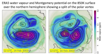
ERA5 is the fifth generation ECMWF atmospheric reanalysis of the global climate covering the period from January 1940 to present. It is produced by the Copernicus Climate Change Service (C3S) at ECMWF and provides hourly estimates of a large number of atmospheric, land and oceanic climate variables. The data cover the Earth on a 31km grid and resolve the atmosphere using 137 levels from the surface up to a height of 80km. ERA5 includes an ensemble component at half the resolution to provide information on synoptic uncertainty of its products.

calendar_today Interval/period: Sat, 01/01/1949 - Thu, 08/27/2026
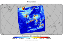
This catalogue entry provides Regional Climate Model (RCM) data on single levels from a number of experiments, models, domains, resolutions, ensemble members, time frequencies and periods computed over several regional domains all over the World in the framework of the Coordinated Regional Climate Downscaling Experiment (CORDEX). The term "single levels" is used to express that the variables are 2D-matrices computed on one vertical level which can be surface (or a level close to the surface) or a dedicated pressure level in the atmosphere.

calendar_today Interval/period: Sun, 01/01/1950 - Fri, 12/31/2100
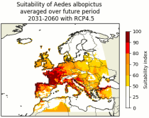
This dataset contains climatic suitability indicators for the Aedes albopictus (tiger mosquito) for Europe produced within the C3S European Health service. The provided indicators are the climatic suitability for the presence of Aedes albopictus and the season length of presence of Aedes albopictus. This mosquito transmits vector-borne diseases, such as dengue and chikungunya.

calendar_today Interval/period: N/A

Cloud properties directly influence the state of the Earth´s upper-air atmosphere. Clouds have an effect on weather and climate through their contribution to the Earth’s water cycle and impact on the Earth’s energy budget. They impact atmospheric motions on a range of spatial and temporal scales and contribute to changes in the atmospheric composition.

calendar_today Interval/period: Mon, 01/01/1979 - Mon, 06/30/2025
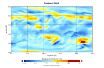
This catalogue entry provides daily climate projections on pressure levels from a large number of experiments, models, members and time periods computed in the framework of fifth phase of the Coupled Model Intercomparison Project (CMIP5). The term "pressure levels" is used to express that the variables were computed at multiple vertical levels, which may differ in number and location among the different models.

calendar_today Interval/period: Sun, 01/01/1860 - Mon, 12/31/2300
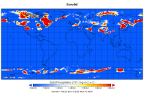
This catalogue entry provides daily climate projections on single levels from a large number of experiments, models, members and time periods computed in the framework of the fifth phase of the Coupled Model Intercomparison Project (CMIP5). The term "single levels" is used to express that the variables are computed at one vertical level which can be surface (or a level close to the surface) or a dedicated pressure level in the atmosphere. Multiple vertical levels are excluded from this catalogue entry.

calendar_today Interval/period: Wed, 01/01/1800 - Fri, 12/31/2100
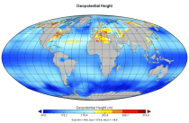
This catalogue entry provides monthly climate projections on pressure levels from a large number of experiments, models, members and time periods computed in the framework of the fifth phase of the Coupled Model Intercomparison Project (CMIP5). The term "pressure levels" is used to express that the variables were computed at multiple vertical levels, which may differ in number and location among the different models.

calendar_today Interval/period: Sun, 01/01/1860 - Mon, 12/31/2300
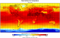
This catalogue entry provides monthly climate projections on single levels from a large number of experiments, models, members and time periods computed in the framework of fifth phase of the Coupled Model Intercomparison Project (CMIP5). The term "single levels" is used to express that the variables are computed at one vertical level which can be surface (or a level close to the surface) or a dedicated pressure level in the atmosphere. Multiple vertical levels are excluded from this catalogue entry.

calendar_today Interval/period: Sun, 01/01/1860 - Mon, 12/31/2300
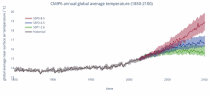
This catalogue entry provides daily and monthly global climate projections data from a large number of experiments, models and time periods computed in the framework of the sixth phase of the Coupled Model Intercomparison Project (CMIP6).
CMIP6 data underpins the Intergovernmental Panel on Climate Change 6th Assessment Report. The use of these data is mostly aimed at:

addressing outstanding scientific questions that arose as part of the IPCC reporting process;
improving the understanding of the climate system;

calendar_today Interval/period: Sun, 01/01/1860 - Mon, 12/31/2300
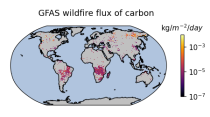
Emissions of atmospheric pollutants from biomass burning and vegetation fires are key drivers of the evolution of atmospheric composition, with a high degree of spatial and temporal variability, and an accurate representation of them in models is essential.

calendar_today Interval/period: Wed, 01/01/2003 - Wed, 12/03/2025
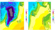
The daily and monthly data of the C3S Arctic Regional Reanalysis (CARRA) dataset contains daily and monthly meteorological variables at 2.5 km resolution. This includes fields at the single levels (including surface) and on pressure, height, soil and model levels.
These daily and monthly data are pre-calculated and have the following types depending on the variables: daily and monthly averages, extremes and totals.

calendar_today Interval/period: Sat, 09/01/1990 - Sat, 02/28/2026

calendar_today Interval/period: N/A

calendar_today Interval/period: N/A

calendar_today Interval/period: N/A

calendar_today Interval/period: N/A