Displaying 26 - 50 of 174
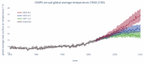
This catalogue entry provides daily and monthly global climate projections data from a large number of experiments, models and time periods computed in the framework of the sixth phase of the Coupled Model Intercomparison Project (CMIP6).
CMIP6 data underpins the Intergovernmental Panel on Climate Change 6th Assessment Report. The use of these data is mostly aimed at:

addressing outstanding scientific questions that arose as part of the IPCC reporting process;
improving the understanding of the climate system;

calendar_today Interval/period: Sun, 01/01/1860 - Mon, 12/31/2300
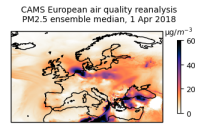
This dataset provides annual air quality reanalyses for Europe based on both unvalidated and validated observations.

calendar_today Interval/period: Tue, 01/01/2013 - Tue, 12/31/2024

Surface aerosol parameters from the CAMS global forecasting system. The products are available every hour.

calendar_today Interval/period: N/A

Surface chemical parameters from the CAMS global forecasting system. The products are available every hour.

calendar_today Interval/period: N/A

Surface meteorological parameters from the CAMS global forecasting system. The products are available every hour.

calendar_today Interval/period: N/A

Pressure levels aerosol parameters from the from the CAMS global forecasting system. The products are available every 3 hours.

calendar_today Interval/period: N/A

Pressure levels chemical parameters from the from the CAMS global forecasting system. The products are available every 3 hours.

calendar_today Interval/period: N/A

Pressure levels meteorological parameters from the from the CAMS global forecasting system. The products are available every 3 hours.

calendar_today Interval/period: N/A

Model levels aerosol parameters from the from the CAMS global forecasting system. The products are available every 3 hours. With the implementation of the IFS Cycle 50r1 a subset of model levels forecast fields is available every hourly step.

calendar_today Interval/period: N/A

Model levels chemical parameters from the from the CAMS global forecasting system. The products are available every 3 hours. With the implementation of the IFS Cycle 50r1 a subset of model levels forecast fields is available every hourly step.

calendar_today Interval/period: N/A

Model levels meteorological parameters from the from the CAMS global forecasting system. The products are available every 3 hours. With the implementation of the IFS Cycle 50r1 a subset of model levels forecast fields is available every hourly step.

calendar_today Interval/period: N/A

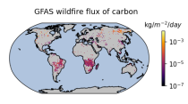
Emissions of atmospheric pollutants from biomass burning and vegetation fires are key drivers of the evolution of atmospheric composition, with a high degree of spatial and temporal variability, and an accurate representation of them in models is essential.

calendar_today Interval/period: Wed, 01/01/2003 - Wed, 12/03/2025
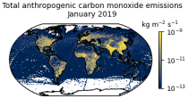
This data set contains gridded distributions of global anthropogenic and natural emissions.

calendar_today Interval/period: Sat, 01/01/2000 - Thu, 12/31/2020
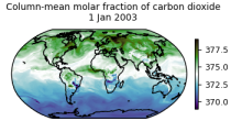
This dataset is part of the ECMWF Atmospheric Composition Reanalysis focusing on long-lived greenhouse gases: carbon dioxide (CO2) and methane (CH4). The emissions and natural fluxes at the surface are crucial for the evolution of the long-lived greenhouse gases in the atmosphere. In this dataset the CO2 fluxes from terrestrial vegetation are modelled in order to simulate the variability across a wide range of scales from diurnal to inter-annual.

calendar_today Interval/period: Wed, 01/01/2003 - Thu, 12/31/2020
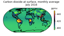
This dataset is part of the ECMWF Atmospheric Composition Reanalysis focusing on long-lived greenhouse gases: carbon dioxide (CO2) and methane (CH4). The emissions and natural fluxes at the surface are crucial for the evolution of the long-lived greenhouse gases in the atmosphere. In this dataset the CO2 fluxes from terrestrial vegetation are modelled in order to simulate the variability across a wide range of scales from diurnal to inter-annual.

calendar_today Interval/period: Wed, 01/01/2003 - Thu, 12/31/2020
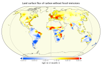
This data set contains net fluxes at the surface, atmospheric mixing ratios at model levels, and column-mean atmospheric mixing ratios for carbon dioxide (CO2), methane (CH4) and nitrous oxide (N20).

calendar_today Interval/period: Mon, 01/01/1979 - Wed, 12/31/2025
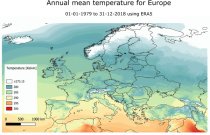
This dataset provides a historical reconstruction of bioclimatic indicators at 1 x 1 km resolution for Europe, Northern Brazil and Central Africa. These bioclimate indicators describe how the climate affects ecosystems, the services they deliver, and nature’s biodiversity. They are specifically relevant for applications within the biodiversity and ecosystem services community.

calendar_today Interval/period: Mon, 01/01/1979 - Mon, 12/31/2018
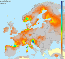
E-OBS is a daily gridded land-only observational dataset over Europe. The blended time series from the station network of the European Climate Assessment & Dataset (ECA&D) project form the basis for the E-OBS gridded dataset. All station data are sourced directly from the European National Meteorological and Hydrological Services (NMHSs) or other data holding institutions.

calendar_today Interval/period: Sun, 01/01/1950 - Tue, 07/14/2026
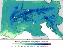
This dataset, also known as the Long-term Alpine Precipitation Reconstruction (LAPrec), provides gridded fields of monthly precipitation for the Alpine region (eight countries). The dataset is derived from station observations and is provided in two issues:

LAPrec1871 starts in 1871 and is based on data from 85 input series;
LAPrec1901 starts in 1901 and is based on data from 165 input series.

calendar_today Interval/period: Sun, 01/01/1871 - Tue, 07/14/2026
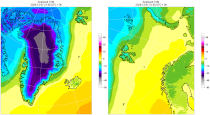
The daily and monthly data of the C3S Arctic Regional Reanalysis (CARRA) dataset contains daily and monthly meteorological variables at 2.5 km resolution. This includes fields at the single levels (including surface) and on pressure, height, soil and model levels.
These daily and monthly data are pre-calculated and have the following types depending on the variables: daily and monthly averages, extremes and totals.

calendar_today Interval/period: Sat, 09/01/1990 - Sat, 02/28/2026
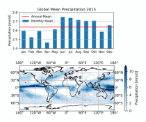
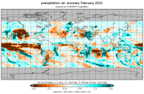
This dataset provides global estimates of daily accumulated and monthly means of precipitation. The precipitation estimates are based on a merge of passive microwave observations from two different radiometer classes operating on multiple Low Earth Orbit (LEO) satellites.

calendar_today Interval/period: Sat, 01/01/2000 - Sun, 12/31/2017
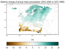
This dataset provides precipitation and near surface air temperature for Europe as Essential Climate Variables (ECVs) and as a set of Climate Impact Indicators (CIIs) based on the ECVs.
ECV datasets provide the empirical evidence needed to understand the current climate and predict future changes.
CIIs contain condensed climate information which facilitate relatively quick and efficient subsequent analysis. Therefore, CIIs make climate information accessible to application focussed users within a sector.

calendar_today Interval/period: N/A

This dataset provides high-resolution gridded temperature and precipitation observations from a selection of sources. Additionally the dataset contains daily global average near-surface temperature anomalies. All fields are defined on either daily or monthly frequency. The datasets are regularly updated to incorporate recent observations. The included data sources are commonly known as GISTEMP, Berkeley Earth, CPC and CPC-CONUS, CHIRPS, IMERG, CMORPH, GPCC and CRU, where the abbreviations are explained below.

calendar_today Interval/period: Thu, 01/01/1750 - Fri, 01/01/2021
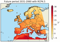
This dataset contains temperature exposure statistics for Europe (e.g. percentiles) derived from the daily 2 metre mean, minimum and maximum air temperature for the entire year, winter (DJF: December-January-February) and summer (JJA: June-July-August). These statistics were derived within the C3S European Health service and are available for different future time periods and using different climate change scenarios.

calendar_today Interval/period: Wed, 01/01/1986 - Mon, 12/31/2085
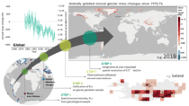
The dataset provides global annual glacier mass changes distributed on a global regular grid at 0.5° resolution (latitude, longitude) based on the Fluctuations of Glaciers (FoG) database of the World Glacier Monitoring Service (WGMS). Glaciers play a fundamental role in the Earth’s water cycles. They are one of the most important freshwater resources for societies and ecosystems and the recent increase in ice melt contributes directly to the rise of ocean levels.

calendar_today Interval/period: Wed, 01/01/1975 - Tue, 07/14/2026