Displaying 26 - 50 of 224
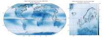
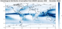
This dataset provides global estimates of precipitation based on satellite observations. Precipitation is the main component of water transport from the atmosphere to the Earth’s surface within the hydrological cycle. It varies strongly, depending on geographical location, season, synopsis, and other meteorological factors. The supply with freshwater through precipitation is vital for many subsystems of the climate and the environment, but there are also hazards related to extensive precipitation or the lack of precipitation.

calendar_today Interval/period: Tue, 01/01/2002 - Sat, 12/31/2022
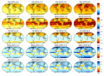
The dataset provides climate extreme indices related to temperature and precipitation as defined by the Expert Team on Climate Change Detection and Indices (ETCCDI), as well as selected heat stress indicators (HSI). The indices are provided for historical and future climate projections (SSP1-2.6, SSP2-4.5, SSP3-7.0, SSP5-8.5) included in the Coupled Model Intercomparison Project Phase 6 (CMIP6) and used in the 6th Assessment Report of the Intergovernmental Panel on Climate Change (IPCC).

calendar_today Interval/period: N/A

This dataset provides a series of climate indices derived from reanalysis and model simulations data hosted on the Copernicus Climate Data Store (CDS). These indicators describe how climate variability and change of essential climate variables can impact sectors such as health, agriculture, forestry, energy, tourism, or water and coastal management.

calendar_today Interval/period: Mon, 01/01/1940 - Fri, 12/31/2100
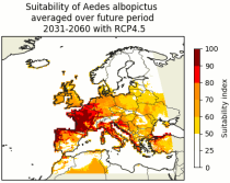
This dataset contains climatic suitability indicators for the Aedes albopictus (tiger mosquito) for Europe produced within the C3S European Health service. The provided indicators are the climatic suitability for the presence of Aedes albopictus and the season length of presence of Aedes albopictus. This mosquito transmits vector-borne diseases, such as dengue and chikungunya.

calendar_today Interval/period: N/A

Cloud properties directly influence the state of the Earth´s upper-air atmosphere. Clouds have an effect on weather and climate through their contribution to the Earth’s water cycle and impact on the Earth’s energy budget. They impact atmospheric motions on a range of spatial and temporal scales and contribute to changes in the atmospheric composition.

calendar_today Interval/period: Mon, 01/01/1979 - Mon, 06/30/2025
This catalogue entry provides daily climate projections on pressure levels from a large number of experiments, models, members and time periods computed in the framework of fifth phase of the Coupled Model Intercomparison Project (CMIP5). The term "pressure levels" is used to express that the variables were computed at multiple vertical levels, which may differ in number and location among the different models.

calendar_today Interval/period: Sun, 01/01/1860 - Mon, 12/31/2300
This catalogue entry provides daily climate projections on single levels from a large number of experiments, models, members and time periods computed in the framework of the fifth phase of the Coupled Model Intercomparison Project (CMIP5). The term "single levels" is used to express that the variables are computed at one vertical level which can be surface (or a level close to the surface) or a dedicated pressure level in the atmosphere. Multiple vertical levels are excluded from this catalogue entry.

calendar_today Interval/period: Wed, 01/01/1800 - Fri, 12/31/2100
This catalogue entry provides monthly climate projections on pressure levels from a large number of experiments, models, members and time periods computed in the framework of the fifth phase of the Coupled Model Intercomparison Project (CMIP5). The term "pressure levels" is used to express that the variables were computed at multiple vertical levels, which may differ in number and location among the different models.

calendar_today Interval/period: Sun, 01/01/1860 - Mon, 12/31/2300
This catalogue entry provides monthly climate projections on single levels from a large number of experiments, models, members and time periods computed in the framework of fifth phase of the Coupled Model Intercomparison Project (CMIP5). The term "single levels" is used to express that the variables are computed at one vertical level which can be surface (or a level close to the surface) or a dedicated pressure level in the atmosphere. Multiple vertical levels are excluded from this catalogue entry.

calendar_today Interval/period: Sun, 01/01/1860 - Mon, 12/31/2300
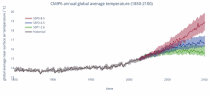
This catalogue entry provides daily and monthly global climate projections data from a large number of experiments, models and time periods computed in the framework of the sixth phase of the Coupled Model Intercomparison Project (CMIP6).
CMIP6 data underpins the Intergovernmental Panel on Climate Change 6th Assessment Report. The use of these data is mostly aimed at:

addressing outstanding scientific questions that arose as part of the IPCC reporting process;
improving the understanding of the climate system;

calendar_today Interval/period: Sun, 01/01/1860 - Mon, 12/31/2300

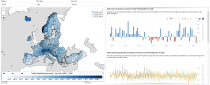
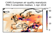
This dataset provides annual air quality reanalyses for Europe based on both unvalidated and validated observations.

calendar_today Interval/period: Tue, 01/01/2013 - Tue, 12/31/2024
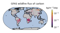
Emissions of atmospheric pollutants from biomass burning and vegetation fires are key drivers of the evolution of atmospheric composition, with a high degree of spatial and temporal variability, and an accurate representation of them in models is essential.

calendar_today Interval/period: Wed, 01/01/2003 - Wed, 12/03/2025
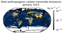
This data set contains gridded distributions of global anthropogenic and natural emissions.

calendar_today Interval/period: Sat, 01/01/2000 - Thu, 12/31/2020
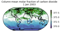
This dataset is part of the ECMWF Atmospheric Composition Reanalysis focusing on long-lived greenhouse gases: carbon dioxide (CO2) and methane (CH4). The emissions and natural fluxes at the surface are crucial for the evolution of the long-lived greenhouse gases in the atmosphere. In this dataset the CO2 fluxes from terrestrial vegetation are modelled in order to simulate the variability across a wide range of scales from diurnal to inter-annual.

calendar_today Interval/period: Wed, 01/01/2003 - Thu, 12/31/2020
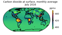
This dataset is part of the ECMWF Atmospheric Composition Reanalysis focusing on long-lived greenhouse gases: carbon dioxide (CO2) and methane (CH4). The emissions and natural fluxes at the surface are crucial for the evolution of the long-lived greenhouse gases in the atmosphere. In this dataset the CO2 fluxes from terrestrial vegetation are modelled in order to simulate the variability across a wide range of scales from diurnal to inter-annual.

calendar_today Interval/period: Wed, 01/01/2003 - Thu, 12/31/2020
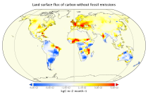
This data set contains net fluxes at the surface, atmospheric mixing ratios at model levels, and column-mean atmospheric mixing ratios for carbon dioxide (CO2), methane (CH4) and nitrous oxide (N20).

calendar_today Interval/period: Mon, 01/01/1979 - Wed, 12/31/2025
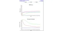
This product shows ENS meteograms from next model version of IFS cycle 50R1 that is planned to be ...

calendar_today Interval/period: N/A

open_in_newview in Open Charts

**Note:** In **June 2023** ECMWF implemented a **major upgrade ...**

calendar_today Interval/period: N/A

open_in_newview in Open Charts
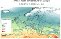
This dataset provides a historical reconstruction of bioclimatic indicators at 1 x 1 km resolution for Europe, Northern Brazil and Central Africa. These bioclimate indicators describe how the climate affects ecosystems, the services they deliver, and nature’s biodiversity. They are specifically relevant for applications within the biodiversity and ecosystem services community.

calendar_today Interval/period: Mon, 01/01/1979 - Mon, 12/31/2018
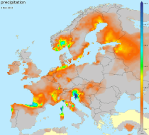
E-OBS is a daily gridded land-only observational dataset over Europe. The blended time series from the station network of the European Climate Assessment & Dataset (ECA&D) project form the basis for the E-OBS gridded dataset. All station data are sourced directly from the European National Meteorological and Hydrological Services (NMHSs) or other data holding institutions.

calendar_today Interval/period: Sun, 01/01/1950 - Tue, 07/14/2026
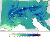
This dataset, also known as the Long-term Alpine Precipitation Reconstruction (LAPrec), provides gridded fields of monthly precipitation for the Alpine region (eight countries). The dataset is derived from station observations and is provided in two issues:

LAPrec1871 starts in 1871 and is based on data from 85 input series;
LAPrec1901 starts in 1901 and is based on data from 165 input series.

calendar_today Interval/period: Sun, 01/01/1871 - Tue, 07/14/2026