
Datasets
Displaying 1 - 11 of 11
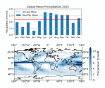
This dataset provides global estimates of daily accumulated and monthly means of precipitation. The precipitation estimates are based on a merge of passive microwave observations from two different radiometer classes operating on multiple Low Earth Orbit (LEO) satellites.
Interval/period: Sat, 01/01/2000 - Sun, 12/31/2017
ERA5-Land is a reanalysis dataset providing a consistent view of the evolution of land variables over several decades at an enhanced resolution compared to the
Fifth Generation of the European Centre for Medium-Range Weather Forecasts (ECMWF) Reanalysis (ERA5).
Produced by replaying only the land component of the ECMWF ERA5 climate reanalysis, it benefits from the same physical data-assimilation framework but runs offline at
higher spatial detail (9 km grid) to deliver richer land-surface information.
Fifth Generation of the European Centre for Medium-Range Weather Forecasts (ECMWF) Reanalysis (ERA5).
Produced by replaying only the land component of the ECMWF ERA5 climate reanalysis, it benefits from the same physical data-assimilation framework but runs offline at
higher spatial detail (9 km grid) to deliver richer land-surface information.
Interval/period: Sun, 01/01/1950 - Thu, 12/31/2026
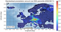
The dataset presents climate impact indicators related to extreme precipitation in Europe under current climate conditions. The suite of indicators include recent historic records, recurrence intervals, and other relevant statistical measures to evaluate the magnitude and frequency of extreme precipitation events. These are provided as gridded products, with one product covering the whole of Europe, and the other higher resolution product focused on 20 European cities that were identified as vulnerable to urban pluvial flooding based on stakeholder surveys.
Interval/period: Sun, 01/01/1950 - Tue, 12/31/2019
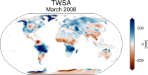
This dataset provides global Terrestrial Water Storage Anomalies (TWSA) on a 0.5° regular grid. TWSA represent deviations from the long-term average of water stored on or below the Earth’s surface in the form of soil moisture, groundwater, surface water, snow and ice. Designated as an Essential Climate Variable (ECV) as defined by the Global Climate Observing System (GCOS), TWSA is considered essential for contributing to a comprehensive view of Earth’s climate, its variability, and trends.
Interval/period: Thu, 04/04/2002 - Tue, 04/01/2025
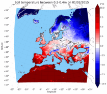
The UERRA dataset provides estimations of the climate in Europe based on model data
combined with observations using the UERRA-HARMONIE system and MESCAN-SURFEX system.
UERRA-HARMONIE is a 3-dimensional data assimilation system, whereas
MESCAN-SURFEX is a complementary surface analysis system. In general, the
assimilation systems are able to estimate biases between observations and to
sift good-quality data from poor data. The laws of physics allow for estimates
combined with observations using the UERRA-HARMONIE system and MESCAN-SURFEX system.
UERRA-HARMONIE is a 3-dimensional data assimilation system, whereas
MESCAN-SURFEX is a complementary surface analysis system. In general, the
assimilation systems are able to estimate biases between observations and to
sift good-quality data from poor data. The laws of physics allow for estimates
Interval/period: Thu, 10/18/2018 - Wed, 07/31/2019
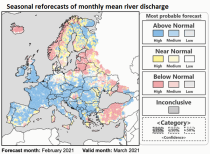
This dataset provides hydrological seasonal reforecasts of monthly mean river discharge across Europe for the period 1993 to 2016. The first is an E-HYPE multi-model system comprising eight model realisations using a catchment-based resolution. The second comprises the E-HYPEgrid, VIC-WUR and LISFLOOD-EFAS hydrological models at a 5km gridded resolution.
Interval/period: Fri, 01/01/2021 - Fri, 08/28/2026
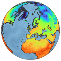
ERA5-Land is a reanalysis dataset providing a consistent view of the evolution of land variables over several decades at an enhanced resolution compared to ERA5. ERA5-Land has been produced by replaying the land component of the ECMWF ERA5 climate reanalysis. Reanalysis combines model data with observations from across the world into a globally complete and consistent dataset using the laws of physics. Reanalysis produces data that goes several decades back in time, providing an accurate description of the climate of the past.
Interval/period: Sun, 01/01/1950 - Thu, 06/25/2026
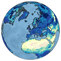
ERA5-Land is a reanalysis dataset providing a consistent view of the evolution of land variables over several decades at an enhanced resolution compared to ERA5. ERA5-Land has been produced by replaying the land component of the ECMWF ERA5 climate reanalysis. Reanalysis combines model data with observations from across the world into a globally complete and consistent dataset using the laws of physics. Reanalysis produces data that goes several decades back in time, providing an accurate description of the climate of the past.
Interval/period: Sun, 01/01/1950 - Fri, 05/01/2026
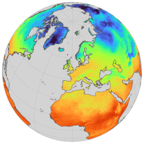
ERA5-Land is a reanalysis dataset providing a consistent view of the evolution of land variables over several decades at an enhanced resolution compared to ERA5. ERA5-Land has been produced by replaying the land component of the ECMWF ERA5 climate reanalysis. Reanalysis combines model data with observations from across the world into a globally complete and consistent dataset using the laws of physics. Reanalysis produces data that goes several decades back in time, providing an accurate description of the climate of the past.
Interval/period: Sun, 01/01/1950 - Thu, 06/25/2026
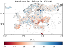
This dataset provides hydrological seasonal forecasts of monthly mean river discharge across Europe. Two hydrological model ensembles are provided. The first is an E-HYPE multi-model system comprising eight model realisations using a catchment-based resolution. The second comprises the E-HYPEgrid, VIC-WUR and EFAS (LISFLOOD) hydrological models at a 5km gridded resolution.
Interval/period: Tue, 12/01/2020 - Mon, 06/01/2026
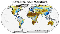
The C3S satellite soil moisture (SM) service provides a range of global soil moisture variables derived from numerous satellite sensors, including scatterometers and radiometers. The products are designed primarily for applications related to climate variability and change, land–atmosphere interactions, global biogeochemical cycles, ecology, hydrological and land surface modelling, drought monitoring, and meteorology.
Interval/period: Wed, 11/01/1978 - Sat, 06/20/2026