
Datasets
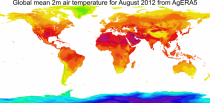
Interval/period: Mon, 01/01/1979 - Tue, 06/23/2026
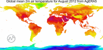
Interval/period: Mon, 01/01/1979 - Sun, 01/04/2026
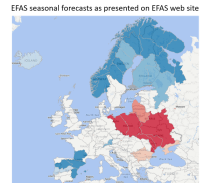
River discharge
Volumetric soil moisture
Snow water equivalent
Soil wetness index (root zone)
Runoff water equivalent (surface plus subsurface)
Interval/period: Sun, 11/01/2020 - Mon, 06/01/2026
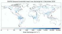
River discharge
Soil wetness index (root zone)
Snow water equivalent
Runoff water equivalent (surface plus subsurface)
Interval/period: Tue, 12/01/2020 - Mon, 06/01/2026
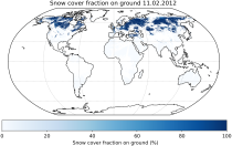
It provides Level 3 collated (L3C) processed products, namely global daily single-sensor Snow cover fraction viewable (SCFV) and Snow cover fraction on ground (SCFG) products, both of which are based on optical satellite data.
Interval/period: Fri, 01/01/1982 - Tue, 09/30/2025
Interval/period: Wed, 11/01/1978 - Sat, 06/20/2026

11-member coupled subseasonal re-forecast experiment using a prototype CY49R2 configuration of the IFS–NEMO4–SI3 system. Re-forecasts are initialized on the first day of each month, covering the period 2004 to 2023, and are integrated to +46 days. The atmospheric component runs at Tco319L137 and is initialized from ERA5, ocean and sea-ice components run at eORCA0.25Z75 and are initialized from ORAS6.
Interval/period: N/A
Standalone ecWAM wave model CY50R1 with altimeter wave height assimilation forced by operational lwda 6-hourly stress equivalent neutral 10m winds, air density, gustiness and sea ice fraction. Native grid is Tco1279 (9km), 36 directions, 36 frequencies. See Bidlot et al. 2026: Wave Hindcast for ERA6 Preparation and Training Data Driven Models. ECMWF Tech Memo, in preparation, 6-hourly output, many parameters.
Interval/period: N/A
Standalone ecWAM wave model CY50R1 with altimeter wave height assimilation forced by operational lwda 6-hourly stress equivalent neutral 10m winds, air density, gustiness and sea ice fraction (2021-2026-02-03). Native grid is Tco1279 (9km), 36 directions, 36 frequencies, See Bidlot et al. 2026: Wave Hindcast for ERA6 Preparation and Training Data Driven Models. ECMWF Tech Memo, in preparation, 6-hourly output, many parameters.
Interval/period: N/A
Standalone ecWAM wave model CY50R1 with altimeter wave height assimilation forced by operational lwda 6-hourly stress equivalent neutral 10m winds, air density, gustiness and sea ice fraction AND surface currents from ORAS6 (2016-2020). Native grid is Tco1279 (9km), 36 directions, 36 frequencies, current refraction. See Bidlot et al. 2026: Wave Hindcast for ERA6 Preparation and Training Data Driven Models. ECMWF Tech Memo, in preparation, 6-hourly output, many parameters.
Interval/period: N/A
Standalone ecWAM wave model CY50R1 with altimeter wave height assimilation forced by operational lwda 6-hourly stress equivalent neutral 10m winds, air density, gustiness and sea ice fraction AND surface currents from ORAS6 (2021-2026-02-03). Native grid is Tco1279 (9km), 36 directions, 36 frequencies, current refraction. See Bidlot et al. 2026: Wave Hindcast for ERA6 Preparation and Training Data Driven Models. ECMWF Tech Memo, in preparation, 6-hourly output, many parameters.
Interval/period: N/A
Interval/period: Sun, 01/01/2017 - Mon, 06/01/2026
Interval/period: Sun, 01/01/2017 - Mon, 06/01/2026
Interval/period: Thu, 01/01/1981 - Mon, 06/01/2026
Interval/period: Fri, 01/01/1993 - Mon, 06/01/2026
Interval/period: Thu, 01/01/1981 - Mon, 06/01/2026
Interval/period: Thu, 01/01/1981 - Mon, 06/01/2026
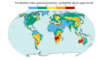
Interval/period: Sun, 02/01/1981 - Fri, 05/01/2026
Interval/period: Thu, 01/01/1981 - Mon, 06/01/2026
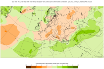
S2S project behind the dataset started in 2013 as a joint initiative of the World Weather Research Programme (WWRP) and the World Climate Research Programme (WCRP).
The goal of S2S project was to improve sub-seasonal forecast skill through combining multiple forecasting systems, enable multi-model evaluations and enhance knowledge sharing between operational centres.
Interval/period: Thu, 01/01/2015 - Mon, 06/29/2026
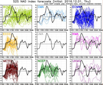
S2S project behind the dataset started in 2013 as a joint initiative of the World Weather Research Programme (WWRP) and the World Climate Research Programme (WCRP).
The goal of S2S project was to improve sub-seasonal forecast skill through combining multiple forecasting systems, enable multi-model evaluations and enhance knowledge sharing between operational centres.
Interval/period: Tue, 03/01/2011 - Sun, 08/09/2026
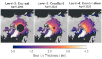
Interval/period: Tue, 10/01/2002 - Sun, 04/12/2026
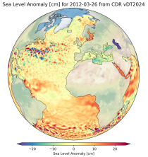
Interval/period: Fri, 01/01/1993 - Fri, 01/16/2026
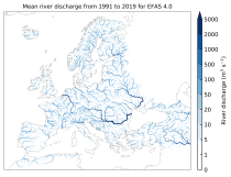
River discharge
Volumetric soil moisture
Snow water equivalent
Soil wetness index (root zone)
Runoff water equivalent (surface plus subsurface)
Interval/period: Thu, 10/11/2018 - Mon, 06/01/2026
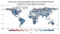
River discharge
Soil wetness index (root zone)
Snow water equivalent
Runoff water equivalent (surface plus subsurface)
Interval/period: Tue, 11/05/2019 - Wed, 07/01/2026