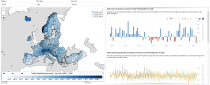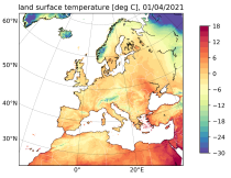
The Copernicus European Regional ReAnalysis Land (CERRA-Land) dataset provides spatially and temporally consistent historical reconstructions of surface and soil variables at the same horizontal resolution as the CERRA high-resolution reanalysis.

calendar_today Interval/period: Sat, 09/01/1984 - Thu, 07/31/2025
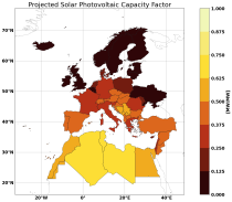
The Pan-European Climate Database (PECD) provides information on climate and renewable energy variables for both historical and future time periods. For historical data, the ERA5 global reanalysis serves as the underlying climate data, while future projections are based on selected CMIP6 global climate models. The raw climate model data are further processed through downscaling to achieve higher spatial and temporal resolution and by applying bias adjustment.

calendar_today Interval/period: Sun, 01/01/1950 - Wed, 12/01/2100
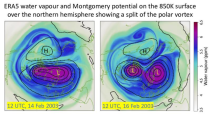
ERA5 is the fifth generation ECMWF atmospheric reanalysis of the global climate covering the period from January 1940 to present. It is produced by the Copernicus Climate Change Service (C3S) at ECMWF and provides hourly estimates of a large number of atmospheric, land and oceanic climate variables. The data cover the Earth on a 31km grid and resolve the atmosphere using 137 levels from the surface up to a height of 80km. ERA5 includes an ensemble component at half the resolution to provide information on synoptic uncertainty of its products.

calendar_today Interval/period: Sat, 01/01/1949 - Tue, 07/14/2026
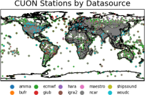
The Comprehensive Upper-air Observation Network (CUON) dataset is designed
to contain all available observations from balloons ascents through the atmosphere.
The main geophysical variables are temperature, humidity, and wind speed and wind direction,
as functions of atmospheric pressure levels. The observation platforms include pilot balloons, radiosondes, and ozonesondes.
The main observation data sources are:
- the NOAA Integrated Global Radiosonde Archive (IGRA version 2),
- the NCAR Upper-Air Database (UADB), and

calendar_today Interval/period: Tue, 01/01/1901 - Tue, 12/31/2024
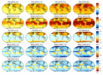
The dataset provides climate extreme indices related to temperature and precipitation as defined by the Expert Team on Climate Change Detection and Indices (ETCCDI), as well as selected heat stress indicators (HSI). The indices are provided for historical and future climate projections (SSP1-2.6, SSP2-4.5, SSP3-7.0, SSP5-8.5) included in the Coupled Model Intercomparison Project Phase 6 (CMIP6) and used in the 6th Assessment Report of the Intergovernmental Panel on Climate Change (IPCC).

calendar_today Interval/period: N/A

This dataset provides a series of climate indices derived from reanalysis and model simulations data hosted on the Copernicus Climate Data Store (CDS). These indicators describe how climate variability and change of essential climate variables can impact sectors such as health, agriculture, forestry, energy, tourism, or water and coastal management.

calendar_today Interval/period: Mon, 01/01/1940 - Fri, 12/31/2100
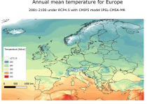
The dataset provides bioclimatic indicators derived from CMIP5 climate projections at 1 km x 1 km resolution for selected regions; Europe, Northern Brazil and Central Africa. This comprehensive set of bioclimatic indicators is specifically relevant for applications within the biodiversity and ecosystem services community.

calendar_today Interval/period: Sun, 01/01/1950 - Thu, 12/31/2099
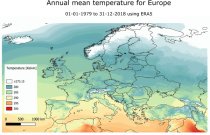
This dataset provides a historical reconstruction of bioclimatic indicators at 1 x 1 km resolution for Europe, Northern Brazil and Central Africa. These bioclimate indicators describe how the climate affects ecosystems, the services they deliver, and nature’s biodiversity. They are specifically relevant for applications within the biodiversity and ecosystem services community.

calendar_today Interval/period: Mon, 01/01/1979 - Mon, 12/31/2018
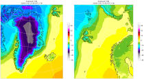
The daily and monthly data of the C3S Arctic Regional Reanalysis (CARRA) dataset contains daily and monthly meteorological variables at 2.5 km resolution. This includes fields at the single levels (including surface) and on pressure, height, soil and model levels.
These daily and monthly data are pre-calculated and have the following types depending on the variables: daily and monthly averages, extremes and totals.

calendar_today Interval/period: Sat, 09/01/1990 - Sat, 02/28/2026
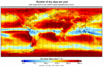
This dataset provides global bioclimatic indicators derived from CMIP5 climate projections. These bioclimatic indicators describe how the climate affects ecosystems, the services ecosystems deliver and nature’s biodiversity. They are specifically relevant for applications within the biodiversity and ecosystem community.

calendar_today Interval/period: Sun, 01/01/1950 - Thu, 12/31/2099
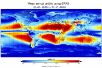
This dataset provides a historical global reconstruction of bioclimatic indicators derived from ERA5 reanalysis on a latitude-longitude grid. These bioclimate indicators describe how the climate affects ecosystems, the services they deliver, and nature’s biodiversity. They are specifically relevant for applications within the biodiversity and ecosystem services community.

calendar_today Interval/period: Mon, 01/01/1979 - Mon, 12/31/2018
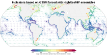
This dataset provides statistical indicators of tides, storm surges and sea level that can be used to characterize global sea level in present-day conditions and also to assess changes under climate change. The indicators calculated include extreme-value indicators (e.g. return periods including confidence bounds for total water levels and surge levels), probability indicators (e.g. percentile for total water levels and surge levels).

calendar_today Interval/period: Mon, 01/01/1951 - Sat, 12/31/2050
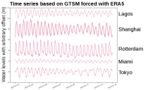
This dataset provides time series of global sea level related variables including tides, storm surges and sea level rise from 1950 to 2050 based on hydrodynamic modelling. The dataset provides a basis for studies, for instance, aiming to evaluate sea level variability, coastal flooding, coastal erosion, and accessibility of ports.

calendar_today Interval/period: Sun, 01/01/1950 - Sat, 12/31/2050
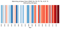
ERA5 is the fifth generation ECMWF reanalysis for the global climate and weather for the past 8 decades.
Data is available from 1940 onwards. ERA5 replaces the ERA-Interim reanalysis.

calendar_today Interval/period: Mon, 01/01/1940 - Fri, 12/06/2024
ERA5-Land is a reanalysis dataset providing a consistent view of the evolution of land variables over several decades at an enhanced resolution compared to the
Fifth Generation of the European Centre for Medium-Range Weather Forecasts (ECMWF) Reanalysis (ERA5).
Produced by replaying only the land component of the ECMWF ERA5 climate reanalysis, it benefits from the same physical data-assimilation framework but runs offline at
higher spatial detail (9 km grid) to deliver richer land-surface information.

calendar_today Interval/period: Sun, 01/01/1950 - Thu, 12/31/2026
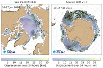
This dataset provides daily gridded fields of sea ice drift vectors for both hemispheres derived from satellite passive microwave brightness temperatures and atmospheric reanalysis data. Sea ice is an important component of our climate system and a sensitive indicator of climate change. Its presence or retreat significantly affects ocean-atmosphere interactions, the Earth’s energy budget as well as marine ecosystems. It is classified as an Essential Climate Variable by the Global Climate Observing System.

calendar_today Interval/period: Tue, 01/01/1991 - Thu, 12/31/2020
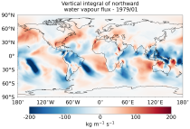
This dataset provides monthly means of mass-consistent, vertically integrated, atmospheric energy and moisture budget quantities derived from 1-hourly ERA5 reanalysis data.
The vertically integrated budget diagnostics include the tendencies and lateral fluxes of total energy, water vapour, and latent heat (with the latent heat of vaporization varying with temperature). In addition, the divergences of the lateral fluxes are provided.

calendar_today Interval/period: Mon, 01/01/1979 - Tue, 07/14/2026
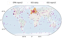
This dataset provides estimates of water vapour derived from atmospheric delays in Global Navigation Satellite System
(GNSS) radio signals.
The initial data is collected from two in situ ground-based network of GNSS receivers – the International GNSS Service
(IGS) and EUREF Permanent Network (EPN). The IGS collects, archives, and freely distributes GNSS data from a
cooperatively operated global network of more than 500 ground-based GNSS stations since 1994. The EPN is a European

calendar_today Interval/period: Mon, 01/01/1996 - Tue, 07/14/2026
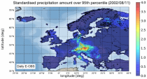
The dataset presents climate impact indicators related to extreme precipitation in Europe under current climate conditions. The suite of indicators include recent historic records, recurrence intervals, and other relevant statistical measures to evaluate the magnitude and frequency of extreme precipitation events. These are provided as gridded products, with one product covering the whole of Europe, and the other higher resolution product focused on 20 European cities that were identified as vulnerable to urban pluvial flooding based on stakeholder surveys.

calendar_today Interval/period: Sun, 01/01/1950 - Tue, 12/31/2019
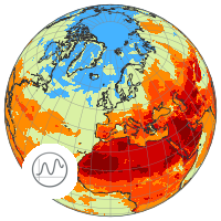
This catalogue entry provides a time series of thermal comfort indices, organised to make time the primary dimension for analysis and extraction. For any user-defined location (point) or small area, the dataset returns the temporal evolution of the selected variables, enabling efficient time-series studies without requiring users to download and manage full global gridded files.

calendar_today Interval/period: Mon, 01/01/1940 - Fri, 05/09/2025
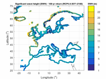
The dataset presents wave climate indicators based upon ocean surface wave parameters computed for a European-wide domain. This dataset provides an understanding of the European wave climate under the impact of climate change. It provides added value for various coastal sectors and studies such as port, shipping, and coastal management.

calendar_today Interval/period: Thu, 01/01/1976 - Fri, 12/31/2100
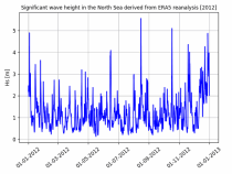
The dataset presents time series of the coastal wave climate based upon ocean surface wave parameters computed for a European-wide domain. This dataset provides an understanding of the wave climate under the impact of climate change for the Northwest European Shelf and Mediterranean Sea. It provides added value for various coastal sectors and studies such as port, shipping, and coastal management.

calendar_today Interval/period: Thu, 01/01/1976 - Fri, 12/31/2100
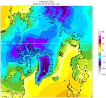
The C3S Arctic Regional Reanalysis second generation (CARRA2) dataset contains daily and monthly meteorological variables at 2.5 km resolution. These variables are specified at single levels (including surface) and also at soil, height, pressure and model levels. These daily and monthly data are pre-calculated and have the following types depending on the variables: daily and monthly averages, extremes and totals.

calendar_today Interval/period: Tue, 10/01/1985 - Wed, 12/31/2025
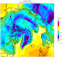
The C3S Arctic Regional Reanalysis second generation (CARRA2) dataset contains 3-hourly analyses at 2.5 km resolution. These variables are specified at single levels (including surface) and also at soil, height, pressure and model levels. Additionally, hourly forecasts are available between the analysis times and particularly forecasts up to 18 hours initialised from the analyses at 00 and 12 UTC.

calendar_today Interval/period: Sun, 09/01/1985 - Wed, 12/31/2025
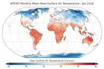
This dataset provides bias-corrected reconstruction of near-surface meteorological variables derived from the fifth generation of the European Centre for Medium-Range Weather Forecasts (ECMWF) atmospheric reanalyses (ERA5). It is intended to be used as a meteorological forcing dataset for land surface and hydrological models.

calendar_today Interval/period: Mon, 01/01/1979 - Tue, 12/31/2024