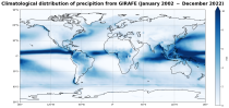
This dataset provides global estimates of precipitation based on satellite observations. Precipitation is the main component of water transport from the atmosphere to the Earth’s surface within the hydrological cycle. It varies strongly, depending on geographical location, season, synopsis, and other meteorological factors. The supply with freshwater through precipitation is vital for many subsystems of the climate and the environment, but there are also hazards related to extensive precipitation or the lack of precipitation.

calendar_today Interval/period: Tue, 01/01/2002 - Sat, 12/31/2022
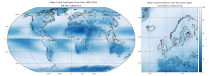
Cloud properties directly influence the state of the Earth´s upper-air atmosphere. Clouds have an effect on weather and climate through their contribution to the Earth’s water cycle and impact on the Earth’s energy budget. They impact atmospheric motions on a range of spatial and temporal scales and contribute to changes in the atmospheric composition.

calendar_today Interval/period: Mon, 01/01/1979 - Mon, 06/30/2025
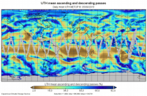
Upper Tropospheric Humidity (UTH) is of key importance to the Earth’s greenhouse effect and understanding of climate change. It is considered an Essential Climate Variable (ECV) because it controls key atmospheric processes, including those involved in water vapour and cloud feedbacks, that can amplify the climate system’s response to increases in other greenhouse gases. The Upper Tropospheric Humidity is defined as the integrated amount of Water Vapour in the atmospheric layer between ~500 hPa and ~200 hPa.

calendar_today Interval/period: Tue, 07/05/1994 - Sun, 02/28/2021
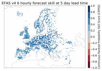
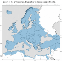
This dataset provides gridded modelled hydrological time series forced with medium- to sub-seasonal range meteorological reforecasts. The data is a consistent representation of the most important hydrological variables across the European Flood Awareness System (EFAS) domain. The temporal resolution is 20 years of sub-daily reforecasts initialised twice weekly (Mondays and Thursdays) of:

River discharge
Volumetric soil moisture
Snow water equivalent
Soil wetness index (root zone)
Runoff water equivalent (surface plus subsurface)

calendar_today Interval/period: Wed, 10/14/2020 - Mon, 08/10/2026
open_in_newview in EWDS|open_in_newview in EWDS
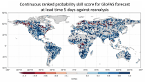
This dataset provides a gridded modelled time series of river discharge, forced with medium- to sub-seasonal range meteorological reforecasts. The data is a consistent representation of a key hydrological variable across the global domain, and is a product of the Global Flood Awareness System (GloFAS). It is accompanied by an ancillary file for interpretation that provides the upstream area (see the related variables table and associated link in the documentation).

calendar_today Interval/period: Sun, 01/03/1999 - Sat, 11/25/2023
open_in_newview in EWDS|open_in_newview in EWDS
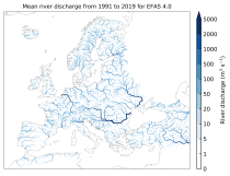
This dataset provides modelled daily hydrological time series forced with seasonal meteorological reforecasts. The dataset is a consistent representation of the most important hydrological variables across the European Flood Awareness (EFAS) domain. The temporal resolution is daily forecasts initialised once a month from 1991 to near real-time of:

River discharge
Volumetric soil moisture
Snow water equivalent
Soil wetness index (root zone)
Runoff water equivalent (surface plus subsurface)

calendar_today Interval/period: Fri, 01/01/1999 - Mon, 08/10/2026
open_in_newview in EWDS|open_in_newview in EWDS
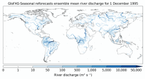
This dataset provides a gridded modelled time series of river discharge forced with seasonal range meteorological reforecasts. The data is a consistent representation of a key hydrological variable across the global domain, and is a product of the Global Flood Awareness System (GloFAS). It is accompanied by an ancillary file for interpretation that provides the upstream area (see the related variables table and associated link in the documentation).

calendar_today Interval/period: Thu, 01/01/1981 - Sat, 07/01/2023
open_in_newview in EWDS|open_in_newview in EWDS
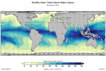
Water vapour is has been recognised as an Essential Climate Variable as it provides the basis for all cloud formation and physics and furthermore influences the Earth's heat budget due to its high absorbance of long and short-wave radiation. Total column water vapour (TCWV) is a measure of the integrated water vapour content of the atmosphere.
This catalogue entry provides the TCWV data product usually called Hamburg Ocean Atmosphere Parameters and Fluxes from Satellite Data (HOAPS).

calendar_today Interval/period: Wed, 05/01/2002 - Thu, 03/01/2012
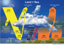
The Surface Radiation Budget (SRB) represents the balance between the heating of the Earth’s surface through absorption of incoming solar radiation and cooling through the emission of infra-red radiation, which is a fundamental component of the surface energy budget. Small changes in the surface radiation budget can lead to large climatological responses, which makes a permanent and precise monitoring indispensable.

calendar_today Interval/period: Mon, 01/01/1979 - Mon, 06/30/2025
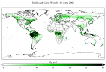
This dataset provides a record of fuel characteristics at high spatiotemporal resolution: ~9km, daily.
The two main variable groups are fuel load and fuel moisture, both of which are further divided by live/dead and wood/foliage fractions.
The dataset combines state-of-the-art model data (ERA5-Land) with observations from multiple satellites and in-situ variables into a globally complete and consistent dataset.

calendar_today Interval/period: Wed, 01/01/2003 - Fri, 12/31/2021
open_in_newview in XDS
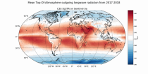
The Earth’s Radiation Budget (ERB) represents the overall balance between incoming and outgoing radiant energy at the Earth’s top-of-the-atmosphere. This Essential Climate Variable is the primary forcing of the climate system and is therefore a fundamental quantity to be monitored to understand the Earth’s climate and its variability. The Earth’s Radiation Budget comprises of the quantification of the incoming radiation from the Sun and the outgoing reflected shortwave and emitted longwave radiation.

calendar_today Interval/period: Mon, 01/01/1979 - Sun, 03/01/2026
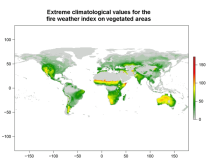
This data set provides complete historical reconstruction of meteorological conditions favourable to the start, spread and sustainability of fires. The fire danger metrics provided are part of a vast dataset produced by the Copernicus Emergency Management Service for the

calendar_today Interval/period: Wed, 01/03/1940 - Mon, 06/29/2026
open_in_newview in EWDS|open_in_newview in EWDS
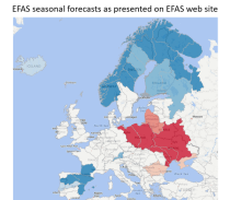
This dataset provides gridded modelled daily hydrological time series forced with seasonal meteorological forecasts. The dataset is a consistent representation of the most important hydrological variables across the European Flood Awareness (EFAS) domain. The temporal resolution is daily forecasts initialised once a month consisting of:

River discharge
Volumetric soil moisture
Snow water equivalent
Soil wetness index (root zone)
Runoff water equivalent (surface plus subsurface)

calendar_today Interval/period: Sun, 11/01/2020 - Mon, 06/01/2026
open_in_newview in EWDS|open_in_newview in EWDS
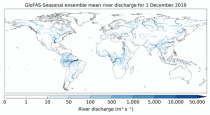
This dataset provides an ensemble of forecasted time series of gridded hydrological data forced with seasonal meteorological forecasts. The data set is a product of the Global Flood Awareness System (GloFAS) and offers a consistent representation of key hydrological variables across the global domain including:

River discharge
Soil wetness index (root zone)
Snow water equivalent
Runoff water equivalent (surface plus subsurface)

calendar_today Interval/period: Tue, 12/01/2020 - Mon, 06/01/2026
open_in_newview in EWDS|open_in_newview in EWDS
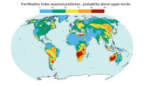
This dataset offers modeled daily fire danger time series, driven by seasonal weather forecasts. It provides long-range predictions of meteorological conditions conducive to the initiation, spread, and persistence of fires. The fire danger metrics included in this dataset are part of an extensive dataset produced by the Copernicus Emergency Management Service (CEMS) for the European Forest Fire Information System (EFFIS) and the Global Wildfire Information System (GWIS).

calendar_today Interval/period: Sun, 02/01/1981 - Fri, 05/01/2026
open_in_newview in EWDS
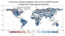
This dataset provides gridded modelled hydrological time series forced with medium-range meteorological forecasts. The data is a consistent representation of the most important hydrological variables across the European Flood Awareness System (EFAS) domain. The temporal resolution is sub-daily high-resolution and ensemble forecasts of:

River discharge
Volumetric soil moisture
Snow water equivalent
Soil wetness index (root zone)
Runoff water equivalent (surface plus subsurface)

calendar_today Interval/period: Thu, 10/11/2018 - Mon, 06/01/2026
open_in_newview in EWDS
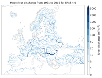
This dataset provides an ensemble of forecast time series of gridded hydrological data. The data set is a product of the Global Flood Awareness System (GloFAS) and offers a consistent representation of key hydrological variables across the global domain including:

River discharge
Soil wetness index (root zone)
Snow water equivalent
Runoff water equivalent (surface plus subsurface)

calendar_today Interval/period: Tue, 11/05/2019 - Wed, 07/01/2026
open_in_newview in EWDS
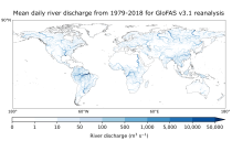
This dataset provides gridded modelled sub-daily and daily hydrological time series forced with meteorological observations. The data set is a consistent representation of the most important hydrological variables across the European Flood Awareness System (EFAS) domain. The temporal resolution is up to 30 years modelled time series of:

River discharge
Volumetric soil moisture
Snow water equivalent
Soil wetness index (root zone)
Runoff water equivalent (surface plus subsurface)

calendar_today Interval/period: Tue, 01/01/1991 - Sun, 06/28/2026
open_in_newview in EWDS|open_in_newview in EWDS
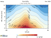
This dataset provides gridded modelled daily hydrological time series forced with meteorological reanalysis data. The data set is a product of the Global Flood Awareness System (GloFAS) and offers a consistent representation of key hydrological variables across the global domain including:

River discharge
Soil wetness index (root zone)
Snow water equivalent
Runoff water equivalent (surface plus subsurface)

calendar_today Interval/period: Mon, 01/01/1979 - Mon, 06/29/2026
open_in_newview in EWDS|open_in_newview in EWDS
This dataset provides monthly and zonally averaged tropospheric humidity profiles derived from globally distributed GPS radio occultation (RO) measurements from EUMETSAT's Metop polar-orbiting satellites. Humidity plays an important role in the Earth's climate system, due to the strong greenhouse effect of water vapour but also for its role in the global energy transport, vertically in the atmosphere and horizontally between different geographical regions.

calendar_today Interval/period: Fri, 12/01/2006 - Mon, 12/01/2025