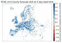
This dataset provides gridded modelled hydrological time series forced with medium- to sub-seasonal range meteorological reforecasts. The data is a consistent representation of the most important hydrological variables across the European Flood Awareness System (EFAS) domain. The temporal resolution is 20 years of sub-daily reforecasts initialised twice weekly (Mondays and Thursdays) of:

River discharge
Volumetric soil moisture
Snow water equivalent
Soil wetness index (root zone)
Runoff water equivalent (surface plus subsurface)

calendar_today Interval/period: Wed, 10/14/2020 - Sun, 08/09/2026
open_in_newview in EWDS|open_in_newview in EWDS
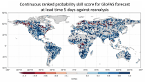
This dataset provides a gridded modelled time series of river discharge, forced with medium- to sub-seasonal range meteorological reforecasts. The data is a consistent representation of a key hydrological variable across the global domain, and is a product of the Global Flood Awareness System (GloFAS). It is accompanied by an ancillary file for interpretation that provides the upstream area (see the related variables table and associated link in the documentation).

calendar_today Interval/period: Sun, 01/03/1999 - Sat, 11/25/2023
open_in_newview in EWDS|open_in_newview in EWDS
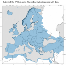
This dataset provides modelled daily hydrological time series forced with seasonal meteorological reforecasts. The dataset is a consistent representation of the most important hydrological variables across the European Flood Awareness (EFAS) domain. The temporal resolution is daily forecasts initialised once a month from 1991 to near real-time of:

River discharge
Volumetric soil moisture
Snow water equivalent
Soil wetness index (root zone)
Runoff water equivalent (surface plus subsurface)

calendar_today Interval/period: Fri, 01/01/1999 - Sun, 08/09/2026
open_in_newview in EWDS|open_in_newview in EWDS
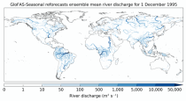
This dataset provides a gridded modelled time series of river discharge forced with seasonal range meteorological reforecasts. The data is a consistent representation of a key hydrological variable across the global domain, and is a product of the Global Flood Awareness System (GloFAS). It is accompanied by an ancillary file for interpretation that provides the upstream area (see the related variables table and associated link in the documentation).

calendar_today Interval/period: Thu, 01/01/1981 - Sat, 07/01/2023
open_in_newview in EWDS|open_in_newview in EWDS
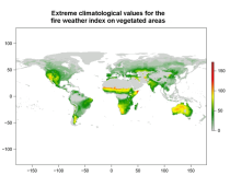
This data set provides complete historical reconstruction of meteorological conditions favourable to the start, spread and sustainability of fires. The fire danger metrics provided are part of a vast dataset produced by the Copernicus Emergency Management Service for the

calendar_today Interval/period: Wed, 01/03/1940 - Mon, 06/29/2026
open_in_newview in EWDS|open_in_newview in EWDS
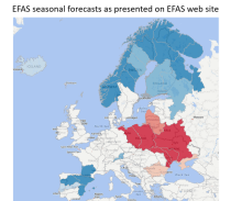
This dataset provides gridded modelled daily hydrological time series forced with seasonal meteorological forecasts. The dataset is a consistent representation of the most important hydrological variables across the European Flood Awareness (EFAS) domain. The temporal resolution is daily forecasts initialised once a month consisting of:

River discharge
Volumetric soil moisture
Snow water equivalent
Soil wetness index (root zone)
Runoff water equivalent (surface plus subsurface)

calendar_today Interval/period: Sun, 11/01/2020 - Mon, 06/01/2026
open_in_newview in EWDS|open_in_newview in EWDS
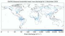
This dataset provides an ensemble of forecasted time series of gridded hydrological data forced with seasonal meteorological forecasts. The data set is a product of the Global Flood Awareness System (GloFAS) and offers a consistent representation of key hydrological variables across the global domain including:

River discharge
Soil wetness index (root zone)
Snow water equivalent
Runoff water equivalent (surface plus subsurface)

calendar_today Interval/period: Tue, 12/01/2020 - Mon, 06/01/2026
open_in_newview in EWDS|open_in_newview in EWDS
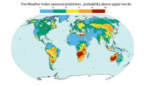
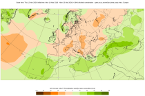
This dataset offers modeled daily fire danger time series, driven by seasonal weather forecasts. It provides long-range predictions of meteorological conditions conducive to the initiation, spread, and persistence of fires. The fire danger metrics included in this dataset are part of an extensive dataset produced by the Copernicus Emergency Management Service (CEMS) for the European Forest Fire Information System (EFFIS) and the Global Wildfire Information System (GWIS).

calendar_today Interval/period: Sun, 02/01/1981 - Fri, 05/01/2026
open_in_newview in EWDS
The Sub-seasonal To Seasonal dataset (S2S) consists of global ensemble real-time forecasts and reforecasts from thirteen numerical weather prediction (NWP) and research centres.
S2S project behind the dataset started in 2013 as a joint initiative of the World Weather Research Programme (WWRP) and the World Climate Research Programme (WCRP).
The goal of S2S project was to improve sub-seasonal forecast skill through combining multiple forecasting systems, enable multi-model evaluations and enhance knowledge sharing between operational centres.

calendar_today Interval/period: Thu, 01/01/2015 - Mon, 06/29/2026
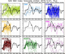
The Sub-seasonal To Seasonal dataset (S2S) consists of global ensemble real-time forecasts and reforecasts from thirteen numerical weather prediction (NWP) and research centres.
S2S project behind the dataset started in 2013 as a joint initiative of the World Weather Research Programme (WWRP) and the World Climate Research Programme (WCRP).
The goal of S2S project was to improve sub-seasonal forecast skill through combining multiple forecasting systems, enable multi-model evaluations and enhance knowledge sharing between operational centres.

calendar_today Interval/period: Tue, 03/01/2011 - Sun, 08/09/2026
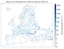
This dataset provides gridded modelled hydrological time series forced with medium-range meteorological forecasts. The data is a consistent representation of the most important hydrological variables across the European Flood Awareness System (EFAS) domain. The temporal resolution is sub-daily high-resolution and ensemble forecasts of:

River discharge
Volumetric soil moisture
Snow water equivalent
Soil wetness index (root zone)
Runoff water equivalent (surface plus subsurface)

calendar_today Interval/period: Thu, 10/11/2018 - Mon, 06/01/2026
open_in_newview in EWDS
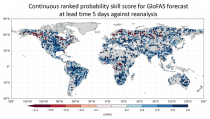
This dataset provides an ensemble of forecast time series of gridded hydrological data. The data set is a product of the Global Flood Awareness System (GloFAS) and offers a consistent representation of key hydrological variables across the global domain including:

River discharge
Soil wetness index (root zone)
Snow water equivalent
Runoff water equivalent (surface plus subsurface)

calendar_today Interval/period: Tue, 11/05/2019 - Wed, 07/01/2026
open_in_newview in EWDS
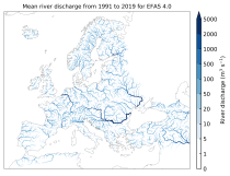
This dataset provides gridded modelled sub-daily and daily hydrological time series forced with meteorological observations. The data set is a consistent representation of the most important hydrological variables across the European Flood Awareness System (EFAS) domain. The temporal resolution is up to 30 years modelled time series of:

River discharge
Volumetric soil moisture
Snow water equivalent
Soil wetness index (root zone)
Runoff water equivalent (surface plus subsurface)

calendar_today Interval/period: Tue, 01/01/1991 - Sun, 06/28/2026
open_in_newview in EWDS|open_in_newview in EWDS
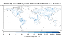
This dataset provides gridded modelled daily hydrological time series forced with meteorological reanalysis data. The data set is a product of the Global Flood Awareness System (GloFAS) and offers a consistent representation of key hydrological variables across the global domain including:

River discharge
Soil wetness index (root zone)
Snow water equivalent
Runoff water equivalent (surface plus subsurface)

calendar_today Interval/period: Mon, 01/01/1979 - Mon, 06/29/2026
open_in_newview in EWDS|open_in_newview in EWDS
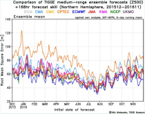
The International Grand Global Ensemble (TIGGE) dataset consists of global medium-range ensemble forecasts from thirteen numerical weather prediction (NWP) centres.
The dataset has been available since October 2006. TIGGE was established as a key component of THORPEX: a World Weather Research Programme to accelerate the improvements in the accuracy of 1-day to 2 week high-impact weather forecasts (THORPEX stands for THe Observing system Research and Predictability EXperiment)

calendar_today Interval/period: Sun, 10/01/2006 - Mon, 06/29/2026