
Datasets
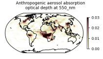
Interval/period: Wed, 01/01/2003 - Sun, 12/31/2017
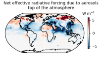
carbon dioxide
methane
tropospheric ozone
stratospheric ozone
interactions between anthropogenic aerosols and radiation
interactions between anthropogenic aerosols and clouds
Interval/period: Wed, 01/01/2003 - Sun, 12/31/2017
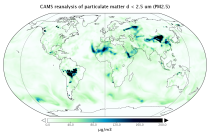
Interval/period: Wed, 01/01/2003 - Thu, 10/31/2024
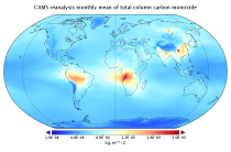
Interval/period: Wed, 01/01/2003 - Sun, 12/31/2023
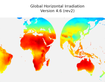
irradiation, as well as direct normal irradiation, on a latitude/longitude grid
covering land surfaces and coastal areas of Europe, Africa, Oceania, Eastern
South America, the Middle East and South-East Asia. It is created from 15 minute
resolved timeseries at each grid point. These timeseries were calculated by the
CAMS Solar Radiation Time Series Service and use information on aerosol, ozone
Interval/period: Sat, 01/01/2005 - Sun, 12/31/2023
Interval/period: Tue, 01/01/2013 - Tue, 12/31/2024
Interval/period: Wed, 01/01/2003 - Wed, 12/03/2025
Interval/period: Sat, 01/01/2000 - Thu, 12/31/2020
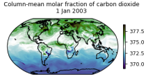
Interval/period: Wed, 01/01/2003 - Thu, 12/31/2020
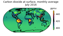
Interval/period: Wed, 01/01/2003 - Thu, 12/31/2020
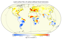
Interval/period: Mon, 01/01/1979 - Wed, 12/31/2025
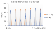
Interval/period: Thu, 01/01/2004 - Tue, 06/30/2026
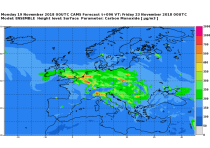
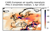
CAMS produces specific daily air quality analyses and forecasts for the European
domain at significantly higher spatial resolution (0.1 degrees, approx. 10km)
than is available from the global analyses and forecasts. The production is
based on an ensemble of eleven air quality forecasting systems across Europe. A
median ensemble is calculated from individual outputs, since ensemble products
Interval/period: Tue, 06/27/2023 - Wed, 07/01/2026
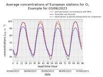
stations after optimisation using a statistical post-processing method called
Model Output Statistics (MOS). The unoptimised "raw" forecasts are also
provided in the same format.
The MOS method uses machine learning with predictive variables including
background air quality observation datasets, ECMWF meteorological forecasts and
the "raw" CAMS European air quality ensemble median forecast. The result is
Interval/period: Wed, 01/17/2024 - Wed, 07/01/2026
Interval/period: Thu, 01/01/2015 - Wed, 07/01/2026

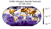
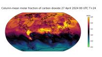
CAMS Global atmospheric composition forecast production system is used to produce the daily forecasts of pollutants, aerosols and greenhouse gases across the globe. Satellite observations of atmospheric composition are merged with a detailed computer simulation of the atmosphere using a method called data assimilation. The resulting analyses, i.e.
Interval/period: N/A
Interval/period: Fri, 03/01/2024 - Wed, 07/01/2026
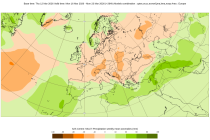
S2S project behind the dataset started in 2013 as a joint initiative of the World Weather Research Programme (WWRP) and the World Climate Research Programme (WCRP).
The goal of S2S project was to improve sub-seasonal forecast skill through combining multiple forecasting systems, enable multi-model evaluations and enhance knowledge sharing between operational centres.
Interval/period: Thu, 01/01/2015 - Mon, 06/29/2026
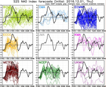
S2S project behind the dataset started in 2013 as a joint initiative of the World Weather Research Programme (WWRP) and the World Climate Research Programme (WCRP).
The goal of S2S project was to improve sub-seasonal forecast skill through combining multiple forecasting systems, enable multi-model evaluations and enhance knowledge sharing between operational centres.
Interval/period: Tue, 03/01/2011 - Sun, 08/09/2026
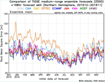
The dataset has been available since October 2006. TIGGE was established as a key component of THORPEX: a World Weather Research Programme to accelerate the improvements in the accuracy of 1-day to 2 week high-impact weather forecasts (THORPEX stands for THe Observing system Research and Predictability EXperiment)
Interval/period: Sun, 10/01/2006 - Mon, 06/29/2026