
Datasets

A subset of ECMWF real-time forecast data from the IFS and AIFS models is made available to the public free of charge. Their use is governed by the Creative Commons CC-BY-4.0 licence and the ECMWF Terms of Use.
Interval/period: N/A
The DestinE Digital Twin for Climate Change Adaptation (Climate DT) supports adaptation activities through the provision of innovative climate information on multi-decadal timescales, at scales at which the impacts of climate change are observed.
Interval/period: N/A
The DestinE Digital Twin for Weather-Induced Extremes (Extremes DT) supports rapid decision-making in response to meteorological, hydrological and air quality extremes.
Interval/period: N/A
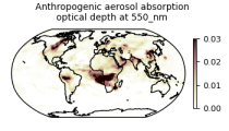
Interval/period: Wed, 01/01/2003 - Sun, 12/31/2017
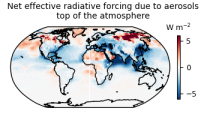
carbon dioxide
methane
tropospheric ozone
stratospheric ozone
interactions between anthropogenic aerosols and radiation
interactions between anthropogenic aerosols and clouds
Interval/period: Wed, 01/01/2003 - Sun, 12/31/2017
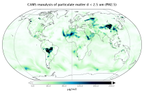
Interval/period: Wed, 01/01/2003 - Thu, 10/31/2024
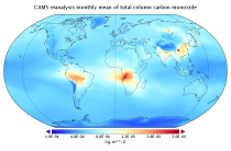
Interval/period: Wed, 01/01/2003 - Sun, 12/31/2023
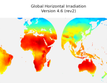
irradiation, as well as direct normal irradiation, on a latitude/longitude grid
covering land surfaces and coastal areas of Europe, Africa, Oceania, Eastern
South America, the Middle East and South-East Asia. It is created from 15 minute
resolved timeseries at each grid point. These timeseries were calculated by the
CAMS Solar Radiation Time Series Service and use information on aerosol, ozone
Interval/period: Sat, 01/01/2005 - Sun, 12/31/2023
Interval/period: Tue, 01/01/2013 - Tue, 12/31/2024
Interval/period: Wed, 01/01/2003 - Wed, 12/03/2025
Interval/period: Sat, 01/01/2000 - Thu, 12/31/2020
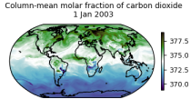
Interval/period: Wed, 01/01/2003 - Thu, 12/31/2020
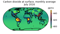
Interval/period: Wed, 01/01/2003 - Thu, 12/31/2020
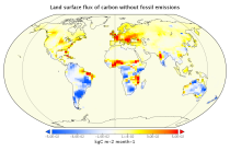
Interval/period: Mon, 01/01/1979 - Wed, 12/31/2025
The AI Weather Quest (AI WQ), organised by ECMWF, is an ambitious international competition designed to harness artificial intelligence (AI) and machine learning (ML) in advancing weather forecasting.
Interval/period: N/A
15-member coupled IFS (cycle 43R1) extended-range reforecast experiment covering the period 1989-2015. The atmosphere is configured with 91 vertical levels and uses the Tco399 cubic octahedral reduced Gaussian grid. The IFS is coupled hourly to the 75 level version of the NEMO v3.4 ocean model and the LIM2 sea-ice model, both of which use the ORCA025 tripolar grid. Coupling follows the implementation used in ECMWF operational forecasts.
Interval/period: N/A
15-member coupled IFS (cycle 43R1) extended-range reforecast experiment covering the period 1989-2015 with bias-corrected sea-surface temperatures (SSTs) in the North Atlantic region. This experiment can be compared with gkzp, which is the relevant control without bias-correction. The atmosphere is configured with 91 vertical levels and uses the Tco399 cubic octahedral reduced Gaussian grid.
Interval/period: N/A
An eddy-permitting ocean reanalysis spanning the period 1979–2012. Includes increased horizontal and vertical resolution, an prognostic sea-ice component, new versions of the ocean and data assimilation system, revised surface fluxes, new version and treatment of satellite sea surface height data, and assimilation of sea-ice concentration, among others.
Interval/period: N/A
Uses a sophisticated data assimilation methodology which includes a model bias correction. The ocean model used is forced by atmospheric daily surface fluxes, relaxed to SST and bias corrected.
Interval/period: N/A
The ECMWF OCEAN5 system is a new global eddy-permitting ocean-sea ice ensemble reanalysis analysis system. This Technical Memorandum gives a full description of the OCEAN5 system, with the focus on its Behind-Real-Time (BRT) component, the reanalysis product ORAS5. The OCEAN5 Real-Time (RT) component includes all upgrades developed for ORAS5 and runs daily using the latest observations and forcing fields from the operational Numerical Weather Prediction (NWP).
Interval/period: N/A
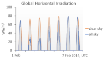
Interval/period: Thu, 01/01/2004 - Tue, 06/30/2026
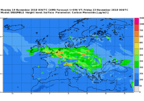
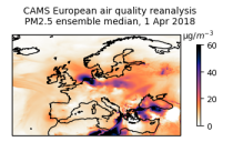
CAMS produces specific daily air quality analyses and forecasts for the European
domain at significantly higher spatial resolution (0.1 degrees, approx. 10km)
than is available from the global analyses and forecasts. The production is
based on an ensemble of eleven air quality forecasting systems across Europe. A
median ensemble is calculated from individual outputs, since ensemble products
Interval/period: Tue, 06/27/2023 - Wed, 07/01/2026
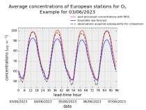
stations after optimisation using a statistical post-processing method called
Model Output Statistics (MOS). The unoptimised "raw" forecasts are also
provided in the same format.
The MOS method uses machine learning with predictive variables including
background air quality observation datasets, ECMWF meteorological forecasts and
the "raw" CAMS European air quality ensemble median forecast. The result is
Interval/period: Wed, 01/17/2024 - Wed, 07/01/2026
Interval/period: Thu, 01/01/2015 - Wed, 07/01/2026
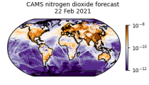
CAMS Global atmospheric composition forecast production system is used to produce the daily forecasts of pollutants, aerosols and greenhouse gases across the globe. Satellite observations of atmospheric composition are merged with a detailed computer simulation of the atmosphere using a method called data assimilation. The resulting analyses, i.e.
Interval/period: N/A