Displaying 676 - 700 of 708
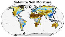
The C3S satellite soil moisture (SM) service provides a range of global soil moisture variables derived from numerous satellite sensors, including scatterometers and radiometers. The products are designed primarily for applications related to climate variability and change, land–atmosphere interactions, global biogeochemical cycles, ecology, hydrological and land surface modelling, drought monitoring, and meteorology.

calendar_today Interval/period: Wed, 11/01/1978 - Sat, 06/20/2026
This entry covers pressure-level data post-processed for bias adjustment on a monthly time resolution.

calendar_today Interval/period: Sun, 01/01/2017 - Mon, 06/01/2026
This entry covers single-level data post-processed for bias adjustment on a monthly time resolution.

calendar_today Interval/period: Sun, 01/01/2017 - Mon, 06/01/2026
This entry covers single-level data and soil-level data at the original time resolution (once a day, or once every 6 hours, depending on the variable).

calendar_today Interval/period: Thu, 01/01/1981 - Mon, 06/01/2026
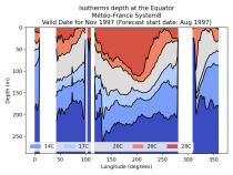
This entry covers global ocean data aggregated to a monthly time resolution. The catalogue entry includes temperature and salinity characteristics of the upper oceans and complements the other seasonal forecast catalogue entries for the land and atmospheric variables.

calendar_today Interval/period: Fri, 01/01/1993 - Mon, 06/01/2026
This entry covers pressure-level data aggregated on a monthly time resolution.

calendar_today Interval/period: Thu, 01/01/1981 - Mon, 06/01/2026
This entry covers single-level data aggregated on a monthly time resolution.

calendar_today Interval/period: Thu, 01/01/1981 - Mon, 06/01/2026
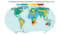
This dataset offers modeled daily fire danger time series, driven by seasonal weather forecasts. It provides long-range predictions of meteorological conditions conducive to the initiation, spread, and persistence of fires. The fire danger metrics included in this dataset are part of an extensive dataset produced by the Copernicus Emergency Management Service (CEMS) for the European Forest Fire Information System (EFFIS) and the Global Wildfire Information System (GWIS).

calendar_today Interval/period: Sun, 02/01/1981 - Fri, 05/01/2026
open_in_newview in EWDS
This entry covers pressure-level data at the original time resolution (once every 12 hours).

calendar_today Interval/period: Thu, 01/01/1981 - Mon, 06/01/2026
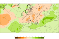
The Sub-seasonal To Seasonal dataset (S2S) consists of global ensemble real-time forecasts and reforecasts from thirteen numerical weather prediction (NWP) and research centres.
S2S project behind the dataset started in 2013 as a joint initiative of the World Weather Research Programme (WWRP) and the World Climate Research Programme (WCRP).
The goal of S2S project was to improve sub-seasonal forecast skill through combining multiple forecasting systems, enable multi-model evaluations and enhance knowledge sharing between operational centres.

calendar_today Interval/period: Thu, 01/01/2015 - Mon, 06/29/2026
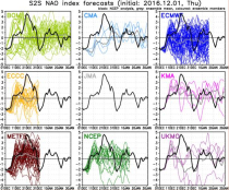
The Sub-seasonal To Seasonal dataset (S2S) consists of global ensemble real-time forecasts and reforecasts from thirteen numerical weather prediction (NWP) and research centres.
S2S project behind the dataset started in 2013 as a joint initiative of the World Weather Research Programme (WWRP) and the World Climate Research Programme (WCRP).
The goal of S2S project was to improve sub-seasonal forecast skill through combining multiple forecasting systems, enable multi-model evaluations and enhance knowledge sharing between operational centres.

calendar_today Interval/period: Tue, 03/01/2011 - Sun, 08/09/2026
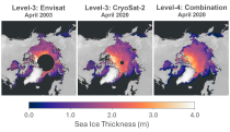
This dataset provides gridded sea ice thickness data for the Arctic, derived from satellite observations. Sea ice plays a vital role in the climate system, influencing air-sea interactions, the Earth’s energy balance, and marine ecosystems. It is recognised by the Global Climate Observing System (GCOS) as an Essential Climate Variable (ECV). Sea ice thickness is a key characteristic used alongside other parameters such as concentration, edge, and type, all available in the Climate Data Store (CDS).

calendar_today Interval/period: Tue, 10/01/2002 - Sun, 04/12/2026
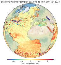
This dataset provides gridded daily and monthly mean global estimates of sea level anomaly based on satellite altimetry measurements. The rise in global mean sea level in recent decades has been one of the most important and well-known consequences of climate warming, putting a large fraction of the world population and economic infrastructure at greater risk of flooding. However, changes in the global average sea level mask regional variations that can be one order of magnitude larger.

calendar_today Interval/period: Fri, 01/01/1993 - Fri, 01/16/2026
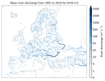
This dataset provides gridded modelled hydrological time series forced with medium-range meteorological forecasts. The data is a consistent representation of the most important hydrological variables across the European Flood Awareness System (EFAS) domain. The temporal resolution is sub-daily high-resolution and ensemble forecasts of:

River discharge
Volumetric soil moisture
Snow water equivalent
Soil wetness index (root zone)
Runoff water equivalent (surface plus subsurface)

calendar_today Interval/period: Thu, 10/11/2018 - Mon, 06/01/2026
open_in_newview in EWDS
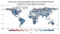
This dataset provides an ensemble of forecast time series of gridded hydrological data. The data set is a product of the Global Flood Awareness System (GloFAS) and offers a consistent representation of key hydrological variables across the global domain including:

River discharge
Soil wetness index (root zone)
Snow water equivalent
Runoff water equivalent (surface plus subsurface)

calendar_today Interval/period: Tue, 11/05/2019 - Wed, 07/01/2026
open_in_newview in EWDS
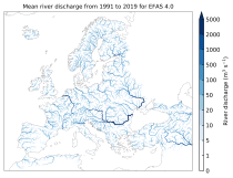
This dataset provides gridded modelled sub-daily and daily hydrological time series forced with meteorological observations. The data set is a consistent representation of the most important hydrological variables across the European Flood Awareness System (EFAS) domain. The temporal resolution is up to 30 years modelled time series of:

River discharge
Volumetric soil moisture
Snow water equivalent
Soil wetness index (root zone)
Runoff water equivalent (surface plus subsurface)

calendar_today Interval/period: Tue, 01/01/1991 - Sun, 06/28/2026
open_in_newview in EWDS|open_in_newview in EWDS
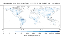
This dataset provides gridded modelled daily hydrological time series forced with meteorological reanalysis data. The data set is a product of the Global Flood Awareness System (GloFAS) and offers a consistent representation of key hydrological variables across the global domain including:

River discharge
Soil wetness index (root zone)
Snow water equivalent
Runoff water equivalent (surface plus subsurface)

calendar_today Interval/period: Mon, 01/01/1979 - Mon, 06/29/2026

open_in_newview in EWDS|open_in_newview in EWDS
Human Thermal Comfort Indices parameters from the Control forecast (formerly HRES) up to 15 days. The products are provided in GRIB 1 or GRIB 2 format.

calendar_today Interval/period: N/A

The products consist of values of the individual members of the real-time forecast at grid points (single locations). The products are provided in BUFR code. Select the number of locations you will require. Once you have submitted your order, you will be required to provide a list of all points to the Licensor handling your data.

calendar_today Interval/period: N/A

Tropical cyclone tracks are provided in BUFR format. These data will only be disseminated when a tropical cyclone is active. Tropical cyclone tracks are free of charge as part of the WMO Essential dataset: https://www.ecmwf.int/en/forecasts/datasets/wmo-essential

calendar_today Interval/period: N/A

Information on Simulated Satellite Images can be found here: https://confluence.ecmwf.int/display/FCST/Simulated+satellite+data

calendar_today Interval/period: N/A

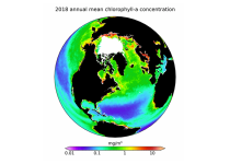
This dataset provides global daily estimates of ocean surface chlorophyll-a concentration and remote sensing reflectance derived from multiple satellite sensors. These two products are part of the broader discipline of ocean colour remote sensing, which analyses ocean surface radiances measured from space to derive information about the optical properties and constituents of the upper ocean.

calendar_today Interval/period: Thu, 09/04/1997 - Tue, 12/31/2024

HRES-WAM (High RESolution WAve Model) is coupled to the atmospheric model (HRES). More details can be found here: https://confluence.ecmwf.int/display/FUG/2.2+Ocean+Wave+Model+-+ECWAM The products are provided in GRIB 1 or GRIB 2 format.

calendar_today Interval/period: N/A

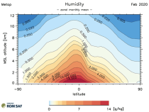
This dataset provides monthly and zonally averaged tropospheric humidity profiles derived from globally distributed GPS radio occultation (RO) measurements from EUMETSAT's Metop polar-orbiting satellites. Humidity plays an important role in the Earth's climate system, due to the strong greenhouse effect of water vapour but also for its role in the global energy transport, vertically in the atmosphere and horizontally between different geographical regions.

calendar_today Interval/period: Fri, 12/01/2006 - Mon, 12/01/2025