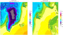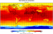
This catalogue entry provides monthly climate projections on single levels from a large number of experiments, models, members and time periods computed in the framework of fifth phase of the Coupled Model Intercomparison Project (CMIP5). The term "single levels" is used to express that the variables are computed at one vertical level which can be surface (or a level close to the surface) or a dedicated pressure level in the atmosphere. Multiple vertical levels are excluded from this catalogue entry.

calendar_today Interval/period: Sun, 01/01/1860 - Mon, 12/31/2300
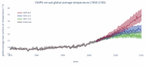
This catalogue entry provides daily and monthly global climate projections data from a large number of experiments, models and time periods computed in the framework of the sixth phase of the Coupled Model Intercomparison Project (CMIP6).
CMIP6 data underpins the Intergovernmental Panel on Climate Change 6th Assessment Report. The use of these data is mostly aimed at:

addressing outstanding scientific questions that arose as part of the IPCC reporting process;
improving the understanding of the climate system;

calendar_today Interval/period: Sun, 01/01/1860 - Mon, 12/31/2300

The DestinE Digital Twin for Climate Change Adaptation (Climate DT) supports adaptation activities by providing innovative climate information on multi-decadal timescales, globally, at scales at which many impacts of climate change are observed. It combines cutting-edge global Earth-system models, impact-sector applications and observations into a unified framework to provide global climate projections and impact-sector information on multi-decadal timescales (1990 to ~2050), at very high spatial resolutions (5 to 10 km).

calendar_today Interval/period: N/A

The DestinE Digital Twin for Climate Change Adaptation (Climate DT) supports adaptation activities by providing innovative climate information on multi-decadal timescales, globally, at scales at which many impacts of climate change are observed. It combines cutting-edge global Earth-system models, impact-sector applications and observations into a unified framework to provide global climate projections and impact-sector information on multi-decadal timescales (1990 to ~2050), at very high spatial resolutions (5 to 10 km).

calendar_today Interval/period: N/A

The DestinE Digital Twin for Climate Change Adaptation (Climate DT) supports adaptation activities by providing innovative climate information on multi-decadal timescales, globally, at scales at which many impacts of climate change are observed. It combines cutting-edge global Earth-system models, impact-sector applications and observations into a unified framework to provide global climate projections and impact-sector information on multi-decadal timescales (1990 to ~2050), at very high spatial resolutions (5 to 10 km).

calendar_today Interval/period: N/A

The daily and monthly data of the C3S Arctic Regional Reanalysis (CARRA) dataset contains daily and monthly meteorological variables at 2.5 km resolution. This includes fields at the single levels (including surface) and on pressure, height, soil and model levels.
These daily and monthly data are pre-calculated and have the following types depending on the variables: daily and monthly averages, extremes and totals.

calendar_today Interval/period: Sat, 09/01/1990 - Sat, 02/28/2026
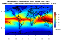
Atmospheric water vapor, quantified here as Total Column Water Vapor (TCWV), holds paramount importance in monitoring and understanding Earth's climate dynamics. Its role as an Essential Climate Variable is pivotal, serving as the foundation for cloud formation, cloud physics, and significantly impacting the Earth's heat budget through its proficient absorption of both long and short-wave radiation.
This catalogue entry presents two extensive, high-quality observational datasets of TCWV, specifically tailored for climate analysis and applications.

calendar_today Interval/period: Tue, 01/01/2002 - Sun, 12/31/2017
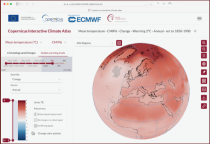
This catalogue entry provides the gridded climate data (monthly/annual timeseries) used for the Copernicus Climate Change Service Atlas (C3S Atlas). The gridded datasets consist of in-situ and satellite observation-based datasets, reanalyses (CERRA, ERA5, ERA5-Land, and ORAS5) and global (CMIP5 and CMIP6) and regional (CORDEX) climate projections for the variables and indices included in the C3S Atlas.

calendar_today Interval/period: Sun, 01/01/1860 - Mon, 12/31/2300
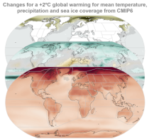
This catalogue entry provides gridded data from global (CMIP5 and CMIP6) and regional (CORDEX) projections for the set of 22 variables and indices included in the IPCC Interactive Atlas, a novel contribution from Working Group I (WGI) to the IPCC Sixth Assessment Report (AR6). These variables and indices are relevant for the climatic impact-drivers used in the regional assessments conducted in AR6 (Chapters 10, 11, 12 and Atlas), related to heat and cold, wet and dry, snow and ice, and wind.

calendar_today Interval/period: Sun, 01/01/1860 - Mon, 12/31/2300
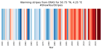
ERA5 is the fifth generation ECMWF reanalysis for the global climate and weather for the past 8 decades.
Data is available from 1940 onwards. ERA5 replaces the ERA-Interim reanalysis.

calendar_today Interval/period: Mon, 01/01/1940 - Fri, 12/06/2024
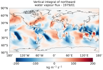
This dataset provides monthly means of mass-consistent, vertically integrated, atmospheric energy and moisture budget quantities derived from 1-hourly ERA5 reanalysis data.
The vertically integrated budget diagnostics include the tendencies and lateral fluxes of total energy, water vapour, and latent heat (with the latent heat of vaporization varying with temperature). In addition, the divergences of the lateral fluxes are provided.

calendar_today Interval/period: Mon, 01/01/1979 - Tue, 07/07/2026
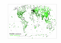
This catalogue entry provides access to vertical profiles of standard meteorological variables. It includes two archives.
The first is version 2 of the Integrated Global Radiosounding Archive (IGRA) from 1978 which incorporates global
radiosounding profiles of temperature, humidity and wind from a large number of data sources,
which is 30% larger than the previous version 1. IGRA v2 is the result of quality assurance procedures applied to the

calendar_today Interval/period: Sun, 01/01/1978 - Tue, 07/07/2026
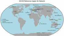
The Global Climate Observing System (GCOS) Reference Upper-Air Network (GRUAN) is an international reference observing network, established in 2006, of sites measuring essential climate variables above Earth's surface, designed to fill an important gap in the current global observing system. GRUAN measurements are providing high-quality climate data records from the surface, through the troposphere, and into the stratosphere.

calendar_today Interval/period: Sun, 01/01/1978 - Wed, 10/17/2018
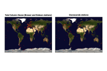
This dataset provides access to two types of ozone observations: total column ozone estimates and vertical profiles of ozone concentration.
The total ozone estimates are based on solar UV radiation measurements made by ground-based spectrophotometers (Dobson or Brewer type spectrophotometers).
The vertical profiles of ozone concentration are estimated primarily using ozonesonde observations.
Data are available for 159 Dobson stations, 109 Brewer stations and 135 ozonesondes stations.

calendar_today Interval/period: Tue, 01/01/1924 - Tue, 07/07/2026
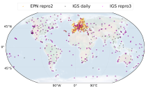
This dataset provides estimates of water vapour derived from atmospheric delays in Global Navigation Satellite System
(GNSS) radio signals.
The initial data is collected from two in situ ground-based network of GNSS receivers – the International GNSS Service
(IGS) and EUREF Permanent Network (EPN). The IGS collects, archives, and freely distributes GNSS data from a
cooperatively operated global network of more than 500 ground-based GNSS stations since 1994. The EPN is a European

calendar_today Interval/period: Mon, 01/01/1996 - Tue, 07/07/2026
This catalogue entry provides a time series of thermal comfort indices, organised to make time the primary dimension for analysis and extraction. For any user-defined location (point) or small area, the dataset returns the temporal evolution of the selected variables, enabling efficient time-series studies without requiring users to download and manage full global gridded files.

calendar_today Interval/period: Mon, 01/01/1940 - Fri, 05/09/2025
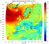
The present UERRA dataset contains analyses of atmospheric variables on height levels, from 1961 to 2019.

calendar_today Interval/period: Thu, 10/18/2018 - Wed, 07/31/2019
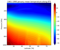
The present UERRA dataset contains analyses of atmospheric variables on pressure levels, from 1961 to 2019.
It has been generated using the UERRA-HARMONIE system by combining model data with observations into a complete and consistent dataset using the laws of physics.

calendar_today Interval/period: Thu, 10/18/2018 - Wed, 07/31/2019
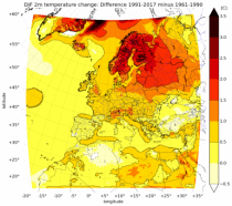
This UERRA dataset contains analyses of surface and near-surface essential climate variables from
UERRA-HARMONIE and MESCAN-SURFEX systems. Forecasts up to 30 hours initialised
from the analyses at 00 and 12 UTC are available only through the CDS-API (see Documentation).
UERRA-HARMONIE is a 3-dimensional variational data assimilation system,
while MESCAN-SURFEX is a complementary surface analysis system.
Using the Optimal Interpolation method, MESCAN provides the best estimate of daily accumulated precipitation

calendar_today Interval/period: Thu, 10/18/2018 - Wed, 07/31/2019
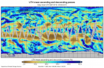
Upper Tropospheric Humidity (UTH) is of key importance to the Earth’s greenhouse effect and understanding of climate change. It is considered an Essential Climate Variable (ECV) because it controls key atmospheric processes, including those involved in water vapour and cloud feedbacks, that can amplify the climate system’s response to increases in other greenhouse gases. The Upper Tropospheric Humidity is defined as the integrated amount of Water Vapour in the atmospheric layer between ~500 hPa and ~200 hPa.

calendar_today Interval/period: Tue, 07/05/1994 - Sun, 02/28/2021
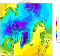
The C3S Arctic Regional Reanalysis second generation (CARRA2) dataset contains daily and monthly meteorological variables at 2.5 km resolution. These variables are specified at single levels (including surface) and also at soil, height, pressure and model levels. These daily and monthly data are pre-calculated and have the following types depending on the variables: daily and monthly averages, extremes and totals.

calendar_today Interval/period: Tue, 10/01/1985 - Wed, 12/31/2025
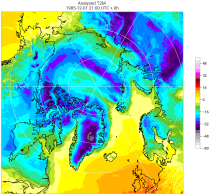
The C3S Arctic Regional Reanalysis second generation (CARRA2) dataset contains 3-hourly analyses at 2.5 km resolution. These variables are specified at single levels (including surface) and also at soil, height, pressure and model levels. Additionally, hourly forecasts are available between the analysis times and particularly forecasts up to 18 hours initialised from the analyses at 00 and 12 UTC.

calendar_today Interval/period: Sun, 09/01/1985 - Wed, 12/31/2025
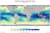
Water vapour is has been recognised as an Essential Climate Variable as it provides the basis for all cloud formation and physics and furthermore influences the Earth's heat budget due to its high absorbance of long and short-wave radiation. Total column water vapour (TCWV) is a measure of the integrated water vapour content of the atmosphere.
This catalogue entry provides the TCWV data product usually called Hamburg Ocean Atmosphere Parameters and Fluxes from Satellite Data (HOAPS).

calendar_today Interval/period: Wed, 05/01/2002 - Thu, 03/01/2012

Note: This Generation 1 Collection has been superseded by Generation 2 Simulation-level Collections

calendar_today Interval/period: N/A

Note: This Generation 1 Collection has been superseded by Generation 2 Simulation-level Collections

calendar_today Interval/period: N/A