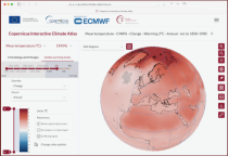
This catalogue entry provides the gridded climate data (monthly/annual timeseries) used for the Copernicus Climate Change Service Atlas (C3S Atlas). The gridded datasets consist of in-situ and satellite observation-based datasets, reanalyses (CERRA, ERA5, ERA5-Land, and ORAS5) and global (CMIP5 and CMIP6) and regional (CORDEX) climate projections for the variables and indices included in the C3S Atlas.

calendar_today Interval/period: Sun, 01/01/1860 - Mon, 12/31/2300
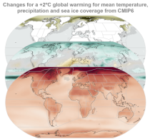
This catalogue entry provides gridded data from global (CMIP5 and CMIP6) and regional (CORDEX) projections for the set of 22 variables and indices included in the IPCC Interactive Atlas, a novel contribution from Working Group I (WGI) to the IPCC Sixth Assessment Report (AR6). These variables and indices are relevant for the climatic impact-drivers used in the regional assessments conducted in AR6 (Chapters 10, 11, 12 and Atlas), related to heat and cold, wet and dry, snow and ice, and wind.

calendar_today Interval/period: Sun, 01/01/1860 - Mon, 12/31/2300
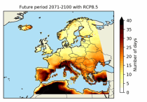
The dataset contains the number of hot and cold spell days using different European-wide and national/regional definitions developed within the C3S European Health service.
These heat wave and cold spell days are available for different future time periods and use different climate change scenarios.

calendar_today Interval/period: Wed, 01/01/1986 - Mon, 12/31/2085
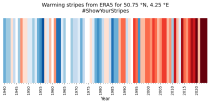
ERA5 is the fifth generation ECMWF reanalysis for the global climate and weather for the past 8 decades.
Data is available from 1940 onwards. ERA5 replaces the ERA-Interim reanalysis.

calendar_today Interval/period: Mon, 01/01/1940 - Fri, 12/06/2024
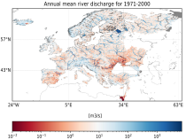
This dataset provides water variables and indicators based on hydrological impact modelling, forced by bias adjusted regional climate simulations from the European Coordinated Regional Climate Downscaling Experiment (EURO-CORDEX). The dataset contains Essential Climate Variable (ECV) data in the form of daily mean river discharge and a set of climate impact indicators (CIIs) for both water quantity and quality.
ECV datasets provide the empirical evidence needed to understand the current climate and predict future changes.

calendar_today Interval/period: N/A

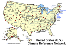
This catalogue entry provides access to a continuous series of near-surface climate observations collected in-situ at
United States Climate Reference Network (USCRN) stations.
There are over 130 USCRN stations over the conterminous United States (U.S.), Alaska, and Hawaii.
The USCRN stations are managed and maintained by the U.S. National Oceanic and Atmospheric Administration (NOAA).
The USCRN observations include air temperature, humidity, wind speed, precipitation, solar radiation,

calendar_today Interval/period: Sun, 01/01/2006 - Thu, 08/27/2026
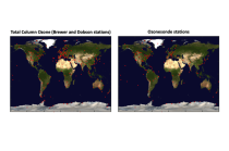
This dataset provides access to two types of ozone observations: total column ozone estimates and vertical profiles of ozone concentration.
The total ozone estimates are based on solar UV radiation measurements made by ground-based spectrophotometers (Dobson or Brewer type spectrophotometers).
The vertical profiles of ozone concentration are estimated primarily using ozonesonde observations.
Data are available for 159 Dobson stations, 109 Brewer stations and 135 ozonesondes stations.

calendar_today Interval/period: Tue, 01/01/1924 - Thu, 08/27/2026
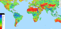
This dataset contains 4 Essential Climate Variables (ECV) for the 18 bias adjusted Global Climate Models (GCM) from CMIP5: daily precipitation rate, and daily mean, maximum and minimum temperatures.
The data are bias adjusted using the Distribution Based Scaling (DBS) method versus the global reference dataset HydroGFD2.0, both bias adjustment method and global reference dataset developed by the Swedish Meteorological and Hydrological Institute (SMHI).
The DBS method is a parametric quantile-mapping variant.

calendar_today Interval/period: Thu, 10/12/2000 - Thu, 10/18/2018
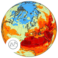
This catalogue entry provides a time series of thermal comfort indices, organised to make time the primary dimension for analysis and extraction. For any user-defined location (point) or small area, the dataset returns the temporal evolution of the selected variables, enabling efficient time-series studies without requiring users to download and manage full global gridded files.

calendar_today Interval/period: Mon, 01/01/1940 - Fri, 05/09/2025
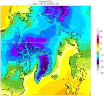
The C3S Arctic Regional Reanalysis second generation (CARRA2) dataset contains daily and monthly meteorological variables at 2.5 km resolution. These variables are specified at single levels (including surface) and also at soil, height, pressure and model levels. These daily and monthly data are pre-calculated and have the following types depending on the variables: daily and monthly averages, extremes and totals.

calendar_today Interval/period: Tue, 10/01/1985 - Wed, 12/31/2025
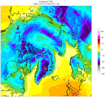
The C3S Arctic Regional Reanalysis second generation (CARRA2) dataset contains 3-hourly analyses at 2.5 km resolution. These variables are specified at single levels (including surface) and also at soil, height, pressure and model levels. Additionally, hourly forecasts are available between the analysis times and particularly forecasts up to 18 hours initialised from the analyses at 00 and 12 UTC.

calendar_today Interval/period: Sun, 09/01/1985 - Wed, 12/31/2025
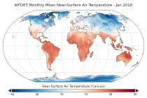
This dataset provides bias-corrected reconstruction of near-surface meteorological variables derived from the fifth generation of the European Centre for Medium-Range Weather Forecasts (ECMWF) atmospheric reanalyses (ERA5). It is intended to be used as a meteorological forcing dataset for land surface and hydrological models.

calendar_today Interval/period: Mon, 01/01/1979 - Tue, 12/31/2024

Note: This Generation 1 Collection has been superseded by Generation 2 Simulation-level Collections

calendar_today Interval/period: N/A

Note: This Generation 1 Collection has been superseded by Generation 2 Simulation-level Collections

calendar_today Interval/period: N/A

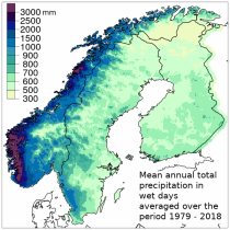
The Nordic Gridded Climate Dataset (NGCD) is a high resolution, observational, gridded dataset of daily minimum, maximum and mean temperatures and daily precipitation totals, covering Finland, Sweden and Norway. The time period covered begins in January 1961 and continues to the present.
Spatial interpolation methods are applied to observational datasets to create gridded datasets.
In general, there are three types of such methods: deterministic (type 1), stochastic (type 2) and pure mathematical (type 3).

calendar_today Interval/period: Sun, 01/01/1961 - Thu, 09/18/2025
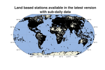
This set of data holdings provides access to data collected from land surface meteorological observations across the globe. Data are available at the observational level and also at daily and monthly aggregations. Data have been collated and harmonised and quality control checks have been performed, but no attempt has been made to assess for potential biases. Data are provided for a range of commonly observed variables.

calendar_today Interval/period: Sun, 01/01/1978 - Wed, 10/17/2018
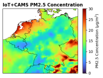
This dataset provides surface-level particulate matter (PM2.5 and PM10) concentrations derived from in situ low-cost sensor (LCS) measurements, produced by the European Centre for Medium-Range Weather Forecasts (ECMWF) in the context of the Horizon Europe All Data for Green Deal project. This dataset differs from existing air quality datasets by combining crowdsourced observations with a robust correction framework, producing high-resolution, reference-aligned gridded products.

calendar_today Interval/period: Mon, 01/01/2018 - Tue, 12/31/2024

open_in_newview in XDS
This dataset provides bias-corrected reconstruction of near-surface meteorological variables derived from the fifth generation of the European Centre for Medium-Range Weather Forecasts (ECMWF) atmospheric reanalyses (ERA5). It is intended to be used as a meteorological forcing dataset for land surface and hydrological models.

calendar_today Interval/period: Mon, 01/01/1979 - Mon, 12/31/2018

The nextGEMS data is aligned with the Climate Change Adaptation Digital Twin. The DestinE Digital Twin for Climate Change Adaptation (Climate DT) supports adaptation activities by providing innovative climate information on multi-decadal timescales, globally, at scales at which many impacts of climate change are observed.

calendar_today Interval/period: N/A

The nextGEMS data is aligned with the Climate Change Adaptation Digital Twin. The DestinE Digital Twin for Climate Change Adaptation (Climate DT) supports adaptation activities by providing innovative climate information on multi-decadal timescales, globally, at scales at which many impacts of climate change are observed.

calendar_today Interval/period: N/A

The Surface Radiation Budget (SRB) represents the balance between the heating of the Earth’s surface through absorption of incoming solar radiation and cooling through the emission of infra-red radiation, which is a fundamental component of the surface energy budget. Small changes in the surface radiation budget can lead to large climatological responses, which makes a permanent and precise monitoring indispensable.

calendar_today Interval/period: Mon, 01/01/1979 - Mon, 06/30/2025
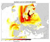
This dataset contains a set of synthetic windstorm events consisting of 22,980 individual storm footprints over Europe. These are a physically realistic set of plausible windstorm events based on the modelled climatic conditions. It is not designed to reproduce actual historical observations but as a comparator for the stochastic event sets generally used for windstorm risk analysis in the insurance industry. This is because there is no data assimilation process used to align the model output to historical observations.

calendar_today Interval/period: Wed, 01/01/1986 - Wed, 11/30/2011
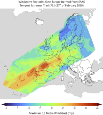
This dataset provides climate indicators of windstorms associated with extratropical cyclones, derived from the fifth generation of the European Centre for Medium-Range Weather Forecasts (ECMWF) atmospheric reanalyses (ERA5) over a pan-European domain. Developed as part of Copernicus Climate Change Service's (C3S) Enhanced Windstorm Service (EWS), and responding to requirements from users in the insurance sector, this dataset extends the previous C3S Windstorm Service (winter months only) to include the entire year.

calendar_today Interval/period: Thu, 02/01/1940 - Fri, 01/23/2026
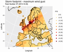
This dataset provides climatological indicators on European winter windstorms and their economic impact derived from ERA5 reanalysis. Also provided are risk indicators from a synthetically derived set of physically realistic windstorm events based on modelled climatic conditions. The primary users include the insurance sector, reinsurers and insurance industry service providers in response to their requirements for a catalogue of historic windstorm events within Europe.

calendar_today Interval/period: Sat, 03/01/1986 - Wed, 11/30/2011
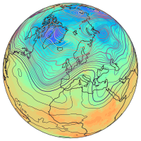
ERA5 is the fifth generation ECMWF reanalysis for the global climate and weather for the past 8 decades.
Data is available from 1940 onwards.
ERA5 replaces the ERA-Interim reanalysis.

calendar_today Interval/period: Mon, 01/01/1940 - Thu, 06/25/2026