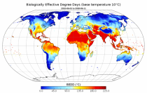
This dataset provides agroclimatic indicators used to characterise plant-climate interactions for global agriculture. Agroclimatic indicators are useful in conveying climate variability and change in the terms that are meaningful to the agricultural sector. The objective of this dataset is to provide these indicators at a global scale in an easily accessible and usable format for further downstream analysis and the forcing of agricultural impact models.

calendar_today Interval/period: Mon, 01/01/1951 - Wed, 08/26/2026
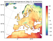
The Copernicus European Regional ReAnalysis Land (CERRA-Land) dataset provides spatially and temporally consistent historical reconstructions of surface and soil variables at the same horizontal resolution as the CERRA high-resolution reanalysis.

calendar_today Interval/period: Sat, 09/01/1984 - Thu, 07/31/2025
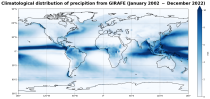
This dataset provides global estimates of precipitation based on satellite observations. Precipitation is the main component of water transport from the atmosphere to the Earth’s surface within the hydrological cycle. It varies strongly, depending on geographical location, season, synopsis, and other meteorological factors. The supply with freshwater through precipitation is vital for many subsystems of the climate and the environment, but there are also hazards related to extensive precipitation or the lack of precipitation.

calendar_today Interval/period: Tue, 01/01/2002 - Sat, 12/31/2022
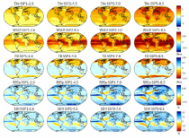
The dataset provides climate extreme indices related to temperature and precipitation as defined by the Expert Team on Climate Change Detection and Indices (ETCCDI), as well as selected heat stress indicators (HSI). The indices are provided for historical and future climate projections (SSP1-2.6, SSP2-4.5, SSP3-7.0, SSP5-8.5) included in the Coupled Model Intercomparison Project Phase 6 (CMIP6) and used in the 6th Assessment Report of the Intergovernmental Panel on Climate Change (IPCC).

calendar_today Interval/period: N/A

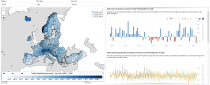
This dataset provides a series of climate indices derived from reanalysis and model simulations data hosted on the Copernicus Climate Data Store (CDS). These indicators describe how climate variability and change of essential climate variables can impact sectors such as health, agriculture, forestry, energy, tourism, or water and coastal management.

calendar_today Interval/period: Mon, 01/01/1940 - Fri, 12/31/2100
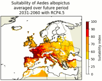
This dataset contains climatic suitability indicators for the Aedes albopictus (tiger mosquito) for Europe produced within the C3S European Health service. The provided indicators are the climatic suitability for the presence of Aedes albopictus and the season length of presence of Aedes albopictus. This mosquito transmits vector-borne diseases, such as dengue and chikungunya.

calendar_today Interval/period: N/A

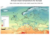
The dataset provides bioclimatic indicators derived from CMIP5 climate projections at 1 km x 1 km resolution for selected regions; Europe, Northern Brazil and Central Africa. This comprehensive set of bioclimatic indicators is specifically relevant for applications within the biodiversity and ecosystem services community.

calendar_today Interval/period: Sun, 01/01/1950 - Thu, 12/31/2099
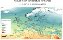
This dataset provides a historical reconstruction of bioclimatic indicators at 1 x 1 km resolution for Europe, Northern Brazil and Central Africa. These bioclimate indicators describe how the climate affects ecosystems, the services they deliver, and nature’s biodiversity. They are specifically relevant for applications within the biodiversity and ecosystem services community.

calendar_today Interval/period: Mon, 01/01/1979 - Mon, 12/31/2018
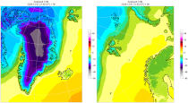
The daily and monthly data of the C3S Arctic Regional Reanalysis (CARRA) dataset contains daily and monthly meteorological variables at 2.5 km resolution. This includes fields at the single levels (including surface) and on pressure, height, soil and model levels.
These daily and monthly data are pre-calculated and have the following types depending on the variables: daily and monthly averages, extremes and totals.

calendar_today Interval/period: Sat, 09/01/1990 - Sat, 02/28/2026
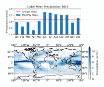
This dataset provides global estimates of daily accumulated and monthly means of precipitation. The precipitation estimates are based on a merge of passive microwave observations from two different radiometer classes operating on multiple Low Earth Orbit (LEO) satellites.

calendar_today Interval/period: Sat, 01/01/2000 - Sun, 12/31/2017
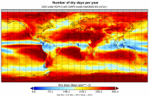
This dataset provides global bioclimatic indicators derived from CMIP5 climate projections. These bioclimatic indicators describe how the climate affects ecosystems, the services ecosystems deliver and nature’s biodiversity. They are specifically relevant for applications within the biodiversity and ecosystem community.

calendar_today Interval/period: Sun, 01/01/1950 - Thu, 12/31/2099
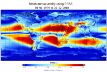
This dataset provides a historical global reconstruction of bioclimatic indicators derived from ERA5 reanalysis on a latitude-longitude grid. These bioclimate indicators describe how the climate affects ecosystems, the services they deliver, and nature’s biodiversity. They are specifically relevant for applications within the biodiversity and ecosystem services community.

calendar_today Interval/period: Mon, 01/01/1979 - Mon, 12/31/2018
ERA5-Land is a reanalysis dataset providing a consistent view of the evolution of land variables over several decades at an enhanced resolution compared to the
Fifth Generation of the European Centre for Medium-Range Weather Forecasts (ECMWF) Reanalysis (ERA5).
Produced by replaying only the land component of the ECMWF ERA5 climate reanalysis, it benefits from the same physical data-assimilation framework but runs offline at
higher spatial detail (9 km grid) to deliver richer land-surface information.

calendar_today Interval/period: Sun, 01/01/1950 - Thu, 12/31/2026
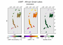
This dataset provides daily mid-morning measurements for Lake Surface Water Temperature (LSWT) derived from satellite observations. LSWT, together with five other variables (lake ice cover and thickness, water leaving reflectance, water level and extent) is recognised as the Essential Climate Variable (ECV) "Lakes" by the Global Climate Observing System (GCOS). LSWT is a key parameter in determining lake ecological conditions as it influences physical, chemical and biological processes.

calendar_today Interval/period: Thu, 06/01/1995 - Wed, 08/26/2026
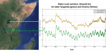
This dataset provides lake water levels for 311 selected lakes on four continents derived from satellite radar altimetry.

calendar_today Interval/period: Wed, 01/01/1992 - Wed, 08/26/2026
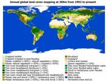
This dataset provides global maps describing the land surface into 22 classes, which have been defined using the United Nations Food and Agriculture Organization’s (UN FAO) Land Cover Classification System (LCCS). In addition to the land cover (LC) maps, four quality flags are produced to document the reliability of the classification and change detection.

calendar_today Interval/period: Wed, 01/01/1992 - Sat, 01/01/2022
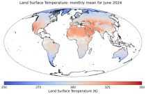
This dataset contains monthly daytime and nighttime clear-sky land surface temperatures (LSTs) and their uncertainty estimates from multiple Infra-Red (IR) instruments on polar orbiting satellites. Daytime and nighttime temperatures correspond to 10:00 and 22:00 local solar time (local solar time is defined as the time in a 24 hour day with 12 noon occurring when the sun is at its highest point at that longitude).

calendar_today Interval/period: Thu, 06/01/1995 - Tue, 12/31/2024
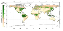
This catalogue entry provides satellite-derived estimates of two related variables: Leaf Area Index (LAI) and fraction of Absorbed Photosynthetically Active Radiation (fAPAR). LAI and fAPAR are both Essential Climate Variables (ECVs) as defined by the Global Climate Observing System (GCOS), meaning they have been designated as essential for contributing to a comprehensive view of Earth’s climate, its variability and trends.

calendar_today Interval/period: Tue, 09/01/1981 - Sun, 12/01/2024
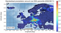
The dataset presents climate impact indicators related to extreme precipitation in Europe under current climate conditions. The suite of indicators include recent historic records, recurrence intervals, and other relevant statistical measures to evaluate the magnitude and frequency of extreme precipitation events. These are provided as gridded products, with one product covering the whole of Europe, and the other higher resolution product focused on 20 European cities that were identified as vulnerable to urban pluvial flooding based on stakeholder surveys.

calendar_today Interval/period: Sun, 01/01/1950 - Tue, 12/31/2019
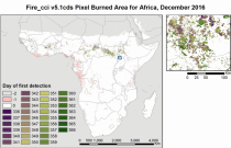
The Burned Area products provide global information of total burned area (BA) at pixel and grid scale. The BA is identified with the date of first detection of the burned signal in the case of the pixel product, and with the total BA per grid cell in the case of the grid product. The products were obtained through the analysis of reflectance changes from medium resolution sensors (Terra MODIS, Sentinel-3 OLCI), supported by the use of MODIS thermal information.

calendar_today Interval/period: Mon, 01/01/2001 - Fri, 04/01/2022
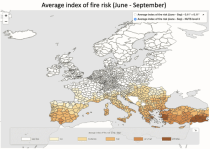
The dataset presents projections of fire danger indicators for Europe based upon the Canadian Fire Weather Index System (FWI) under future climate conditions. The FWI is a meteorologically based index used worldwide to estimate the fire danger and is implemented in the Global ECMWF Fire Forecasting model (GEFF). In this dataset, daily FWI values, seasonal FWI values, and other FWI derived, threshold-specific, indicators were modelled using the GEFF model to estimate the fire danger in future climate scenarios.

calendar_today Interval/period: N/A

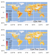
This dataset provides global information on the timing and location of Active Fires (AF) burning on Earth's surface during satellite overpasses, and also records their Fire Radiative Power (FRP) as a measure of strength. FRP relates to a fire's combustion rate, and the rate at which smoke containing greenhouse gases, reactive gases and particular matter is released into the atmosphere. The vast majority of detected hotspots are related to landscape fires, however other high temperature targets such as active volcanoes and gas flares are also present in the data.

calendar_today Interval/period: Wed, 01/01/2020 - Fri, 02/28/2025
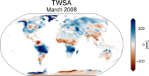
This dataset provides global Terrestrial Water Storage Anomalies (TWSA) on a 0.5° regular grid. TWSA represent deviations from the long-term average of water stored on or below the Earth’s surface in the form of soil moisture, groundwater, surface water, snow and ice. Designated as an Essential Climate Variable (ECV) as defined by the Global Climate Observing System (GCOS), TWSA is considered essential for contributing to a comprehensive view of Earth’s climate, its variability, and trends.

calendar_today Interval/period: Thu, 04/04/2002 - Tue, 04/01/2025
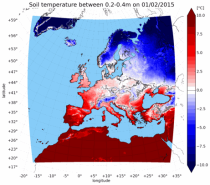
The UERRA dataset provides estimations of the climate in Europe based on model data
combined with observations using the UERRA-HARMONIE system and MESCAN-SURFEX system.
UERRA-HARMONIE is a 3-dimensional data assimilation system, whereas
MESCAN-SURFEX is a complementary surface analysis system. In general, the
assimilation systems are able to estimate biases between observations and to
sift good-quality data from poor data. The laws of physics allow for estimates

calendar_today Interval/period: Thu, 10/18/2018 - Wed, 07/31/2019
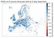
This dataset provides gridded modelled hydrological time series forced with medium- to sub-seasonal range meteorological reforecasts. The data is a consistent representation of the most important hydrological variables across the European Flood Awareness System (EFAS) domain. The temporal resolution is 20 years of sub-daily reforecasts initialised twice weekly (Mondays and Thursdays) of:

River discharge
Volumetric soil moisture
Snow water equivalent
Soil wetness index (root zone)
Runoff water equivalent (surface plus subsurface)

calendar_today Interval/period: Wed, 10/14/2020 - Wed, 08/26/2026

open_in_newview in EWDS|open_in_newview in EWDS