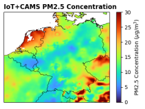
This dataset provides surface-level particulate matter (PM2.5 and PM10) concentrations derived from in situ low-cost sensor (LCS) measurements, produced by the European Centre for Medium-Range Weather Forecasts (ECMWF) in the context of the Horizon Europe All Data for Green Deal project. This dataset differs from existing air quality datasets by combining crowdsourced observations with a robust correction framework, producing high-resolution, reference-aligned gridded products.

calendar_today Interval/period: Mon, 01/01/2018 - Tue, 12/31/2024
open_in_newview in XDS
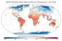
This dataset provides bias-corrected reconstruction of near-surface meteorological variables derived from the fifth generation of the European Centre for Medium-Range Weather Forecasts (ECMWF) atmospheric reanalyses (ERA5). It is intended to be used as a meteorological forcing dataset for land surface and hydrological models.

calendar_today Interval/period: Mon, 01/01/1979 - Mon, 12/31/2018
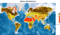
This catalogue entry provides satellite-derived estimates of surface albedo, an Essential Climate Variable (ECV) as defined by the Global Climate Observing System (GCOS). Surface albedo is critical for understanding the Earth’s climate, its variability, and trends, as it quantifies the fraction of solar irradiance reflected by the Earth’s surface. This variable plays a vital role in the global radiation budget, influencing surface temperatures, water balance, and climate feedback mechanisms, such as the ice-albedo feedback in polar regions.

calendar_today Interval/period: Tue, 09/01/1981 - Sun, 12/01/2024
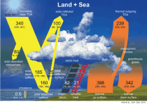
The Surface Radiation Budget (SRB) represents the balance between the heating of the Earth’s surface through absorption of incoming solar radiation and cooling through the emission of infra-red radiation, which is a fundamental component of the surface energy budget. Small changes in the surface radiation budget can lead to large climatological responses, which makes a permanent and precise monitoring indispensable.

calendar_today Interval/period: Mon, 01/01/1979 - Mon, 06/30/2025
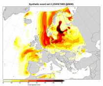
This dataset contains a set of synthetic windstorm events consisting of 22,980 individual storm footprints over Europe. These are a physically realistic set of plausible windstorm events based on the modelled climatic conditions. It is not designed to reproduce actual historical observations but as a comparator for the stochastic event sets generally used for windstorm risk analysis in the insurance industry. This is because there is no data assimilation process used to align the model output to historical observations.

calendar_today Interval/period: Wed, 01/01/1986 - Wed, 11/30/2011
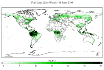
This dataset provides a record of fuel characteristics at high spatiotemporal resolution: ~9km, daily.
The two main variable groups are fuel load and fuel moisture, both of which are further divided by live/dead and wood/foliage fractions.
The dataset combines state-of-the-art model data (ERA5-Land) with observations from multiple satellites and in-situ variables into a globally complete and consistent dataset.

calendar_today Interval/period: Wed, 01/01/2003 - Fri, 12/31/2021
open_in_newview in XDS
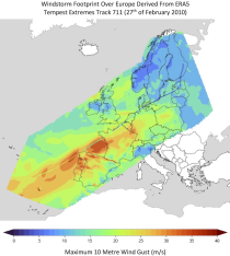
This dataset provides climate indicators of windstorms associated with extratropical cyclones, derived from the fifth generation of the European Centre for Medium-Range Weather Forecasts (ECMWF) atmospheric reanalyses (ERA5) over a pan-European domain. Developed as part of Copernicus Climate Change Service's (C3S) Enhanced Windstorm Service (EWS), and responding to requirements from users in the insurance sector, this dataset extends the previous C3S Windstorm Service (winter months only) to include the entire year.

calendar_today Interval/period: Thu, 02/01/1940 - Fri, 01/23/2026
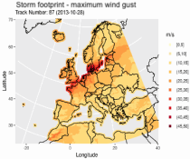
This dataset provides climatological indicators on European winter windstorms and their economic impact derived from ERA5 reanalysis. Also provided are risk indicators from a synthetically derived set of physically realistic windstorm events based on modelled climatic conditions. The primary users include the insurance sector, reinsurers and insurance industry service providers in response to their requirements for a catalogue of historic windstorm events within Europe.

calendar_today Interval/period: Sat, 03/01/1986 - Wed, 11/30/2011
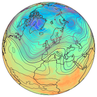
ERA5 is the fifth generation ECMWF reanalysis for the global climate and weather for the past 8 decades.
Data is available from 1940 onwards.
ERA5 replaces the ERA-Interim reanalysis.

calendar_today Interval/period: Mon, 01/01/1940 - Thu, 06/25/2026
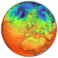
ERA5 is the fifth generation ECMWF reanalysis for the global climate and weather for the past 8 decades.
Data is available from 1940 onwards.
ERA5 replaces the ERA-Interim reanalysis.

calendar_today Interval/period: Mon, 01/01/1940 - Thu, 06/25/2026
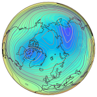
ERA5 is the fifth generation ECMWF reanalysis for the global climate and weather for the past 8 decades.
Data is available from 1940 onwards.
ERA5 replaces the ERA-Interim reanalysis.

calendar_today Interval/period: Mon, 01/01/1940 - Fri, 05/01/2026
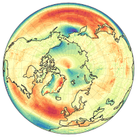
ERA5 is the fifth generation ECMWF reanalysis for the global climate and weather for the past 8 decades.
Data is available from 1940 onwards.
ERA5 replaces the ERA-Interim reanalysis.

calendar_today Interval/period: Mon, 01/01/1940 - Fri, 05/01/2026
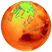
ERA5 is the fifth generation ECMWF reanalysis for the global climate and weather for the past 8 decades.
Data is available from 1940 onwards.
ERA5 replaces the ERA-Interim reanalysis.

calendar_today Interval/period: Mon, 01/01/1940 - Thu, 06/25/2026
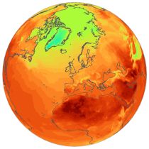
ERA5 is the fifth generation ECMWF reanalysis for the global climate and weather for the past 8 decades.
Data is available from 1940 onwards.
ERA5 replaces the ERA-Interim reanalysis.

calendar_today Interval/period: Mon, 01/01/1940 - Thu, 06/25/2026
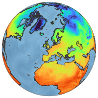
ERA5-Land is a reanalysis dataset providing a consistent view of the evolution of land variables over several decades at an enhanced resolution compared to ERA5. ERA5-Land has been produced by replaying the land component of the ECMWF ERA5 climate reanalysis. Reanalysis combines model data with observations from across the world into a globally complete and consistent dataset using the laws of physics. Reanalysis produces data that goes several decades back in time, providing an accurate description of the climate of the past.

calendar_today Interval/period: Sun, 01/01/1950 - Thu, 06/25/2026
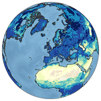
ERA5-Land is a reanalysis dataset providing a consistent view of the evolution of land variables over several decades at an enhanced resolution compared to ERA5. ERA5-Land has been produced by replaying the land component of the ECMWF ERA5 climate reanalysis. Reanalysis combines model data with observations from across the world into a globally complete and consistent dataset using the laws of physics. Reanalysis produces data that goes several decades back in time, providing an accurate description of the climate of the past.

calendar_today Interval/period: Sun, 01/01/1950 - Fri, 05/01/2026
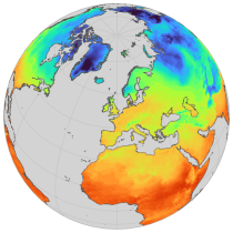
ERA5-Land is a reanalysis dataset providing a consistent view of the evolution of land variables over several decades at an enhanced resolution compared to ERA5. ERA5-Land has been produced by replaying the land component of the ECMWF ERA5 climate reanalysis. Reanalysis combines model data with observations from across the world into a globally complete and consistent dataset using the laws of physics. Reanalysis produces data that goes several decades back in time, providing an accurate description of the climate of the past.

calendar_today Interval/period: Sun, 01/01/1950 - Thu, 06/25/2026
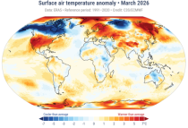
The Essential Climate Variables for assessment of climate variability from 1979 to present dataset contains a selection of climatologies, monthly anomalies and monthly mean fields of Essential Climate Variables (ECVs) suitable for monitoring and assessment of climate variability and change. Selection criteria are based on accuracy and temporal consistency on monthly to decadal time scales.

calendar_today Interval/period: Mon, 01/01/1979 - Fri, 05/01/2026
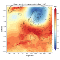
The Copernicus European Regional ReAnalysis (CERRA) datasets provide spatially and temporally consistent historical reconstructions of meteorological variables in the atmosphere and at the surface. There are four subsets: single levels (atmospheric and surface quantities), height levels (upper-air fields up to 500m), pressure levels (upper-air fields up to 1hPa) and model levels (native levels of the model). This entry provides reanalysis and forecast data on single levels for Europe from 1984 to present.

calendar_today Interval/period: Sat, 09/01/1984 - Tue, 03/31/2026
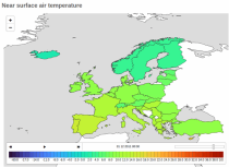
The Copernicus climate change service (C3S) operational energy dataset provides climate and energy indicators for the European energy sector. The climate-relevant indicators for the energy sector considered are: air temperature, precipitation, incoming solar radiation, wind speed at 10 m and 100 m, and mean sea level air pressure. The energy indicators are electricity demand and power generation from various sources: wind (both onshore and offshore), solar and hydro (run-of-river and reservoir) power.

calendar_today Interval/period: Mon, 01/01/1979 - Fri, 05/01/2026
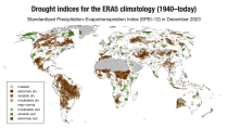
ERA5–Drought is a global reconstruction of drought indices from 1940 to present.
The dataset comprises two standardised drought indices:
- the Standardised Precipitation Index (SPI)
- the Standardised Precipitation-Evapotranspiration Index (SPEI).

calendar_today Interval/period: Mon, 01/01/1940 - Fri, 05/01/2026
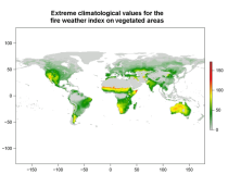
This data set provides complete historical reconstruction of meteorological conditions favourable to the start, spread and sustainability of fires. The fire danger metrics provided are part of a vast dataset produced by the Copernicus Emergency Management Service for the

calendar_today Interval/period: Wed, 01/03/1940 - Mon, 06/29/2026
open_in_newview in EWDS|open_in_newview in EWDS
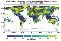
This dataset provides global climate and energy indicators from 1950 to the present at hourly and coarser temporal resolutions, offering a long-term, harmonised data foundation for energy-sector applications. It enables users to analyse energy indicators for the past climate, supporting energy planning, system design, risk assessments, climate impact modelling and model benchmarking.

calendar_today Interval/period: Sun, 01/01/1950 - Wed, 04/01/2026
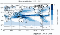
Within the hydrological cycle, precipitation is the main component of water transport from the atmosphere to the Earth’s surface. Precipitation varies strongly, depending on geographical location, season, synopsis, and other meteorological factors. The supply of freshwater through precipitation is vital for many subsystems of the climate and the environment, but there are also hazards related to extensive precipitation or the lack of precipitation.

calendar_today Interval/period: Mon, 01/01/1979 - Mon, 06/30/2025
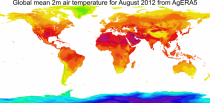
This dataset provides daily surface meteorological data for the period from 1979 to present as input for agriculture and agro-ecological studies. This dataset is based on the hourly ECMWF ERA5 data at surface level and is referred to as AgERA5. Acquisition and pre-processing of the original ERA5 data is a complex and specialized job. By providing the AgERA5 dataset, users are freed from this work and can directly start with meaningful input for their analyses and modelling.

calendar_today Interval/period: Mon, 01/01/1979 - Tue, 06/23/2026