Displaying 276 - 293 of 293

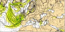
Vorticity is the tendency of an air particle to rotate or circulate around a particular point. Relative Vorticity is a measure about a vertical axis of the local rotation or spin of the air relative...

calendar_today Interval/period: N/A

open_in_newview in Open Charts

The air flow is not the same at all levels and can be very different in strength and direction when associated with vigorous weather systems...

calendar_today Interval/period: N/A

open_in_newview in Open Charts

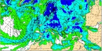
Uncoloured areas (relative humidity < 65%) are likely to be free of cloud. Coloured areas (relative humidity > 65%) show where moisture is likely to be available for cloud development...

calendar_today Interval/period: N/A

open_in_newview in Open Charts

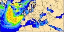
Mean windsea wave direction is the spectrally averaged direction of propagation of the windsea waves (weighted by wave height). Arrow length is proportional to the speed of wave propagation...

calendar_today Interval/period: N/A

open_in_newview in Open Charts

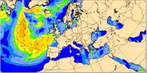
Significant windsea wave height can be shown to correspond to the average wave height of the top one-third highest windsea waves. Wave heights are shown in metres using colour shading...

calendar_today Interval/period: N/A

open_in_newview in Open Charts

This chart is derived from the ECMWF ensemble (ENS) and shows the probability that the ...

calendar_today Interval/period: N/A

open_in_newview in Open Charts
Human Thermal Comfort Indices parameters from the Control forecast (formerly HRES) up to 15 days. The products are provided in GRIB 1 or GRIB 2 format.

calendar_today Interval/period: N/A

The products consist of values of the individual members of the real-time forecast at grid points (single locations). The products are provided in BUFR code. Select the number of locations you will require. Once you have submitted your order, you will be required to provide a list of all points to the Licensor handling your data.

calendar_today Interval/period: N/A

Tropical cyclone tracks are provided in BUFR format. These data will only be disseminated when a tropical cyclone is active. Tropical cyclone tracks are free of charge as part of the WMO Essential dataset: https://www.ecmwf.int/en/forecasts/datasets/wmo-essential

calendar_today Interval/period: N/A

Information on Simulated Satellite Images can be found here: https://confluence.ecmwf.int/display/FCST/Simulated+satellite+data

calendar_today Interval/period: N/A

HRES-WAM (High RESolution WAve Model) is coupled to the atmospheric model (HRES). More details can be found here: https://confluence.ecmwf.int/display/FUG/2.2+Ocean+Wave+Model+-+ECWAM The products are provided in GRIB 1 or GRIB 2 format.

calendar_today Interval/period: N/A

Surface parameters from the ECMWF HRES Atmospheric Model (10-day). The products are provided in GRIB 1 or GRIB 2 format.

calendar_today Interval/period: N/A

Pressure level parameters from the ECMWF HRES Atmospheric Model (10-day). The products are provided in GRIB 1 or GRIB 2 format.

calendar_today Interval/period: N/A

Model level parameters from the ECMWF HRES Atmospheric Model (10-day). The products are provided in GRIB 1 or GRIB 2 format. Model level information can be found here: https://confluence.ecmwf.int/display/UDOC/Model+level+definitions

calendar_today Interval/period: N/A

WMO Recommended, previously known as WMO Additional, is available to the public and governed by the Creative Commons CC-4.0-BY licence and also ECMWF Terms Of Use.

calendar_today Interval/period: N/A

WMO Core, previously known as WMO Essential, is available to the public and governed by the Creative Commons CC-4.0-BY licence and also ECMWF Terms of Use.

calendar_today Interval/period: N/A