Displaying 626 - 643 of 643
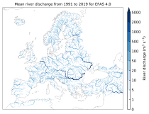
This dataset provides gridded modelled sub-daily and daily hydrological time series forced with meteorological observations. The data set is a consistent representation of the most important hydrological variables across the European Flood Awareness System (EFAS) domain. The temporal resolution is up to 30 years modelled time series of:

River discharge
Volumetric soil moisture
Snow water equivalent
Soil wetness index (root zone)
Runoff water equivalent (surface plus subsurface)

calendar_today Interval/period: Tue, 01/01/1991 - Sun, 06/28/2026
open_in_newview in EWDS|open_in_newview in EWDS
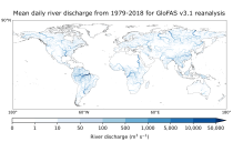
This dataset provides gridded modelled daily hydrological time series forced with meteorological reanalysis data. The data set is a product of the Global Flood Awareness System (GloFAS) and offers a consistent representation of key hydrological variables across the global domain including:

River discharge
Soil wetness index (root zone)
Snow water equivalent
Runoff water equivalent (surface plus subsurface)

calendar_today Interval/period: Mon, 01/01/1979 - Mon, 06/29/2026

open_in_newview in EWDS|open_in_newview in EWDS
Human Thermal Comfort Indices parameters from the Control forecast (formerly HRES) up to 15 days. The products are provided in GRIB 1 or GRIB 2 format.

calendar_today Interval/period: N/A

The products consist of values of the individual members of the real-time forecast at grid points (single locations). The products are provided in BUFR code. Select the number of locations you will require. Once you have submitted your order, you will be required to provide a list of all points to the Licensor handling your data.

calendar_today Interval/period: N/A

Tropical cyclone tracks are provided in BUFR format. These data will only be disseminated when a tropical cyclone is active. Tropical cyclone tracks are free of charge as part of the WMO Essential dataset: https://www.ecmwf.int/en/forecasts/datasets/wmo-essential

calendar_today Interval/period: N/A

Information on Simulated Satellite Images can be found here: https://confluence.ecmwf.int/display/FCST/Simulated+satellite+data

calendar_today Interval/period: N/A

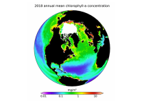
This dataset provides global daily estimates of ocean surface chlorophyll-a concentration and remote sensing reflectance derived from multiple satellite sensors. These two products are part of the broader discipline of ocean colour remote sensing, which analyses ocean surface radiances measured from space to derive information about the optical properties and constituents of the upper ocean.

calendar_today Interval/period: Thu, 09/04/1997 - Tue, 12/31/2024

HRES-WAM (High RESolution WAve Model) is coupled to the atmospheric model (HRES). More details can be found here: https://confluence.ecmwf.int/display/FUG/2.2+Ocean+Wave+Model+-+ECWAM The products are provided in GRIB 1 or GRIB 2 format.

calendar_today Interval/period: N/A

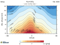
This dataset provides monthly and zonally averaged tropospheric humidity profiles derived from globally distributed GPS radio occultation (RO) measurements from EUMETSAT's Metop polar-orbiting satellites. Humidity plays an important role in the Earth's climate system, due to the strong greenhouse effect of water vapour but also for its role in the global energy transport, vertically in the atmosphere and horizontally between different geographical regions.

calendar_today Interval/period: Fri, 12/01/2006 - Mon, 12/01/2025

Surface parameters from the ECMWF HRES Atmospheric Model (10-day). The products are provided in GRIB 1 or GRIB 2 format.

calendar_today Interval/period: N/A

Pressure level parameters from the ECMWF HRES Atmospheric Model (10-day). The products are provided in GRIB 1 or GRIB 2 format.

calendar_today Interval/period: N/A

Model level parameters from the ECMWF HRES Atmospheric Model (10-day). The products are provided in GRIB 1 or GRIB 2 format. Model level information can be found here: https://confluence.ecmwf.int/display/UDOC/Model+level+definitions

calendar_today Interval/period: N/A

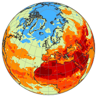
This dataset provides a complete historical reconstruction for a set of indices representing human thermal stress and discomfort in outdoor conditions. This dataset, also known as ERA5-HEAT (Human thErmAl comforT) represents the current state-of-the-art for bioclimatology data record production.
The dataset is organised around two main variables:

the mean radiant temperature (MRT)
the universal thermal climate index (UTCI)

calendar_today Interval/period: Fri, 12/01/1939 - Fri, 06/26/2026
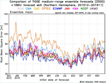
The International Grand Global Ensemble (TIGGE) dataset consists of global medium-range ensemble forecasts from thirteen numerical weather prediction (NWP) centres.
The dataset has been available since October 2006. TIGGE was established as a key component of THORPEX: a World Weather Research Programme to accelerate the improvements in the accuracy of 1-day to 2 week high-impact weather forecasts (THORPEX stands for THe Observing system Research and Predictability EXperiment)

calendar_today Interval/period: Sun, 10/01/2006 - Mon, 06/29/2026

WMO Recommended, previously known as WMO Additional, is available to the public and governed by the Creative Commons CC-4.0-BY licence and also ECMWF Terms Of Use.

calendar_today Interval/period: N/A

WMO Core, previously known as WMO Essential, is available to the public and governed by the Creative Commons CC-4.0-BY licence and also ECMWF Terms of Use.

calendar_today Interval/period: N/A