Displaying 126 - 145 of 145
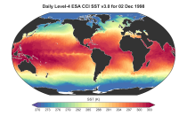
This dataset provides daily and monthly global estimates of sea surface temperature (SST) based on observations from multiple satellite sensors since July 1979 (for the daily product) and January 1980 respectivly (for the monthly product). SST is a key driver of global weather and climate patterns and plays an important role in the exchanges of energy, momentum, moisture and gases between the ocean and atmosphere. Accurate SST data are therefore essential for understanding and assessing variability and long-term changes in the Earth’s climate.

calendar_today Interval/period: Fri, 07/13/1979 - Thu, 06/11/2026
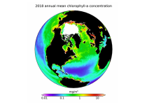
This dataset provides global daily and monthly estimates of ocean surface chlorophyll-a concentration and remote sensing reflectance derived from multiple satellite sensors. These two products are part of the broader discipline of ocean colour remote sensing, which analyses ocean surface radiances measured from space to derive information about the optical properties and constituents of the upper ocean.

calendar_today Interval/period: Mon, 09/01/1997 - Tue, 03/31/2026
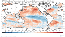
This dataset provides global ocean and sea-ice reanalysis (ORAS5: Ocean Reanalysis System 5) monthly mean data prepared by the European Centre for Medium-Range Weather Forecasts (ECMWF) OCEAN5 ocean analysis-reanalysis system. This system comprises 5 ensemble members from which one member is published in this catalogue entry.

calendar_today Interval/period: Wed, 01/01/1958 - Fri, 05/01/2026
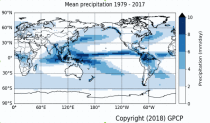
Within the hydrological cycle, precipitation is the main component of water transport from the atmosphere to the Earth’s surface. Precipitation varies strongly, depending on geographical location, season, synopsis, and other meteorological factors. The supply of freshwater through precipitation is vital for many subsystems of the climate and the environment, but there are also hazards related to extensive precipitation or the lack of precipitation.

calendar_today Interval/period: Mon, 01/01/1979 - Mon, 06/30/2025
This dataset provides daily surface meteorological data for the period from 1979 to present as input for agriculture and agro-ecological studies. This dataset is based on the hourly ECMWF ERA5 data at surface level and is referred to as AgERA5. Acquisition and pre-processing of the original ERA5 data is a complex and specialized job. By providing the AgERA5 dataset, users are freed from this work and can directly start with meaningful input for their analyses and modelling.

calendar_today Interval/period: Mon, 01/01/1979 - Tue, 06/23/2026
This catalogue entry provides the time series of the originally gridded Agrometeorological indicators from 1979 to present derived from reanalysis, also known as AgERA5. The main difference with the related entry is that the dataset is organised here to make time the primary dimension for analysis and extraction. For any user-defined location (point) or small area, the dataset returns the temporal evolution of the selected variables, enabling efficient time-series studies without requiring users to download and manage full global gridded files.

calendar_today Interval/period: Mon, 01/01/1979 - Sun, 01/04/2026
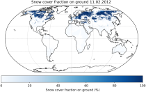
This dataset provides daily estimates of snow-covered land areas obtained from observations collected by multiple optical satellite instruments. As snow cover plays a crucial role in weather and climate, this data is particularly valuable for monitoring, estimating and assessing relevant changes.
It provides Level 3 collated (L3C) processed products, namely global daily single-sensor Snow cover fraction viewable (SCFV) and Snow cover fraction on ground (SCFG) products, both of which are based on optical satellite data.

calendar_today Interval/period: Fri, 01/01/1982 - Tue, 09/30/2025
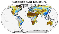
The C3S satellite soil moisture (SM) service provides a range of global soil moisture variables derived from numerous satellite sensors, including scatterometers and radiometers. The products are designed primarily for applications related to climate variability and change, land–atmosphere interactions, global biogeochemical cycles, ecology, hydrological and land surface modelling, drought monitoring, and meteorology.

calendar_today Interval/period: Wed, 11/01/1978 - Sat, 06/20/2026
This entry covers pressure-level data post-processed for bias adjustment on a monthly time resolution.

calendar_today Interval/period: Sun, 01/01/2017 - Mon, 06/01/2026
This entry covers single-level data post-processed for bias adjustment on a monthly time resolution.

calendar_today Interval/period: Sun, 01/01/2017 - Mon, 06/01/2026
This entry covers single-level data and soil-level data at the original time resolution (once a day, or once every 6 hours, depending on the variable).

calendar_today Interval/period: Thu, 01/01/1981 - Mon, 06/01/2026
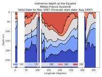
This entry covers global ocean data aggregated to a monthly time resolution. The catalogue entry includes temperature and salinity characteristics of the upper oceans and complements the other seasonal forecast catalogue entries for the land and atmospheric variables.

calendar_today Interval/period: Fri, 01/01/1993 - Mon, 06/01/2026
This entry covers pressure-level data aggregated on a monthly time resolution.

calendar_today Interval/period: Thu, 01/01/1981 - Mon, 06/01/2026
This entry covers single-level data aggregated on a monthly time resolution.

calendar_today Interval/period: Thu, 01/01/1981 - Mon, 06/01/2026
This entry covers pressure-level data at the original time resolution (once every 12 hours).

calendar_today Interval/period: Thu, 01/01/1981 - Mon, 06/01/2026
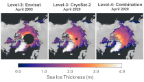
This dataset provides gridded sea ice thickness data for the Arctic, derived from satellite observations. Sea ice plays a vital role in the climate system, influencing air-sea interactions, the Earth’s energy balance, and marine ecosystems. It is recognised by the Global Climate Observing System (GCOS) as an Essential Climate Variable (ECV). Sea ice thickness is a key characteristic used alongside other parameters such as concentration, edge, and type, all available in the Climate Data Store (CDS).

calendar_today Interval/period: Tue, 10/01/2002 - Sun, 04/12/2026
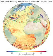
This dataset provides gridded daily and monthly mean global estimates of sea level anomaly based on satellite altimetry measurements. The rise in global mean sea level in recent decades has been one of the most important and well-known consequences of climate warming, putting a large fraction of the world population and economic infrastructure at greater risk of flooding. However, changes in the global average sea level mask regional variations that can be one order of magnitude larger.

calendar_today Interval/period: Fri, 01/01/1993 - Fri, 01/16/2026

This dataset provides global daily estimates of ocean surface chlorophyll-a concentration and remote sensing reflectance derived from multiple satellite sensors. These two products are part of the broader discipline of ocean colour remote sensing, which analyses ocean surface radiances measured from space to derive information about the optical properties and constituents of the upper ocean.

calendar_today Interval/period: Thu, 09/04/1997 - Tue, 12/31/2024
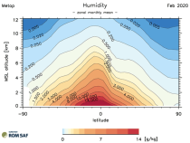
This dataset provides monthly and zonally averaged tropospheric humidity profiles derived from globally distributed GPS radio occultation (RO) measurements from EUMETSAT's Metop polar-orbiting satellites. Humidity plays an important role in the Earth's climate system, due to the strong greenhouse effect of water vapour but also for its role in the global energy transport, vertically in the atmosphere and horizontally between different geographical regions.

calendar_today Interval/period: Fri, 12/01/2006 - Mon, 12/01/2025
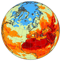
This dataset provides a complete historical reconstruction for a set of indices representing human thermal stress and discomfort in outdoor conditions. This dataset, also known as ERA5-HEAT (Human thErmAl comforT) represents the current state-of-the-art for bioclimatology data record production.
The dataset is organised around two main variables:

the mean radiant temperature (MRT)
the universal thermal climate index (UTCI)

calendar_today Interval/period: Fri, 12/01/1939 - Fri, 06/26/2026