
Datasets

A vast amount of data is archived daily containing IFS (Integrated Forecast System) experiments produced by ECMWF's Research Department or by Member States' users at ECMWF. Basically, an experiment can address any area of meteorology and it is archived accordingly. Users wanting to retrieve Research experiments need to know in advance the name of the specific experiment and its nature. For this information please, contact User Support.
Interval/period: N/A
Single prediction that uses
observations prior information about the Earth-system ECMWF's highest-resolution modelHRES Direct model output Products offers "High Frequency products"
Interval/period: N/A
A pre-operational Data Targeting System (DTS) was developed to assess the feasibility of operational adaptive control of the observing system and as a facility to aid research projects using data targeting. The DTS was developed and hosted at ECMWF. The work was jointly funded by EUCOS and the EC as part of the PREVIEW Integrated Project (work package WP3320) of the EU 6th Framework Programme.
Interval/period: N/A
The EU-funded ENSEMBLES project intends to develop an ensemble prediction system for climate change based on the principal state-of-the-art, high resolution, global and regional Earth System models developed in Europe, validated against quality controlled, high resolution gridded datasets for Europe, to produce for the first time, an objective probabilistic estimate of uncertainty in future climate at the seasonal to decadal and longer timescales.
Interval/period: N/A
HIRETYCS is the High Resolution Ten Year Climate Simulation. This data set consist of 10-year climate simulations produced at three centres: Centre National de Recherches Météorologiques (CNRM), Max-Planck Institute (MPI) and United Kingdom Met Office.
Interval/period: N/A
ECMWF is a participant in the Development of a European Land Data Assimilation System to predict Floods and Droughts (ELDAS) project funded by the European Union.
Interval/period: N/A
European Reanalysis and Observations for Monitoring project is a EU funded project that provides timely and reliable information about the state and evolution of the European climate. It combines observations from satellites, ground-based stations and results from comprehensive model-based regional reanalyses. By closely monitoring European climate, climate variability and change can be better understood and predicted.
Interval/period: N/A
The objective of the EU-funded DEMETER project is to develop a well-validated European coupled multi-model ensemble forecast system for reliable seasonal to inter annual prediction. Six comprehensive European global coupled atmosphere-ocean models are being installed at ECMWF, those of: ECMWF, Météo-France, LODYC, Met Office, MPI, INGV, INM-HIRLAM and CERFACS.
Interval/period: N/A
A meso-scale ensemble system focusing on short range probabilistic forecasts and profiting from advanced multi-scale ALARO physics. Its main purpose is to provide probabilistic forecast on daily basis for the national weather services of RC LACE partners. It also serves as a reliable source of probabilistic information applied to downstream hydrology and energy industry.
Interval/period: N/A
It is the Limited-area Ensemble Prediction System (LEPS), based on COSMO-model and implemented within COSMO (COnsortium for Small-scale Modelling, including Germany, Greece, Israel, Italy, Poland, Romania, Russia, Switzerland) implemented and maintained by Arpae-SIMC.
Interval/period: N/A
Each country's experiments can be accessed via the links below:
Interval/period: N/A
Some Member States also archive output other than from IFS into MARS. One example of such activity is the COSMO-LEPS forecast suite, running daily at ECMWF.
Interval/period: N/A
A set of experiments from four centres: ECMWF, Météo-France, EDF and Met Office. The experiments are 120 day runs from 9 consecutive starting days, with write-ups every 24 hours of Pressure level and Surface data.
Interval/period: N/A

The DestinE Digital Twin for Climate Change Adaptation (Climate DT) supports adaptation activities by providing innovative climate information on multi-decadal timescales, globally, at scales at which many impacts of climate change are observed. It combines cutting-edge global Earth-system models, impact-sector applications and observations into a unified framework to provide global climate projections and impact-sector information on multi-decadal timescales (1990 to ~2050), at very high spatial resolutions (5 to 10 km).
Interval/period: N/A
The DestinE Digital Twin for Climate Change Adaptation (Climate DT) supports adaptation activities by providing innovative climate information on multi-decadal timescales, globally, at scales at which many impacts of climate change are observed. It combines cutting-edge global Earth-system models, impact-sector applications and observations into a unified framework to provide global climate projections and impact-sector information on multi-decadal timescales (1990 to ~2050), at very high spatial resolutions (5 to 10 km).
Interval/period: N/A
The DestinE Digital Twin for Climate Change Adaptation (Climate DT) supports adaptation activities by providing innovative climate information on multi-decadal timescales, globally, at scales at which many impacts of climate change are observed. It combines cutting-edge global Earth-system models, impact-sector applications and observations into a unified framework to provide global climate projections and impact-sector information on multi-decadal timescales (1990 to ~2050), at very high spatial resolutions (5 to 10 km).
Interval/period: N/A
The DestinE Digital Twin for Climate Change Adaptation (Climate DT) supports adaptation activities by providing innovative climate information on multi-decadal timescales, globally, at scales at which many impacts of climate change are observed. It combines cutting-edge global Earth-system models, impact-sector applications and observations into a unified framework to provide global climate projections and impact-sector information on multi-decadal timescales (1990 to ~2050), at very high spatial resolutions (5 to 10 km).
Interval/period: N/A
The DestinE Digital Twin for Climate Change Adaptation (Climate DT) supports adaptation activities by providing innovative climate information on multi-decadal timescales, globally, at scales at which many impacts of climate change are observed. It combines cutting-edge global Earth-system models, impact-sector applications and observations into a unified framework to provide global climate projections and impact-sector information on multi-decadal timescales (1990 to ~2050), at very high spatial resolutions (5 to 10 km).
Interval/period: N/A
The DestinE Digital Twin for Climate Change Adaptation (Climate DT) supports adaptation activities by providing innovative climate information on multi-decadal timescales, globally, at scales at which many impacts of climate change are observed. It combines cutting-edge global Earth-system models, impact-sector applications and observations into a unified framework to provide global climate projections and impact-sector information on multi-decadal timescales (1990 to ~2050), at very high spatial resolutions (5 to 10 km).
Interval/period: N/A
The DestinE Digital Twin for Climate Change Adaptation (Climate DT) supports adaptation activities by providing innovative climate information on multi-decadal timescales, globally, at scales at which many impacts of climate change are observed. It combines cutting-edge global Earth-system models, impact-sector applications and observations into a unified framework to provide global climate projections and impact-sector information on multi-decadal timescales (1990 to ~2050), at very high spatial resolutions (5 to 10 km).
Interval/period: N/A
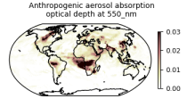
This dataset provides aerosol optical depths and aerosol-radiation radiative effects for four different aerosol origins: anthropogenic, mineral dust, marine, and land-based fine-mode natural aerosol. The latter mostly consists of biogenic aerosols.
Interval/period: N/A
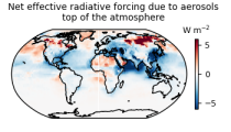
This dataset provides geographical distributions of the radiative forcing (RF) by key atmospheric constituents. The radiative forcing estimates are based on the CAMS reanalysis and additional model simulations and are provided separately for...
- carbon dioxide
- methane
- tropospheric ozone
- stratospheric ozone
- interactions between anthropogenic aerosols and radiation
Interval/period: N/A
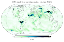
EAC4 (ECMWF Atmospheric Composition Reanalysis 4) is the fourth generation ECMWF global reanalysis of atmospheric composition. Reanalysis combines model data with observations from across the world into a globally complete and consistent dataset using a model of the atmosphere based on the laws of physics and chemistry.
Interval/period: N/A
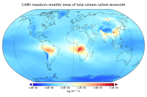
EAC4 (ECMWF Atmospheric Composition Reanalysis 4) is the fourth generation ECMWF global reanalysis of atmospheric composition. Reanalysis combines model data with observations from across the world into a globally complete and consistent dataset using a model of the atmosphere based on the laws of physics and chemistry.
Interval/period: N/A