Displaying 51 - 75 of 145
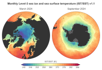
This dataset provides daily and monthly sea ice surface temperature (IST) fields over the polar oceans from 1982 to the present. The data are derived from thermal infrared measurements from a single satellite sensor type: the Advanced Very High Resolution Radiometer (AVHRR) onboard National Oceanic and Atmospheric Administration (NOAA) and Meteorological Operational (MetOp) satellites.

calendar_today Interval/period: Mon, 01/01/1979 - Tue, 09/30/2025
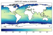
This dataset provides global daily sea surface temperature (SST) data from the Group for High Resolution Sea Surface Temperature (GHRSST) multi-product ensemble (GMPE) produced by the European Space Agency SST Climate Change Initiative (ESA SST CCI). The GMPE system was designed to allow users to compare the outputs from different SST analysis systems and understand their similarities and differences. Although originally intended for comparison of near real time data, it has also been used to compare long historical datasets.

calendar_today Interval/period: Tue, 09/01/1981 - Sat, 12/31/2016
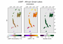
This dataset provides daily mid-morning measurements for Lake Surface Water Temperature (LSWT) derived from satellite observations. LSWT, together with five other variables (lake ice cover and thickness, water leaving reflectance, water level and extent) is recognised as the Essential Climate Variable (ECV) "Lakes" by the Global Climate Observing System (GCOS). LSWT is a key parameter in determining lake ecological conditions as it influences physical, chemical and biological processes.

calendar_today Interval/period: Thu, 06/01/1995 - Sun, 08/09/2026
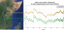
This dataset provides lake water levels for 311 selected lakes on four continents derived from satellite radar altimetry.

calendar_today Interval/period: Wed, 01/01/1992 - Sun, 08/09/2026
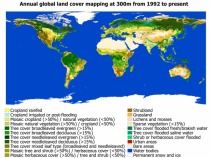
This dataset provides global maps describing the land surface into 22 classes, which have been defined using the United Nations Food and Agriculture Organization’s (UN FAO) Land Cover Classification System (LCCS). In addition to the land cover (LC) maps, four quality flags are produced to document the reliability of the classification and change detection.

calendar_today Interval/period: Wed, 01/01/1992 - Sat, 01/01/2022
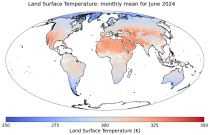
This dataset contains monthly daytime and nighttime clear-sky land surface temperatures (LSTs) and their uncertainty estimates from multiple Infra-Red (IR) instruments on polar orbiting satellites. Daytime and nighttime temperatures correspond to 10:00 and 22:00 local solar time (local solar time is defined as the time in a 24 hour day with 12 noon occurring when the sun is at its highest point at that longitude).

calendar_today Interval/period: Thu, 06/01/1995 - Tue, 12/31/2024
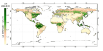
This catalogue entry provides satellite-derived estimates of two related variables: Leaf Area Index (LAI) and fraction of Absorbed Photosynthetically Active Radiation (fAPAR). LAI and fAPAR are both Essential Climate Variables (ECVs) as defined by the Global Climate Observing System (GCOS), meaning they have been designated as essential for contributing to a comprehensive view of Earth’s climate, its variability and trends.

calendar_today Interval/period: Tue, 09/01/1981 - Sun, 12/01/2024
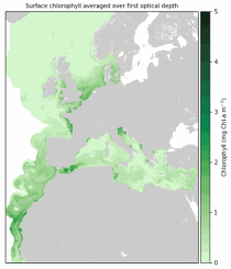
The dataset contains model projections of changes in marine physics and biogeochemistry and the lower trophic levels of the marine food web across the Northwest European Shelf and Mediterranean Sea out to the year 2100.

calendar_today Interval/period: Mon, 01/01/1979 - Mon, 12/31/2018
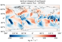
This dataset provides monthly means of mass-consistent, vertically integrated, atmospheric energy and moisture budget quantities derived from 1-hourly ERA5 reanalysis data.
The vertically integrated budget diagnostics include the tendencies and lateral fluxes of total energy, water vapour, and latent heat (with the latent heat of vaporization varying with temperature). In addition, the divergences of the lateral fluxes are provided.

calendar_today Interval/period: Mon, 01/01/1979 - Sun, 08/09/2026
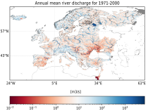
This dataset provides water variables and indicators based on hydrological impact modelling, forced by bias adjusted regional climate simulations from the European Coordinated Regional Climate Downscaling Experiment (EURO-CORDEX). The dataset contains Essential Climate Variable (ECV) data in the form of daily mean river discharge and a set of climate impact indicators (CIIs) for both water quantity and quality.
ECV datasets provide the empirical evidence needed to understand the current climate and predict future changes.

calendar_today Interval/period: N/A

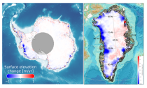
This dataset provides estimates of surface elevation change over the Greenland and Antarctic ice sheets since 1992, utilizing satellite radar altimetry from five missions: ERS-1, ERS-2, ENVISAT, CryoSat-2, and Sentinel-3A. The surface elevation change is modelled over successive, overlapping periods and reported monthly.

calendar_today Interval/period: Wed, 01/01/1992 - Sun, 08/09/2026
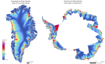
This dataset provides annual ice velocity maps of the Greenland and Antarctic Ice Sheets derived from Sentinel-1 data. The product represents the current state-of-the-art in Europe for satellite-based ice velocity data records. It follows from the European Space Agency (ESA) Climate Change Initiative (CCI) and is guided by the Global Climate Observing System (GCOS) targets for the Ice Sheets Essential Climate Variable (ECV).

calendar_today Interval/period: Sun, 10/01/2017 - Sun, 08/09/2026
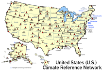
This catalogue entry provides access to a continuous series of near-surface climate observations collected in-situ at
United States Climate Reference Network (USCRN) stations.
There are over 130 USCRN stations over the conterminous United States (U.S.), Alaska, and Hawaii.
The USCRN stations are managed and maintained by the U.S. National Oceanic and Atmospheric Administration (NOAA).
The USCRN observations include air temperature, humidity, wind speed, precipitation, solar radiation,

calendar_today Interval/period: Sun, 01/01/2006 - Sun, 08/09/2026
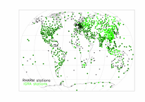
This catalogue entry provides access to vertical profiles of standard meteorological variables. It includes two archives.
The first is version 2 of the Integrated Global Radiosounding Archive (IGRA) from 1978 which incorporates global
radiosounding profiles of temperature, humidity and wind from a large number of data sources,
which is 30% larger than the previous version 1. IGRA v2 is the result of quality assurance procedures applied to the

calendar_today Interval/period: Sun, 01/01/1978 - Sun, 08/09/2026
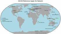
The Global Climate Observing System (GCOS) Reference Upper-Air Network (GRUAN) is an international reference observing network, established in 2006, of sites measuring essential climate variables above Earth's surface, designed to fill an important gap in the current global observing system. GRUAN measurements are providing high-quality climate data records from the surface, through the troposphere, and into the stratosphere.

calendar_today Interval/period: Sun, 01/01/1978 - Wed, 10/17/2018
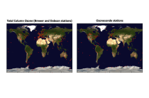
This dataset provides access to two types of ozone observations: total column ozone estimates and vertical profiles of ozone concentration.
The total ozone estimates are based on solar UV radiation measurements made by ground-based spectrophotometers (Dobson or Brewer type spectrophotometers).
The vertical profiles of ozone concentration are estimated primarily using ozonesonde observations.
Data are available for 159 Dobson stations, 109 Brewer stations and 135 ozonesondes stations.

calendar_today Interval/period: Tue, 01/01/1924 - Sun, 08/09/2026
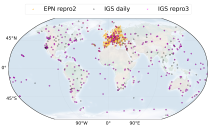
This dataset provides estimates of water vapour derived from atmospheric delays in Global Navigation Satellite System
(GNSS) radio signals.
The initial data is collected from two in situ ground-based network of GNSS receivers – the International GNSS Service
(IGS) and EUREF Permanent Network (EPN). The IGS collects, archives, and freely distributes GNSS data from a
cooperatively operated global network of more than 500 ground-based GNSS stations since 1994. The EPN is a European

calendar_today Interval/period: Mon, 01/01/1996 - Sun, 08/09/2026
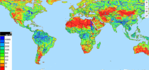
This dataset contains 4 Essential Climate Variables (ECV) for the 18 bias adjusted Global Climate Models (GCM) from CMIP5: daily precipitation rate, and daily mean, maximum and minimum temperatures.
The data are bias adjusted using the Distribution Based Scaling (DBS) method versus the global reference dataset HydroGFD2.0, both bias adjustment method and global reference dataset developed by the Swedish Meteorological and Hydrological Institute (SMHI).
The DBS method is a parametric quantile-mapping variant.

calendar_today Interval/period: Thu, 10/12/2000 - Thu, 10/18/2018
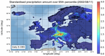
The dataset presents climate impact indicators related to extreme precipitation in Europe under current climate conditions. The suite of indicators include recent historic records, recurrence intervals, and other relevant statistical measures to evaluate the magnitude and frequency of extreme precipitation events. These are provided as gridded products, with one product covering the whole of Europe, and the other higher resolution product focused on 20 European cities that were identified as vulnerable to urban pluvial flooding based on stakeholder surveys.

calendar_today Interval/period: Sun, 01/01/1950 - Tue, 12/31/2019
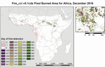
The Burned Area products provide global information of total burned area (BA) at pixel and grid scale. The BA is identified with the date of first detection of the burned signal in the case of the pixel product, and with the total BA per grid cell in the case of the grid product. The products were obtained through the analysis of reflectance changes from medium resolution sensors (Terra MODIS, Sentinel-3 OLCI), supported by the use of MODIS thermal information.

calendar_today Interval/period: Mon, 01/01/2001 - Fri, 04/01/2022
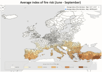
The dataset presents projections of fire danger indicators for Europe based upon the Canadian Fire Weather Index System (FWI) under future climate conditions. The FWI is a meteorologically based index used worldwide to estimate the fire danger and is implemented in the Global ECMWF Fire Forecasting model (GEFF). In this dataset, daily FWI values, seasonal FWI values, and other FWI derived, threshold-specific, indicators were modelled using the GEFF model to estimate the fire danger in future climate scenarios.

calendar_today Interval/period: N/A

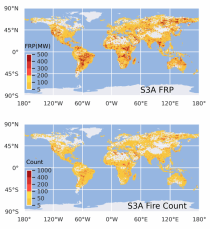
This dataset provides global information on the timing and location of Active Fires (AF) burning on Earth's surface during satellite overpasses, and also records their Fire Radiative Power (FRP) as a measure of strength. FRP relates to a fire's combustion rate, and the rate at which smoke containing greenhouse gases, reactive gases and particular matter is released into the atmosphere. The vast majority of detected hotspots are related to landscape fires, however other high temperature targets such as active volcanoes and gas flares are also present in the data.

calendar_today Interval/period: Wed, 01/01/2020 - Fri, 02/28/2025
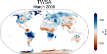
This dataset provides global Terrestrial Water Storage Anomalies (TWSA) on a 0.5° regular grid. TWSA represent deviations from the long-term average of water stored on or below the Earth’s surface in the form of soil moisture, groundwater, surface water, snow and ice. Designated as an Essential Climate Variable (ECV) as defined by the Global Climate Observing System (GCOS), TWSA is considered essential for contributing to a comprehensive view of Earth’s climate, its variability, and trends.

calendar_today Interval/period: Thu, 04/04/2002 - Tue, 04/01/2025
This catalogue entry provides a time series of thermal comfort indices, organised to make time the primary dimension for analysis and extraction. For any user-defined location (point) or small area, the dataset returns the temporal evolution of the selected variables, enabling efficient time-series studies without requiring users to download and manage full global gridded files.

calendar_today Interval/period: Mon, 01/01/1940 - Fri, 05/09/2025
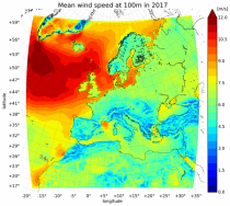
The present UERRA dataset contains analyses of atmospheric variables on height levels, from 1961 to 2019.

calendar_today Interval/period: Thu, 10/18/2018 - Wed, 07/31/2019