Displaying 551 - 575 of 708

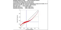
The reliability diagram shows the reliability of the ECMWF seasonal forecast system (SEAS5) with ...

calendar_today Interval/period: N/A

open_in_newview in Open Charts

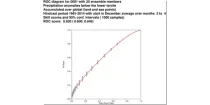
This chart shows the Relative Operating Characteristics (ROC) diagram for the three-month ...

calendar_today Interval/period: N/A

open_in_newview in Open Charts
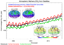
This dataset provides atmospheric CH₄ observations as derived from satellite radiances. It consists of two types of products each covering a different part of the atmosphere: (i) The average CH₄ mixing ratio of the entire atmosphere from the Earth’s surface to the top of the atmosphere. These column-averaged mixing ratio products are referred to as “XCH4” products. (ii) Mid-tropospheric (MT) CH₄ mixing ratio products. These products are referred to as "MTCH4" products. These products can be used to monitor the spatial distribution and temporal evolution of CH₄.

calendar_today Interval/period: Tue, 10/01/2002 - Mon, 06/30/2025
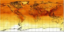
CAMS methane forecasts

calendar_today Interval/period: N/A

open_in_newview in Open Charts

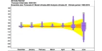
The ECMWF seasonal forecasts (SEAS5) are produced every month with a 51-member ensemble at ...

calendar_today Interval/period: N/A

open_in_newview in Open Charts
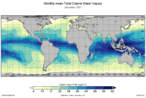
Water vapour is has been recognised as an Essential Climate Variable as it provides the basis for all cloud formation and physics and furthermore influences the Earth's heat budget due to its high absorbance of long and short-wave radiation. Total column water vapour (TCWV) is a measure of the integrated water vapour content of the atmosphere.
This catalogue entry provides the TCWV data product usually called Hamburg Ocean Atmosphere Parameters and Fluxes from Satellite Data (HOAPS).

calendar_today Interval/period: Wed, 05/01/2002 - Thu, 03/01/2012
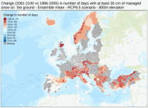
This dataset provides meteorological and snow indicators for Europe, characterizing operating conditions of winter ski resorts under past and future climate scenarios. The dataset consists of 39 indicators of atmospheric and snow conditions computed in a similar manner for all mountain regions in Europe at the scale of NUTS-3 regions (Nomenclature of Territorial Units for Statistics) and by steps of 100 m elevation.

calendar_today Interval/period: Sun, 01/01/1950 - Fri, 01/01/2100
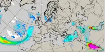
MUCAPE (Most Unstable Convective Available Potential Energy) is an indicator of atmospheric instability (the susceptibility of the troposphere to support free convection) and...

calendar_today Interval/period: N/A

open_in_newview in Open Charts
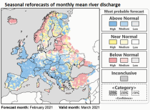
This dataset provides hydrological seasonal reforecasts of monthly mean river discharge across Europe for the period 1993 to 2016. The first is an E-HYPE multi-model system comprising eight model realisations using a catchment-based resolution. The second comprises the E-HYPEgrid, VIC-WUR and LISFLOOD-EFAS hydrological models at a 5km gridded resolution.

calendar_today Interval/period: Fri, 01/01/2021 - Sun, 08/09/2026
These charts aim to point towards areas where anomalous weather is likely to occur. ...

calendar_today Interval/period: N/A

open_in_newview in Open Charts

This chart shows 7-day mean anomalies for a range of parameters from the ECMWF Sub-seasonal ...

calendar_today Interval/period: N/A

open_in_newview in Open Charts
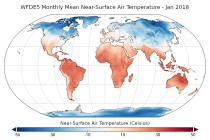
This dataset provides bias-corrected reconstruction of near-surface meteorological variables derived from the fifth generation of the European Centre for Medium-Range Weather Forecasts (ECMWF) atmospheric reanalyses (ERA5). It is intended to be used as a meteorological forcing dataset for land surface and hydrological models.

calendar_today Interval/period: Mon, 01/01/1979 - Tue, 12/31/2024

Note: This Generation 1 Collection has been superseded by Generation 2 Simulation-level Collections

calendar_today Interval/period: N/A

Note: This Generation 1 Collection has been superseded by Generation 2 Simulation-level Collections

calendar_today Interval/period: N/A

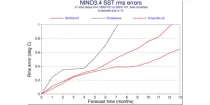
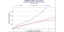
This chart provides a range of skill scores relating to forecasts of the evolution of the sea ...

calendar_today Interval/period: N/A

open_in_newview in Open Charts

This chart provides a range of skill scores relating to forecasts of the evolution of the sea ...

calendar_today Interval/period: N/A

open_in_newview in Open Charts

CAMS nitrogen dioxide forecasts

calendar_today Interval/period: N/A

open_in_newview in Open Charts
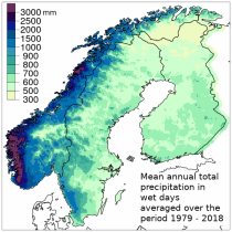
The Nordic Gridded Climate Dataset (NGCD) is a high resolution, observational, gridded dataset of daily minimum, maximum and mean temperatures and daily precipitation totals, covering Finland, Sweden and Norway. The time period covered begins in January 1961 and continues to the present.
Spatial interpolation methods are applied to observational datasets to create gridded datasets.
In general, there are three types of such methods: deterministic (type 1), stochastic (type 2) and pure mathematical (type 3).

calendar_today Interval/period: Sun, 01/01/1961 - Thu, 09/18/2025
**Note:** In **June 2023** ECMWF implemented a **major upgrade ...**

calendar_today Interval/period: N/A

open_in_newview in Open Charts
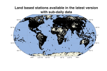
This set of data holdings provides access to data collected from land surface meteorological observations across the globe. Data are available at the observational level and also at daily and monthly aggregations. Data have been collated and harmonised and quality control checks have been performed, but no attempt has been made to assess for potential biases. Data are provided for a range of commonly observed variables.

calendar_today Interval/period: Sun, 01/01/1978 - Wed, 10/17/2018
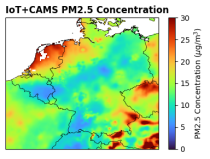
This dataset provides surface-level particulate matter (PM2.5 and PM10) concentrations derived from in situ low-cost sensor (LCS) measurements, produced by the European Centre for Medium-Range Weather Forecasts (ECMWF) in the context of the Horizon Europe All Data for Green Deal project. This dataset differs from existing air quality datasets by combining crowdsourced observations with a robust correction framework, producing high-resolution, reference-aligned gridded products.

calendar_today Interval/period: Mon, 01/01/2018 - Tue, 12/31/2024

open_in_newview in XDS

ECMWF is now running a series of data-driven forecasts as part of its experimental suite. These machine-learning based models are very fast, and they produce a 10-day forecast with 6-hourly time steps in approximately one minute. The outputs are available in graphical form.

Currently, three of these models are available:

calendar_today Interval/period: N/A

This dataset provides bias-corrected reconstruction of near-surface meteorological variables derived from the fifth generation of the European Centre for Medium-Range Weather Forecasts (ECMWF) atmospheric reanalyses (ERA5). It is intended to be used as a meteorological forcing dataset for land surface and hydrological models.

calendar_today Interval/period: Mon, 01/01/1979 - Mon, 12/31/2018

The nextGEMS data is aligned with the Climate Change Adaptation Digital Twin. The DestinE Digital Twin for Climate Change Adaptation (Climate DT) supports adaptation activities by providing innovative climate information on multi-decadal timescales, globally, at scales at which many impacts of climate change are observed.

calendar_today Interval/period: N/A

The nextGEMS data is aligned with the Climate Change Adaptation Digital Twin. The DestinE Digital Twin for Climate Change Adaptation (Climate DT) supports adaptation activities by providing innovative climate information on multi-decadal timescales, globally, at scales at which many impacts of climate change are observed.

calendar_today Interval/period: N/A