Datasets
Displaying 1 - 2 of 2

This dataset provides lake water levels for 311 selected lakes on four continents derived from satellite radar altimetry.
Interval/period: Wed, 01/01/1992 - Sun, 05/10/2026
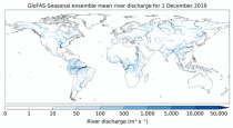
This dataset provides an ensemble of forecasted time series of gridded hydrological data forced with seasonal meteorological forecasts. The data set is a product of the Global Flood Awareness System (GloFAS) and offers a consistent representation of key hydrological variables across the global domain including:
River discharge
Soil wetness index (root zone)
Snow water equivalent
Runoff water equivalent (surface plus subsurface)
River discharge
Soil wetness index (root zone)
Snow water equivalent
Runoff water equivalent (surface plus subsurface)
Interval/period: Tue, 12/01/2020 - Wed, 04/01/2026