| ← prev Some thoughts on the contributions of Tim Palmer |
Contents |
next → Ensemble forecasts at ECMWF in the present and future |

Liz Stephens
University of Reading, UK
In 2013, Super Typhoon Haiyan led to over 6,000 fatalities in the Philippines. At the ECMWF Users Meeting in 2014, a question was put to a speaker about why the humanitarian response was so slow given that the track of Haiyan was well forecasted in advance. Since then, the use of forecasts for anticipatory humanitarian action has grown rapidly.
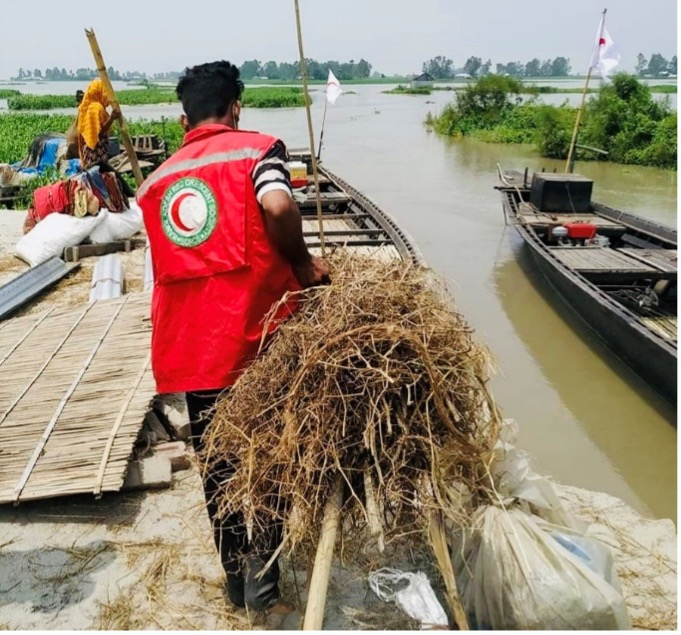
Within the Red Cross Red Crescent Movement, anticipatory action is financed through a fund hosted by the International Federation of Red Cross and Red Crescent Societies. The lead time required to send funds from Geneva to the country at risk means that medium-range ensemble forecasts from ECMWF have become intrinsic to many of the Early Action Protocols (EAPs) developed to access the financing.
It is important to ensure that the use of humanitarian funds is robust, and the ECMWF reforecasts enable confidence in the use of forecasts at longer lead times. By using the reforecasts to play with different thresholds a balance between the number of false alarms and missed events can be discussed and agreed upon.
The Global Flood Awareness System (GloFAS) is an ensemble hydrometeorological forecast driven by the ECMWF ensemble forecasts. Using the reforecasts, GloFAS was shown to have sufficient skill out to 10 days on the Brahmaputra River in Bangladesh. On 4 July 2020, on the basis of the GloFAS forecast, over $5million was released from the UN’s Central Emergency Response Fund and the Red Cross’s Forecast based Action by the Disaster Relief Emergency Fund. Once the Bangladesh Flood Forecasting and Warning Centre’s short-range forecast confirmed the imminent flooding, the agencies executed the pre-defined actions from the EAP. This early action before the flooding struck protected over 100,000 people before the flooding. Similar set-ups using GloFAS have now been established in countries including Kenya, Philippines, Uganda and Zambia.
Returning to tropical cyclones, the ECMWF medium-range forecasts are specified in Early Action Protocols for tropical cyclones in Bangladesh, Mozambique and Philippines. For the Philippines each ECMWF ensemble member drives a machine-learning model to predict the percentage of buildings damaged. Accordingly, a probabilistic impact forecast is generated. So would this approach been successful for Super Typhoon Haiyan?
Unfortunately, international humanitarian financing is not unlimited, and so AA is designed to deal with events of an approximate 1 in 5 year return period or greater. For the Philippines, which is threatened on average by 20 tropical cyclones a year, this means predicting the most impactful of around 100 such storms, a challenging task! As Mogensen et al. 2018 state, the operational forecast severely underpredicted the intensity of Haiyan, and as such the humanitarian financing would have not been triggered in time. For Super Typhoon Rai in December 2021, again the track of the storm was well predicted, but the rapid intensification which occurred overnight before landfall was not well captured by the forecasts.
While errors in magnitude forecasts leads to difficulties in predicting storm surge flooding, other hazards associated with tropical cyclones have greater predictability. The use of ensemble forecasts is now routine in providing valued information to the UK Foreign, Commonwealth and Development Office to support their humanitarian operations. On November 17th 2020 Hurricane Iota made landfall in Nicaragua, but there was a growing signal for subsequent flooding, particularly severe in Honduras, many days before, and the derived estimates of the population exposed to flooding were used to guide humanitarian efforts.

Nevertheless, ensemble forecasts could still be further exploited by the humanitarian community. For example, current collaborative research is underway to explore how ECMWF’s Extreme Forecast Index, a product derived from a comparison between the ensemble forecast and the model climatology, could be adapted to support humanitarian decision-making. The best avenue for the successful use of ensemble products is when they are developed in collaboration with those who use them.
| ← prev Some thoughts on the contributions of Tim Palmer |
↑ top | next → Ensemble forecasts at ECMWF in the present and future |