
A ground-breaking satellite mission to be launched in late 2017 or early 2018 could herald a step change in the quality of weather forecasts around the globe by providing new wind data, a meeting on tropical modelling held at ECMWF has heard.
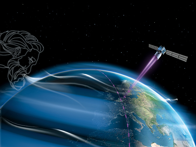
The European Space Agency’s ADM-Aeolus mission will use a Doppler wind lidar operating in the ultraviolet spectrum to retrieve wind profile data across the globe.
“I have great hopes that the new wind information from the Aeolus satellite will provide us with much-improved tropical analyses and therefore improved medium-range forecasts, including in the mid-latitudes,” ECMWF Director of Research Erland Källén said.
Anne Grete Straume, ESA’s Aeolus mission scientist, noted that there is growing excitement as the satellite’s launch date approaches.
“This is a ground-breaking type of observations eagerly awaited by forecasters and scientists worldwide,” she said.
The Workshop on tropical modelling, observations and assimilation from 7 to 10 November was organised jointly by ESA and ECMWF.
Why the tropics?
In the northern hemisphere, the range at which skilful weather forecasts can be made has increased by about a day a decade over the last 30 years.
In the tropics, on the other hand, the pace of progress has been slower.
Part of the reason is that, due to a limited range of weather observations, it is difficult to make accurate assessments of the current state of the atmosphere in that region.

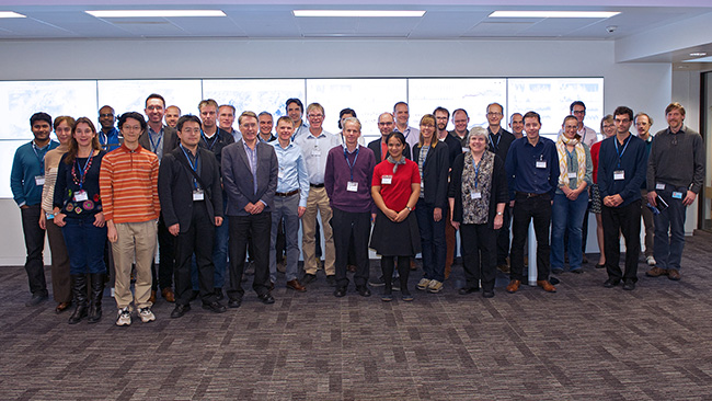
The workshop was attended by 42 scientists from across the world.
Those assessments or ‘analyses’ are used to initialise the forecast model. Due to the chaotic nature of the atmosphere, even small errors in the analysis can lead to significant errors in predictions of the weather a few days ahead.
“There is evidence to suggest that errors in the analysis in the tropics can lead to major forecast busts in the mid-latitudes,” Professor Källén points out.
How will Aeolus help?
“The aim of Aeolus is to measure winds globally to improve weather forecasts but also to advance our understanding of atmospheric dynamics and to help scientists improve climate models,” Dr Straume says.
 |
“This is the first time this kind of technology will be used to measure winds from space over a sustained period of time.” (Anne Grete Straume) |
She emphasises that Aeolus is a technology demonstrator, intended to pave the way for future missions.
“This is the first time this kind of technology will be used to measure winds from space over a sustained period of time,” she points out.
The need to address technical issues has led to a number delays, but Dr Straume confirms that Aeolus is now set to launch in the period December 2017 to February 2018.
She adds that Aeolus data will provide information on winds along the view of the satellite, which will be predominantly in the east–west direction.
“The data will have to be combined with the model to obtain full wind field information,” she explains.
 |
“Ideally in the future two or three satellites will be in orbit.” (Oliver Reitebuch) |
Oliver Reitebuch from the German Aerospace Center (DLR) adds that, to maximise the benefits for numerical weather prediction, ideally two or three satellites should be in orbit.
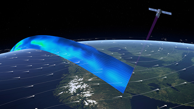
“This is because the lidar measurements are along a curtain in the atmosphere up to 20 to 30 km in altitude but only along a very narrow horizontal swath,” he says.
How does it work?
The satellite can provide wind profiles from the ground up to a height of 30 km.
It carries a lidar which emits pulses of ultraviolet light. These are backscattered from air molecules, particles of dust, droplets of water and ice clouds in the atmosphere.
The receiver analyses the Doppler shift and travel time of the backscattered signal to determine the wind speed at various altitudes.

ADM-Aeolus is a polar-orbiting satellite which will circle Earth at an altitude of 320 km. (Image: ESA/ATG Medialab)
Dr Straume explains that the light can pass through optically thin clouds or aerosol layers.
The laser beam is only about 10 m wide, meaning that it can also pass through small gaps in clouds to measure wind speeds down to the ground, Dr Reitebuch adds.
What is ECMWF’s role?
ECMWF will be heavily involved in monitoring and processing the data provided by Aeolus.
“What is unique about this Earth Explorer mission is that ECMWF is running the Level 2 Processing Facility,” Dr Straume says.
“The reason is that this is a weather mission and ECMWF is a prime customer for ingesting the data.”
She adds that, very early in the mission, ECMWF will be able to look at data quality and feed the results back into data production and Level 1 processing.
What did the workshop achieve?
“The discussions among experts in tropical modelling, observations and data assimilation from both atmosphere and ocean communities have resulted in very useful recommendations on how ECMWF can improve numerical weather prediction in the tropical region,” says ECMWF scientist Lars Isaksen, one of the organisers of the workshop.
There was general agreement that the most needed observations in the tropics are wind profiles, he notes. Moreover, all participants agreed that models and data assimilation systems have much larger deficiencies and uncertainties in the tropics.
“More observations, both in the atmosphere and the ocean, are required to improve analyses in the tropics,” Dr Isaksen says.
“Convincing examples presented confirmed the strong link between tropical analyses and medium-range weather forecasts in Europe. So further research and development at ECMWF in this area is essential.”
More information
ECMWF/ESA workshop: Tropical modelling, observations and assimilation, 7 to 10 November 2016
ECMWF’s role in the Aeolus mission
Top image: ESA/AOES Medialab
